
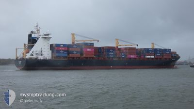
EF OLIVIA
Container Ship
Current Trip
| Time Travelled | 12 h, 55 mins |
|---|---|
| Remaining Time | 5 days |
| Distance Travelled | 195.07 nm |
| Remaining Distance | 2267.21 nm |
| AVG Speed | 13.9 Knop |
| MAX Speed | 17.6 Knop |
| AVG Wind | 8.6 knots |
| MAX Wind | 13.5 knots |
| MIN Temp | 24.1°C / 75.38°F |
| MAX Temp | 26.7°C / 80.06°F |
| Djupgående | 12 m |
| Position mottagen | 10 h, 56 m sen |
Current Position
| Longitud | --- |
|---|---|
| Latitude | --- |
| Status | Under way using engine |
| Fart | 7.4 Knop |
| Kurs | 299° |
| Område | Malacca Strait |
| Station | T-AIS |
| Position mottagen | 10 h, 56 m sen |
Info
Information
The current position of EF OLIVIA is in Malacca Strait with coordinates 1.24822° / 103.40934° as reported on 2024-12-18 17:01 by AIS to our vessel tracker app. The vessel's current speed is 7.4 Knop and is heading at the port of NHAVA SHEVA. The estimated time of arrival as calculated by MyShipTracking vessel tracking app is 2024-12-24 19:57 LT
The vessel EF OLIVIA (IMO: 9252735, MMSI: 255805987) is a Container Ship that was built in 2006 ( 18 År gammal ). It's sailing under the flag of [PT] Portugal.
In this page you can find informations about the vessels current position, last detected port calls, and current voyage information. If the vessels is not in coverage by AIS you will find the latest position.
The current position of EF OLIVIA is detected by our AIS receivers and we are not responsible for the reliability of the data. The last position was recorded while the vessel was in Coverage by the Ais receivers of our vessel tracking app.
The current draught of EF OLIVIA as reported by AIS is 12 meters
Weather
| Temperature | 25.2°C / 77.36°F |
|---|---|
| Wind Speed | 5 knots |
| Direction | 133° SE |
| Pressure | 1012.2 hPa |
| Humidity | 86.4 % |
| Cloud Coverage | 100 % |
Featured Company
Last Port Calls
| Port | Arrival | Departure | Time In Port |
|---|---|---|---|
| 2024-12-16 22:46 | 2024-12-18 15:02 | 1 d | |
| 2024-12-12 01:45 | 2024-12-12 07:21 | 5 h | |
| 2024-12-03 19:08 | 2024-12-04 23:06 | 1 d | |
| 2024-12-01 19:54 | 2024-12-02 18:02 | 22 h | |
| 2024-11-26 09:08 | 2024-11-26 18:52 | 9 h | |
| 2024-11-23 17:21 | 2024-11-24 07:00 | 13 h | |
| 2024-11-14 00:42 | 2024-11-15 13:46 | 1 d | |
| 2024-10-28 05:51 | 2024-10-29 05:40 | 23 h | |
| 2024-10-26 07:20 | 2024-10-27 01:23 | 18 h | |
| 2024-10-22 04:10 | 2024-10-22 11:23 | 7 h |
Most Visited Ports (Last year)
| Port | Arrivals | |
|---|---|---|
| 4 | ||
| 4 | ||
| 3 | ||
| 3 | ||
| 3 | ||
| 3 |
Last Trips
| Origin | Departure | Destination | Arrival | Distance | |
|---|---|---|---|---|---|
| 2024-12-12 12:51 | 2024-12-17 06:46 | 1615.37 nm | |||
| 2024-12-05 03:06 | 2024-12-12 07:15 | 2006.68 nm | |||
| 2024-12-02 21:02 | 2024-12-03 23:08 | 323.69 nm | |||
| 2024-11-27 00:22 | 2024-12-01 22:54 | 1269.60 nm | |||
| 2024-11-24 12:30 | 2024-11-26 14:38 | 457.01 nm | |||
| 2024-11-15 21:46 | 2024-11-23 22:51 | 2541.69 nm | |||
| 2024-10-29 08:40 | 2024-11-14 08:42 | 3836.66 nm | |||
| 2024-10-27 05:23 | 2024-10-28 08:51 | 330.21 nm | |||
| 2024-10-22 16:53 | 2024-10-26 11:20 | 1002.45 nm | |||
| 2024-10-20 01:15 | 2024-10-22 09:40 | 427.80 nm |
Events
| Tid | Event | Detaljer | Position / Dest | Information |
|---|---|---|---|---|
| 2024-12-18 17:09 | Status ändrad | Default Under way using engine |
1.25957 / 103.39336
IN NSA
|
Fart: 7.4 kn Kurs: 299° |
| 2024-12-18 17:01 | UTANFÖR täckningsområde |
1.24822 / 103.40934
Malacca Strait
IN NSA
|
Fart: 7.4 kn Kurs: 299° |
|
| 2024-12-18 16:58 | Byter havsområde | Malaysian part of the Malacca Strait Malaysian part of the Singapore Strait |
1.24510 / 103.41402
Malacca Strait
IN NSA
|
Fart: 9.3 kn Kurs: 313.3° |
| 2024-12-18 16:58 | Status ändrad | Under way using engine Default |
1.24510 / 103.41402
IN NSA
|
Fart: 10.9 kn Kurs: 307° |
| 2024-12-18 16:41 | Status ändrad | Default Under way using engine |
1.22019 / 103.47092
IN NSA
|
Fart: 13.8 kn Kurs: 285.3° |
| 2024-12-18 16:30 | Status ändrad | Under way using engine Default |
1.20962 / 103.51070
IN NSA
|
Fart: 14 kn Kurs: 285° |
| 2024-12-18 16:29 | Status ändrad | Default Under way using engine |
1.20835 / 103.51520
IN NSA
|
Fart: 14.3 kn Kurs: 280.7° |
| 2024-12-18 16:11 | Byter havsområde | Malaysian part of the Singapore Strait Indonesian part of the Singapore Strait |
1.19669 / 103.58473
Singapore Strait
IN NSA
|
Fart: 14.3 kn Kurs: 271.3° |
| 2024-12-18 15:56 | Byter havsområde | Indonesian part of the Singapore Strait Singaporean part of the Singapore Strait |
1.19785 / 103.63962
Singapore Strait
IN NSA
|
Fart: 11.2 kn Kurs: 259° |
| 2024-12-18 15:02 | AVGÅTT HAMN |
|
1.27001 / 103.75946
IN NSA
|
Fart: 3.9 kn Kurs: 269° |