

DOENNLAND
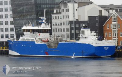
Fish Carrier

Current Trip
| Trip Time | --- |
|---|---|
| Trip Distance | --- |
| AVG Speed | --- |
| MAX Speed | --- |
| Djupgående | --- |
| AVG Wind | --- |
| MAX Wind | --- |
| MIN Temp | --- |
| MAX Temp | --- |
| Position mottagen | 2 h, 30 m sen |
Current Position
| Longitud | --- |
|---|---|
| Latitude | --- |
| Status | Under way using engine |
| Fart | |
| Kurs | 238° |
| Område | North Sea |
| Station | T-AIS |
| Position mottagen | 2 h, 30 m sen |
Information
The current position of DOENNLAND is in North Sea with coordinates 56.02661° / -3.69955° as reported on 2025-03-15 11:50 by AIS to our vessel tracker app. The vessel's current speed is 0 Knop and is currently inside the port of GRANGEMOUTH.
The vessel DOENNLAND (IMO: 9632569, MMSI: 257797000) is a Fish Carrier that was built in 2012 ( 13 År gammal ). It's sailing under the flag of [NO] Norway.
In this page you can find informations about the vessels current position, last detected port calls, and current voyage information. If the vessels is not in coverage by AIS you will find the latest position.
The current position of DOENNLAND is detected by our AIS receivers and we are not responsible for the reliability of the data. The last position was recorded while the vessel was in Coverage by the Ais receivers of our vessel tracking app.
The current draught of DOENNLAND as reported by AIS is 5.6 meters
Weather
| Temperature | 6.5°C / 43.7°F |
|---|---|
| Wind Speed | 3 knots |
| Direction | 281° W |
| Pressure | 1025.6 hPa |
| Humidity | 64.3 % |
| Cloud Coverage | 10 % |


Featured Company
Last Port Calls
| Port | Arrival | Departure | Time In Port |
|---|---|---|---|
| 2025-03-13 17:07 | 2025-03-13 21:18 | 4 h | |
| 2025-03-08 20:01 | 2025-03-09 12:14 | 16 h | |
| 2025-03-02 04:43 | 2025-03-02 07:40 | 2 h | |
| 2025-02-21 02:34 | 2025-02-21 22:12 | 19 h | |
| 2025-02-16 10:55 | 2025-02-16 15:15 | 4 h | |
| 2025-02-15 15:19 | 2025-02-15 18:19 | 2 h | |
| 2025-02-15 13:03 | 2025-02-15 15:09 | 2 h | |
| 2025-01-18 10:44 | 2025-02-14 14:49 | 27 d | |
| 2025-01-17 17:55 | 2025-01-17 18:26 | 31 m | |
| 2025-01-12 21:25 | 2025-01-16 11:25 | 3 d |
Last Trips
| Origin | Departure | Destination | Arrival | Distance | |
|---|---|---|---|---|---|
| 2025-03-09 12:14 | 2025-03-13 17:07 | 383.93 nm | |||
| 2025-03-02 07:40 | 2025-03-08 20:01 | 833.87 nm | |||
| 2025-02-21 22:12 | 2025-03-02 04:43 | 581.52 nm | |||
| 2025-02-16 16:15 | 2025-02-21 02:34 | 564.17 nm | |||
| 2025-02-15 19:19 | 2025-02-16 11:55 | 151.49 nm | |||
| 2025-02-15 16:09 | 2025-02-15 16:19 | 0.78 nm | |||
| 2025-02-14 15:49 | 2025-02-15 14:03 | 229.22 nm | |||
| 2025-01-17 19:26 | 2025-01-18 11:44 | 79.91 nm | |||
| 2025-01-16 12:25 | 2025-01-17 18:55 | 173.03 nm | |||
| 2025-01-07 16:44 | 2025-01-12 22:25 | 452.93 nm |
Events
| Tid | Event | Detaljer | Position / Dest | Information |
|---|---|---|---|---|
| 2025-03-15 11:50 | UTANFÖR täckningsområde |
56.02661 / -3.69955
North Sea
[GB] GRANGEMOUTH
|
Fart: Kurs: 17.2° |
|
| 2025-03-15 09:20 | I täckningsområde |
56.02661 / -3.69955
North Sea
[GB] GRANGEMOUTH
|
Fart: Kurs: 211.4° |
|
| 2025-03-14 20:19 | UTANFÖR täckningsområde |
56.04449 / -3.18235
North Sea
GRANGEMOOUTH
|
Fart: 8.1 kn Kurs: 249.8° |
|
| 2025-03-14 18:22 | I täckningsområde |
56.15445 / -2.74947
North Sea
GRANGEMOOUTH
|
Fart: 8.2 kn Kurs: 240.7° |
|
| 2025-03-14 12:17 | UTANFÖR täckningsområde |
56.85952 / -2.02729
North Sea
GRANGEMOOUTH
|
Fart: 10.6 kn Kurs: 199.6° |
|
| 2025-03-14 06:44 | ETA ändrat | 2025/03/14 22:00 2025/03/14 23:59 |
57.73749 / -1.66964
GRANGEMOOUTH
|
Fart: 8.6 kn Kurs: 156.7° |
| 2025-03-14 06:03 | I täckningsområde |
57.82598 / -1.73946
North Sea
GRANGEMOOUTH
|
Fart: 9.2 kn Kurs: 155.3° |
|
| 2025-03-13 22:47 | UTANFÖR täckningsområde |
58.87623 / -2.59050
North Sea
GRANGEMOOUTH
|
Fart: 9.7 kn Kurs: 156° |
|
| 2025-03-13 21:35 | Destination ändrad | GRANGEMOOUTH WESTRAY |
59.01077 / -2.87134
GRANGEMOOUTH
|
Fart: 11.8 kn Kurs: 104.5° |
| 2025-03-13 21:35 | ETA ändrat | 2025/03/14 23:59 2025/03/12 16:00 |
59.01077 / -2.87134
GRANGEMOOUTH
|
Fart: 11.8 kn Kurs: 104.5° |