
DOENNLAND
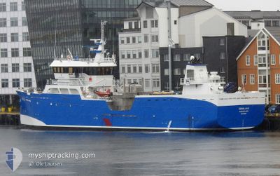
Fish Carrier
Current Trip
FORSAN
| Time Travelled | 4 days |
|---|---|
| Remaining Time | --- |
| Distance Travelled | 650.21 nm |
| Remaining Distance | --- |
| AVG Speed | 9.5 Knopen |
| MAX Speed | 15.3 Knopen |
| AVG Wind | 4.3 knots |
| MAX Wind | 13 knots |
| MIN Temp | -6.1°C / 21.02°F |
| MAX Temp | 4°C / 39.2°F |
| Diepgang | 5.2 M |
| Positie ontvangen | 1 h, 36 m geleden |
Current Position
| Lengtegraad | 16.75445° |
|---|---|
| Breedtegraat | 68.75748° |
| Status | Under way using engine |
| Snelheid | 10.5 Knopen |
| Koers | 204.9° |
| Gebied | Norwegian Sea |
| Station | T-AIS |
| Positie ontvangen | 1 h, 36 m geleden |
Info
Information
The current position of DOENNLAND is in Norwegian Sea with coordinates 68.75748° / 16.75445° as reported on 2024-04-27 10:18 by AIS to our vessel tracker app. The vessel's current speed is 10.5 Knopen
The vessel DOENNLAND (IMO: 9632569, MMSI: 257797000) is a Fish Carrier that was built in 2012 ( 12 Jaar oud ). It's sailing under the flag of [NO] Norway.
In this page you can find informations about the vessels current position, last detected port calls, and current voyage information. If the vessels is not in coverage by AIS you will find the latest position.
The current position of DOENNLAND is detected by our AIS receivers and we are not responsible for the reliability of the data. The last position was recorded while the vessel was in Coverage by the Ais receivers of our vessel tracking app.
The current draught of DOENNLAND as reported by AIS is 5.2 meters
Weather
| Temperature | 2.7°C / 36.86°F |
|---|---|
| Wind Speed | 5 knots |
| Direction | 121° ESE |
| Pressure | 1016.2 hPa |
| Humidity | 63.7 % |
| Cloud Coverage | 72 % |
Featured Company
Events
| Tijd | Evenement | Details | Positie / Bestemming | Info |
|---|---|---|---|---|
| 2024-04-27 10:18 | Buitenbereik |
68.75748 / 16.75445
Norwegian Sea
|
Snelheid: 10.5 kn Koers: 204.9° |
|
| 2024-04-26 22:59 | Destination Changed | FORSAN KOMANGNES |
70.02074 / 20.57485
FORSAN
|
Snelheid: 10.9 kn Koers: 250.5° |
| 2024-04-26 18:33 | Binnenbereik |
70.30177 / 22.31345
Norwegian Sea
|
Snelheid: 10.7 kn Koers: 301.2° |
|
| 2024-04-26 15:10 | Buitenbereik |
70.46379 / 23.66694
Norwegian Sea
|
Snelheid: 9 kn Koers: 169.7° |
|
| 2024-04-26 15:10 | Binnenbereik |
70.46379 / 23.66694
Norwegian Sea
|
Snelheid: 9 kn Koers: 169.7° |
|
| 2024-04-26 14:08 | Buitenbereik |
70.48131 / 23.63421
Norwegian Sea
|
Snelheid: Koers: 267.3° |
|
| 2024-04-26 08:58 | Stop beweging | 9.39 nm, South of RYPEFJORD |
70.47910 / 23.62876
KOMANGNES
|
Snelheid: Koers: 341° |
| 2024-04-25 17:00 | ETA Changed | 2024/04/25 11:30 2024/04/25 14:30 |
69.43402 / 18.12459
KOMANGNES
|
Snelheid: 9.5 kn Koers: 353.9° |
| 2024-04-25 03:40 | Destination Changed | KOMANGNES HJARTOY |
67.95668 / 15.54036
KOMANGNES
|
Snelheid: 9.2 kn Koers: 263.3° |
| 2024-04-25 03:24 | Start beweging | 11.67 nm, South West of DRAG |
67.95483 / 15.62600
HJARTOY
|
Snelheid: 5.5 kn Koers: 309.5° |