
DELTA AMAZON
Tanker
Current Trip
| Time Travelled | 23 days |
|---|---|
| Remaining Time | --- |
| Distance Travelled | 5971.77 nm |
| Remaining Distance | --- |
| AVG Speed | 11.7 Knop |
| MAX Speed | 22.5 Knop |
| AVG Wind | 7.8 knots |
| MAX Wind | 27 knots |
| MIN Temp | 19.9°C / 67.82°F |
| MAX Temp | 30.7°C / 87.26°F |
| Djupgående | 19.6 m |
| Position mottagen | 2 d sen |
Current Position
| Longitud | 119.00308° |
|---|---|
| Latitude | 24.78724° |
| Status | Under way using engine |
| Fart | 5.9 Knop |
| Kurs | 27.9° |
| Område | South China Sea |
| Station | T-AIS |
| Position mottagen | 2 d sen |
Info
Information
The current position of DELTA AMAZON is in South China Sea with coordinates 24.78724° / 119.00308° as reported on 2024-05-15 06:11 by AIS to our vessel tracker app. The vessel's current speed is 5.9 Knop
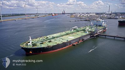
The vessel DELTA AMAZON (IMO: 9748916, MMSI: 636019059) is a Tanker It's sailing under the flag of [LR] Liberia.
In this page you can find informations about the vessels current position, last detected port calls, and current voyage information. If the vessels is not in coverage by AIS you will find the latest position.
The current position of DELTA AMAZON is detected by our AIS receivers and we are not responsible for the reliability of the data. The last position was recorded while the vessel was in Coverage by the Ais receivers of our vessel tracking app.
The current draught of DELTA AMAZON as reported by AIS is 19.6 meters
Weather
| Temperature | 21.6°C / 70.88°F |
|---|---|
| Wind Speed | 6 knots |
| Direction | 16° NNE |
| Pressure | 1011.7 hPa |
| Humidity | 79.5 % |
| Cloud Coverage | 98 % |
Featured Company
Last Port Calls
| Port | Arrival | Departure | Time In Port |
|---|---|---|---|
| 2024-04-22 09:11 | 2024-04-23 23:23 | 1 d | |
| 2024-03-14 06:59 | 2024-03-18 03:00 | 3 d |
Most Visited Ports (Last year)
| Port | Arrivals | |
|---|---|---|
| 1 | ||
| 1 | ||
| 1 | ||
| 1 |
Last Trips
| Origin | Departure | Destination | Arrival | Distance | |
|---|---|---|---|---|---|
| 2024-03-18 11:00 | 2024-04-22 12:11 | 6231.10 nm |
Events
| Tid | Event | Detaljer | Position / Dest | Information |
|---|---|---|---|---|
| 2024-05-15 09:09 | STOPPAR förflyttning | 8.24 nm, South of XIUYU |
25.05683 / 119.02057
CN QZJ
|
Fart: 0.3 kn Kurs: 312° |
| 2024-05-15 06:16 | Status ändrad | Default Under way using engine |
24.79564 / 119.00854
CN QZJ
|
Fart: 5.9 kn Kurs: 27.9° |
| 2024-05-15 06:11 | Status ändrad | Under way using engine Default |
24.78724 / 119.00308
CN QZJ
|
Fart: 6.1 kn Kurs: 21° |
| 2024-05-15 06:11 | UTANFÖR täckningsområde |
24.78724 / 119.00308
South China Sea
|
Fart: 5.9 kn Kurs: 27.9° |
|
| 2024-05-15 05:53 | Status ändrad | Default Under way using engine |
24.75495 / 118.99913
CN QZJ
|
Fart: 7.1 kn Kurs: 343.2° |
| 2024-05-15 05:46 | Byter havsområde | Chinese part of the South China Sea Taiwanese part of the Eastern China Sea |
24.74292 / 119.00249
South China Sea
|
Fart: 7.1 kn Kurs: 343.2° |
| 2024-05-15 05:46 | Status ändrad | Under way using engine Default |
24.74292 / 119.00249
CN QZJ
|
Fart: 6.7 kn Kurs: 343° |
| 2024-05-15 05:40 | I täckningsområde |
24.74292 / 119.00249
South China Sea
|
Fart: 7.1 kn Kurs: 343.2° |
|
| 2024-05-15 05:32 | STARTAR förflyttning | 18.86 nm, East of QUANZHOU |
24.72405 / 119.00277
CN QZJ
|
Fart: 3.8 kn Kurs: 39° |
| 2024-05-14 17:20 | STOPPAR förflyttning | 18.66 nm, East of QUANZHOU |
24.72347 / 118.99862
CN QZJ
|
Fart: 0.1 kn Kurs: 267° |