
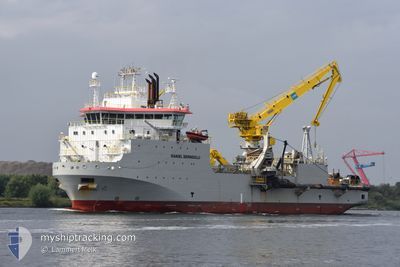
DANIEL BERNOULLI
Dredging or underwater ops
Current Trip
| Time Travelled | 37 days |
|---|---|
| Remaining Time | --- |
| Distance Travelled | 4571.74 nm |
| Remaining Distance | --- |
| AVG Speed | 6.7 Knop |
| MAX Speed | 11.4 Knop |
| AVG Wind | 11.5 knots |
| MAX Wind | 31 knots |
| MIN Temp | 7.9°C / 46.22°F |
| MAX Temp | 25.2°C / 77.36°F |
| Djupgående | 5.7 m |
| Position mottagen | 5 m sen |
Current Position
| Longitud | --- |
|---|---|
| Latitude | --- |
| Status | Moored |
| Fart | 0.1 Knop |
| Kurs | 234° |
| Område | North Atlantic Ocean |
| Station | T-AIS |
| Position mottagen | 5 m sen |
Info
Information
The current position of DANIEL BERNOULLI is in North Atlantic Ocean with coordinates 43.46188° / -8.32750° as reported on 2025-02-08 10:19 by AIS to our vessel tracker app. The vessel's current speed is 0.1 Knop
The vessel DANIEL BERNOULLI (IMO: 9778715, MMSI: 253350000) is a Dredging or underwater ops It's sailing under the flag of [LU] Luxembourg.
In this page you can find informations about the vessels current position, last detected port calls, and current voyage information. If the vessels is not in coverage by AIS you will find the latest position.
The current position of DANIEL BERNOULLI is detected by our AIS receivers and we are not responsible for the reliability of the data. The last position was recorded while the vessel was in Coverage by the Ais receivers of our vessel tracking app.
The current draught of DANIEL BERNOULLI as reported by AIS is 5.7 meters
Weather
| Temperature | 7.2°C / 44.96°F |
|---|---|
| Wind Speed | 7 knots |
| Direction | 170° S |
| Pressure | 1023.5 hPa |
| Humidity | 66.9 % |
| Cloud Coverage | 25 % |
Featured Company
Most Visited Ports (Last year)
| Port | Arrivals | |
|---|---|---|
| 54 | ||
| 1 | ||
| 1 |
Last Trips
| Origin | Departure | Destination | Arrival | Distance | |
|---|---|---|---|---|---|
| 2025-01-02 07:32 | 2025-01-17 13:09 | 1819.44 nm | |||
| 2024-12-28 13:33 | 2024-12-28 16:07 | 1.36 nm | |||
| 2024-12-24 16:11 | 2024-12-28 13:05 | 250.58 nm | |||
| 2024-12-12 09:35 | 2024-12-23 22:04 | 243.57 nm | |||
| 2024-11-26 21:50 | 2024-12-11 08:52 | 375.65 nm |
Events
| Tid | Event | Detaljer | Position / Dest | Information |
|---|---|---|---|---|
| 2025-02-07 06:50 | Status ändrad | Moored Under way using engine |
43.46185 / -8.32751
ES FRO
|
Fart: Kurs: 235° |
| 2025-02-07 05:44 | STOPPAR förflyttning | 3.58 nm, West of MUGARDOS |
43.46086 / -8.32667
ES FRO
|
Fart: 0.3 kn Kurs: 231° |
| 2025-02-06 21:40 | Upptäckt i hav | Spanish part of the North Atlantic Ocean |
43.44587 / -9.25168
North Atlantic Ocean
ES FRO
|
Fart: 6.1 kn Kurs: 90.1° |
| 2025-02-06 21:40 | I täckningsområde |
43.44587 / -9.25168
North Atlantic Ocean
ES FRO
|
Fart: 6.1 kn Kurs: 90.1° |
|
| 2025-02-06 03:39 | UTANFÖR täckningsområde |
41.32817 / -9.86947
North Atlantic Ocean
ES FRO
|
Fart: 9.1 kn Kurs: 1.6° |
|
| 2025-02-06 03:26 | I täckningsområde |
41.29297 / -9.87062
North Atlantic Ocean
ES FRO
|
Fart: 9.3 kn Kurs: 1.1° |
|
| 2025-02-06 02:12 | UTANFÖR täckningsområde |
41.10144 / -9.88001
North Atlantic Ocean
ES FRO
|
Fart: 9.3 kn Kurs: 2.3° |
|
| 2025-02-05 18:12 | ETA ändrat | 2025/02/07 05:00 2025/07/02 05:00 |
39.88909 / -9.93989
ES FRO
|
Fart: 9.3 kn Kurs: 1.6° |
| 2025-02-05 05:21 | Status ändrad | Under way using engine At anchor |
38.70887 / -9.10826
ES FRO
|
Fart: 3.2 kn Kurs: 257° |
| 2025-02-05 05:21 | STARTAR förflyttning | 1.04 nm, East of LISBOA |
38.70891 / -9.10771
ES FRO
|
Fart: 3.1 kn Kurs: 256° |