
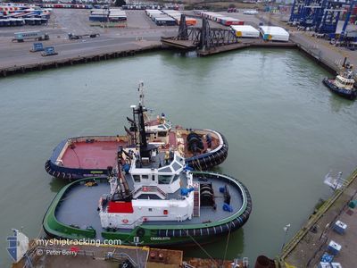
CRAIGLEITH
Tug
Current Trip
FORTH ESTUARY TOWAGE
| Time Travelled | 2 h, 13 mins |
|---|---|
| Remaining Time | --- |
| Distance Travelled | 0.17 nm |
| Remaining Distance | --- |
| AVG Speed | --- |
| MAX Speed | --- |
| AVG Wind | 3 knots |
| MAX Wind | 3 knots |
| MIN Temp | 2.1°C / 35.78°F |
| MAX Temp | 2.4°C / 36.32°F |
| Djupgående | 5.6 m |
| Position mottagen | 5 m sen |
Current Position
| Longitud | --- |
|---|---|
| Latitude | --- |
| Status | Moored |
| Fart | |
| Kurs | 263° |
| Område | North Sea |
| Station | T-AIS |
| Position mottagen | 5 m sen |
Info
Information
The current position of CRAIGLEITH is in North Sea with coordinates 56.03261° / -3.30825° as reported on 2025-03-18 01:53 by AIS to our vessel tracker app. The vessel's current speed is 0 Knop
The vessel CRAIGLEITH (IMO: 9803819, MMSI: 232015861) is a Tug It's sailing under the flag of [GB] United Kingdom.
In this page you can find informations about the vessels current position, last detected port calls, and current voyage information. If the vessels is not in coverage by AIS you will find the latest position.
The current position of CRAIGLEITH is detected by our AIS receivers and we are not responsible for the reliability of the data. The last position was recorded while the vessel was in Coverage by the Ais receivers of our vessel tracking app.
The current draught of CRAIGLEITH as reported by AIS is 5.6 meters
Weather
| Temperature | 2.1°C / 35.78°F |
|---|---|
| Wind Speed | 3 knots |
| Direction | 106° ESE |
| Pressure | 1030.8 hPa |
| Humidity | 79.5 % |
| Cloud Coverage | 11 % |
Featured Company
Last Port Calls
| Port | Arrival | Departure | Time In Port |
|---|---|---|---|
| 2025-03-17 23:20 | 2025-03-17 23:46 | 26 m | |
| 2025-03-16 18:24 | 2025-03-16 18:46 | 22 m | |
| 2025-03-15 10:13 | 2025-03-15 10:46 | 32 m | |
| 2025-03-15 02:10 | 2025-03-15 02:36 | 26 m | |
| 2025-03-14 00:34 | 2025-03-14 14:33 | 13 h | |
| 2025-03-13 06:38 | 2025-03-13 07:11 | 32 m | |
| 2025-03-11 12:29 | 2025-03-11 23:48 | 11 h | |
| 2025-03-11 10:32 | 2025-03-11 11:20 | 47 m | |
| 2025-03-10 18:38 | 2025-03-10 19:15 | 37 m | |
| 2025-03-08 09:37 | 2025-03-09 13:15 | 1 d |
Last Trips
| Origin | Departure | Destination | Arrival | Distance | |
|---|---|---|---|---|---|
| 2025-03-16 18:46 | 2025-03-17 23:20 | 15.72 nm | |||
| 2025-03-15 10:46 | 2025-03-16 18:24 | 0.96 nm | |||
| 2025-03-15 02:36 | 2025-03-15 10:13 | 16.51 nm | |||
| 2025-03-14 14:33 | 2025-03-15 02:10 | 94.74 nm | |||
| 2025-03-13 07:11 | 2025-03-14 00:34 | 91.23 nm | |||
| 2025-03-11 23:48 | 2025-03-13 06:38 | 20.45 nm | |||
| 2025-03-11 11:20 | 2025-03-11 12:29 | 10.64 nm | |||
| 2025-03-10 19:15 | 2025-03-11 10:32 | 10.74 nm | |||
| 2025-03-09 13:15 | 2025-03-10 18:38 | 91.52 nm | |||
| 2025-03-08 08:46 | 2025-03-08 09:37 | 3.62 nm |
Events
| Tid | Event | Detaljer | Position / Dest | Information |
|---|---|---|---|---|
| 2025-03-18 01:47 | Status ändrad | Moored Default |
56.03259 / -3.30835
FORTH ESTUARY TOWAGE
|
Fart: Kurs: 249° |
| 2025-03-18 01:29 | Status ändrad | Default Moored |
56.03256 / -3.30836
FORTH ESTUARY TOWAGE
|
Fart: Kurs: 246° |
| 2025-03-18 01:23 | Status ändrad | Moored Default |
56.03255 / -3.30837
FORTH ESTUARY TOWAGE
|
Fart: 0.1 kn Kurs: 247° |
| 2025-03-18 01:14 | Status ändrad | Default Moored |
56.03257 / -3.30836
FORTH ESTUARY TOWAGE
|
Fart: Kurs: 252° |
| 2025-03-17 23:53 | Status ändrad | Moored Under way using engine |
56.03260 / -3.30764
FORTH ESTUARY TOWAGE
|
Fart: 0.3 kn Kurs: 319° |
| 2025-03-17 23:49 | STOPPAR förflyttning | 0.2 nm, South East of BRAEFOOT |
56.03300 / -3.30735
FORTH ESTUARY TOWAGE
|
Fart: 0.2 kn Kurs: 83° |
| 2025-03-17 23:47 | STARTAR förflyttning | 0.14 nm, South of BRAEFOOT |
56.03345 / -3.30977
FORTH ESTUARY TOWAGE
|
Fart: 6.4 kn Kurs: 280° |
| 2025-03-17 23:46 | AVGÅTT HAMN |
|
56.03345 / -3.30977
FORTH ESTUARY TOWAGE
|
Fart: 6 kn Kurs: 315° |
| 2025-03-17 23:21 | STOPPAR förflyttning |
56.03397 / -3.31342
[GB] BRAEFOOT
|
Fart: 0.1 kn Kurs: 41° |
|
| 2025-03-17 23:20 | ANLÄNDER HAMN |
|
56.03398 / -3.31348
[GB] BRAEFOOT
|
Fart: 0.9 kn Kurs: 55° |