
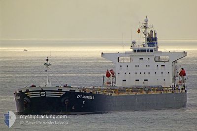
CPT GEORGIOS S
Bulk Carrier
Current Trip
| Time Travelled | 1 day |
|---|---|
| Remaining Time | --- |
| Distance Travelled | 7.30 nm |
| Remaining Distance | --- |
| AVG Speed | 5.9 Knop |
| MAX Speed | 9.4 Knop |
| AVG Wind | 5.8 knots |
| MAX Wind | 8.2 knots |
| MIN Temp | 7.7°C / 45.86°F |
| MAX Temp | 9.7°C / 49.46°F |
| Djupgående | 13.8 m |
| Position mottagen | 5 d sen |
Current Position
| Longitud | --- |
|---|---|
| Latitude | --- |
| Status | Under way using engine |
| Fart | 9.2 Knop |
| Kurs | 30.7° |
| Område | Sea of Marmara |
| Station | T-AIS |
| Position mottagen | 5 d sen |
Information
The current position of CPT GEORGIOS S is in Sea of Marmara with coordinates 40.35558° / 26.66273° as reported on 2025-02-22 15:31 by AIS to our vessel tracker app. The vessel's current speed is 9.2 Knop and is heading at the port of ICDAS. The estimated time of arrival as calculated by MyShipTracking vessel tracking app is 2025-02-22 21:00 LT
The vessel CPT GEORGIOS S (IMO: 9262936, MMSI: 636019585) is a Bulk Carrier that was built in 2002 ( 23 År gammal ). It's sailing under the flag of [LR] Liberia.
In this page you can find informations about the vessels current position, last detected port calls, and current voyage information. If the vessels is not in coverage by AIS you will find the latest position.
The current position of CPT GEORGIOS S is detected by our AIS receivers and we are not responsible for the reliability of the data. The last position was recorded while the vessel was in Coverage by the Ais receivers of our vessel tracking app.
The current draught of CPT GEORGIOS S as reported by AIS is 13.8 meters
Weather
| Temperature | 9.2°C / 48.56°F |
|---|---|
| Wind Speed | 11 knots |
| Direction | 82° E |
| Pressure | 1020 hPa |
| Humidity | 86.2 % |
| Cloud Coverage | 100 % |
Featured Company
Most Visited Ports (Last year)
| Port | Arrivals | |
|---|---|---|
| 11 | ||
| 6 | ||
| 6 | ||
| 5 | ||
| 1 | ||
| 1 |
Events
| Tid | Event | Detaljer | Position / Dest | Information |
|---|---|---|---|---|
| 2025-02-26 17:19 | STOPPAR förflyttning | 3.11 nm, North West of ICDAS |
40.48413 / 27.08882
ICDAS,TURKEY
|
Fart: 0.3 kn Kurs: 111° |
| 2025-02-26 15:43 | STARTAR förflyttning | 0.98 nm, South West of KEMER |
40.40755 / 27.03321
ICDAS,TURKEY
|
Fart: 3.5 kn Kurs: 313° |
| 2025-02-26 15:43 | AVGÅTT HAMN |
|
40.40755 / 27.03321
ICDAS,TURKEY
|
Fart: 2 kn Kurs: 114° |
| 2025-02-22 18:33 | STOPPAR förflyttning |
40.40665 / 27.04421
[TR] KEMER
|
Fart: 0.2 kn Kurs: 121° |
|
| 2025-02-22 18:33 | ANLÄNDER HAMN |
|
40.40665 / 27.04421
[TR] KEMER
|
Fart: 3.7 kn Kurs: 109° |
| 2025-02-22 15:38 | Status ändrad | Default Under way using engine |
40.37100 / 26.67461
ICDAS,TURKEY
|
Fart: 9.2 kn Kurs: 30.7° |
| 2025-02-22 15:31 | Status ändrad | Under way using engine Default |
40.35558 / 26.66273
ICDAS,TURKEY
|
Fart: 9.7 kn Kurs: 44° |
| 2025-02-22 15:31 | UTANFÖR täckningsområde |
40.35558 / 26.66273
Sea of Marmara
ICDAS,TURKEY
|
Fart: 9.2 kn Kurs: 30.7° |
|
| 2025-02-22 14:56 | Status ändrad | Default Under way using engine |
40.28841 / 26.57360
ICDAS,TURKEY
|
Fart: 10 kn Kurs: 46.5° |
| 2025-02-22 11:55 | Byter havsområde | Turkish part of the Sea of Marmara Turkish part of the Aegean Sea |
40.01728 / 26.18951
Sea of Marmara
ICDAS,TURKEY
|
Fart: 4.4 kn Kurs: 76.9° |