
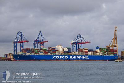
COSCO HIMALAYAS
Cargo B
Current Trip
| Time Travelled | 24 days |
|---|---|
| Remaining Time | 5 days |
| Distance Travelled | 10022.91 nm |
| Remaining Distance | 2084.93 nm |
| AVG Speed | 16.8 Knop |
| MAX Speed | 23 Knop |
| AVG Wind | 11.7 knots |
| MAX Wind | 27 knots |
| MIN Temp | 16.7°C / 62.06°F |
| MAX Temp | 33.5°C / 92.3°F |
| Djupgående | 14.8 m |
| Position mottagen | 1 d sen |
Current Position
| Longitud | -17.99279° |
|---|---|
| Latitude | 16.40807° |
| Status | Under way using engine |
| Fart | 16.8 Knop |
| Kurs | 1.4° |
| Område | North Atlantic Ocean |
| Station | T-AIS |
| Position mottagen | 1 d sen |
Info
Information
The current position of COSCO HIMALAYAS is in North Atlantic Ocean with coordinates 16.40807° / -17.99279° as reported on 2024-04-27 12:28 by AIS to our vessel tracker app. The vessel's current speed is 16.8 Knop and is heading at the port of HAMBURG. The estimated time of arrival as calculated by MyShipTracking vessel tracking app is 2024-05-04 06:54 LT
The vessel COSCO HIMALAYAS (IMO: 9757840, MMSI: 477100300) is a Cargo B It's sailing under the flag of [HK] Hong Kong.
In this page you can find informations about the vessels current position, last detected port calls, and current voyage information. If the vessels is not in coverage by AIS you will find the latest position.
The current position of COSCO HIMALAYAS is detected by our AIS receivers and we are not responsible for the reliability of the data. The last position was recorded while the vessel was in Coverage by the Ais receivers of our vessel tracking app.
The current draught of COSCO HIMALAYAS as reported by AIS is 14.8 meters
Weather
| Temperature | 19.1°C / 66.38°F |
|---|---|
| Wind Speed | 22 knots |
| Direction | 19° NNE |
| Pressure | 1019.9 hPa |
| Humidity | 61.5 % |
| Cloud Coverage | --- |
Featured Company
Last Port Calls
| Port | Arrival | Departure | Time In Port |
|---|---|---|---|
| 2024-04-04 05:13 | 2024-04-04 18:58 | 13 h | |
| 2024-03-29 09:18 | 2024-03-30 03:09 | 17 h | |
| 2024-03-28 15:35 | 2024-03-29 04:36 | 13 h | |
| 2024-03-27 21:51 | 2024-03-28 08:25 | 10 h | |
| 2024-03-23 04:41 | 2024-03-24 16:56 | 1 d | |
| 2024-03-16 00:23 | 2024-03-17 18:55 | 1 d | |
| 2024-03-15 07:17 | 2024-03-15 22:50 | 15 h | |
| 2024-02-16 03:56 | 2024-02-17 09:09 | 1 d | |
| 2024-02-13 16:37 | 2024-02-15 02:32 | 1 d | |
| 2024-02-10 20:36 | 2024-02-13 02:32 | 2 d |
Last Trips
| Origin | Departure | Destination | Arrival | Distance | |
|---|---|---|---|---|---|
| 2024-03-30 11:09 | 2024-04-04 13:13 | 1557.42 nm | |||
| 2024-03-29 12:36 | 2024-03-29 17:18 | 57.01 nm | |||
| 2024-03-28 16:25 | 2024-03-28 23:35 | 77.40 nm | |||
| 2024-03-25 00:56 | 2024-03-28 05:51 | 916.14 nm | |||
| 2024-03-18 02:55 | 2024-03-23 12:41 | 2202.43 nm | |||
| 2024-03-16 06:50 | 2024-03-16 08:23 | 11.03 nm | |||
| 2024-02-17 10:09 | 2024-03-15 15:17 | 11143.45 nm | |||
| 2024-02-15 03:32 | 2024-02-16 04:56 | 351.02 nm | |||
| 2024-02-13 03:32 | 2024-02-13 17:37 | 225.63 nm | |||
| 2024-02-10 16:21 | 2024-02-10 21:36 | 64.17 nm |
Events
| Tid | Event | Detaljer | Position / Dest | Information |
|---|---|---|---|---|
| 2024-04-27 12:43 | Status ändrad | Default Under way using engine |
16.51297 / -17.99101
DE HAM
|
Fart: 16.8 kn Kurs: 1.4° |
| 2024-04-27 12:28 | UTANFÖR täckningsområde |
16.40807 / -17.99279
North Atlantic Ocean
DE HAM
|
Fart: 16.8 kn Kurs: 1.4° |
|
| 2024-04-27 12:11 | Byter havsområde | Mauritanian part of the North Atlantic Ocean High seas of the South Atlantic Ocean |
16.35120 / -17.99199
North Atlantic Ocean
DE HAM
|
Fart: 16.8 kn Kurs: 357.8° |
| 2024-04-27 12:11 | Status ändrad | Under way using engine Default |
16.35120 / -17.99199
DE HAM
|
Fart: 16.8 kn Kurs: 358° |
| 2024-04-27 11:55 | I täckningsområde |
16.35120 / -17.99199
North Atlantic Ocean
DE HAM
|
Fart: 16.8 kn Kurs: 357.8° |
|
| 2024-04-20 20:47 | Status ändrad | Default Under way using engine |
-22.38833 / 7.95167
DE HAM
|
Fart: 18 kn Kurs: 324.1° |
| 2024-04-20 20:42 | Byter havsområde | High seas of the South Atlantic Ocean South African part of the South Atlantic Ocean |
-22.40482 / 7.96344
South Atlantic Ocean
DE HAM
|
Fart: 18 kn Kurs: 324.1° |
| 2024-04-20 20:42 | Status ändrad | Under way using engine Default |
-22.40482 / 7.96344
DE HAM
|
Fart: 18 kn Kurs: 325° |
| 2024-04-20 20:42 | UTANFÖR täckningsområde |
-22.40482 / 7.96344
South Atlantic Ocean
DE HAM
|
Fart: 18 kn Kurs: 324.1° |
|
| 2024-04-20 20:35 | I täckningsområde |
-22.40482 / 7.96344
South Atlantic Ocean
DE HAM
|
Fart: 18 kn Kurs: 324.1° |