
COPERNICUS
Tanker
Current Trip
| Time Travelled | 6 days |
|---|---|
| Remaining Time | 16 days |
| Distance Travelled | 2142.03 nm |
| Remaining Distance | 6117.63 nm |
| AVG Speed | 14.1 Knop |
| MAX Speed | 18.7 Knop |
| AVG Wind | 12.6 knots |
| MAX Wind | 27 knots |
| MIN Temp | 2.4°C / 36.32°F |
| MAX Temp | 16°C / 60.8°F |
| Djupgående | 7.9 m |
| Position mottagen | 3 d sen |
Current Position
| Longitud | 142.20466° |
|---|---|
| Latitude | 41.64066° |
| Status | Under way using engine |
| Fart | 15.5 Knop |
| Kurs | 85.3° |
| Område | North Pacific Ocean |
| Station | T-AIS |
| Position mottagen | 3 d sen |
Info
Information
The current position of COPERNICUS is in North Pacific Ocean with coordinates 41.64066° / 142.20466° as reported on 2024-05-09 18:07 by AIS to our vessel tracker app. The vessel's current speed is 15.5 Knop and is heading at the port of BALBOA. The estimated time of arrival as calculated by MyShipTracking vessel tracking app is 2024-05-29 20:19 LT
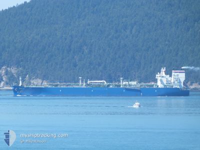
The vessel COPERNICUS (IMO: 9706516, MMSI: 311000375) is a Tanker It's sailing under the flag of [BS] Bahamas.
In this page you can find informations about the vessels current position, last detected port calls, and current voyage information. If the vessels is not in coverage by AIS you will find the latest position.
The current position of COPERNICUS is detected by our AIS receivers and we are not responsible for the reliability of the data. The last position was recorded while the vessel was in Coverage by the Ais receivers of our vessel tracking app.
The current draught of COPERNICUS as reported by AIS is 7.9 meters
Weather
| Temperature | 3.8°C / 38.84°F |
|---|---|
| Wind Speed | 6 knots |
| Direction | 249° WSW |
| Pressure | 1035.5 hPa |
| Humidity | 83.5 % |
| Cloud Coverage | 100 % |
Featured Company
Most Visited Ports (Last year)
| Port | Arrivals | |
|---|---|---|
| 3 | ||
| 2 | ||
| 1 | ||
| 1 | ||
| 1 | ||
| 1 |
Last Trips
Events
| Tid | Event | Detaljer | Position / Dest | Information |
|---|---|---|---|---|
| 2024-05-09 18:12 | Status ändrad | Default Under way using engine |
41.64274 / 142.23509
PA BLB
|
Fart: 15.5 kn Kurs: 85.3° |
| 2024-05-09 18:07 | Status ändrad | Under way using engine Default |
41.64066 / 142.20466
PA BLB
|
Fart: 15.6 kn Kurs: 85° |
| 2024-05-09 18:07 | UTANFÖR täckningsområde |
41.64066 / 142.20466
North Pacific Ocean
PA BLB
|
Fart: 15.5 kn Kurs: 85.3° |
|
| 2024-05-09 18:04 | Status ändrad | Default Under way using engine |
41.63973 / 142.18907
PA BLB
|
Fart: 15.5 kn Kurs: 85.8° |
| 2024-05-09 17:59 | Status ändrad | Under way using engine Default |
41.63796 / 142.15962
PA BLB
|
Fart: 15.4 kn Kurs: 87° |
| 2024-05-09 17:44 | Status ändrad | Default Under way using engine |
41.63334 / 142.07333
PA BLB
|
Fart: 15.4 kn Kurs: 84.3° |
| 2024-05-09 15:34 | Byter havsområde | Japanese part of the North Pacific Ocean Japanese part of the Japan Sea |
41.63018 / 141.30519
North Pacific Ocean
PA BLB
|
Fart: 15.7 kn Kurs: 89.6° |
| 2024-05-09 12:18 | Status ändrad | Under way using engine Default |
41.31091 / 140.24778
PA BLB
|
Fart: 16 kn Kurs: 58° |
| 2024-05-09 12:14 | Status ändrad | Default Under way using engine |
41.29833 / 140.22333
PA BLB
|
Fart: 17.2 kn Kurs: 63.7° |
| 2024-05-09 12:08 | Status ändrad | Under way using engine Default |
41.28502 / 140.18917
PA BLB
|
Fart: 17 kn Kurs: 68° |