
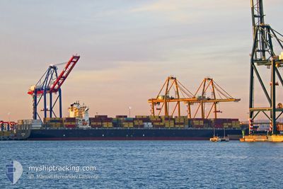
CONTI COURAGE
Container Ship
Current Trip
| Time Travelled | 11 days |
|---|---|
| Remaining Time | --- |
| Distance Travelled | 4203.65 nm |
| Remaining Distance | --- |
| AVG Speed | 15.2 Knop |
| MAX Speed | 23 Knop |
| AVG Wind | 14.8 knots |
| MAX Wind | 31.9 knots |
| MIN Temp | 17.8°C / 64.04°F |
| MAX Temp | 31.2°C / 88.16°F |
| Djupgående | 14.6 m |
| Position mottagen | 15 h, 16 m sen |
Current Position
| Longitud | 31.37720° |
|---|---|
| Latitude | -30.29096° |
| Status | Under way using engine |
| Fart | 18.4 Knop |
| Kurs | 223° |
| Område | Indian Ocean |
| Station | T-AIS |
| Position mottagen | 15 h, 16 m sen |
Info
Information
The current position of CONTI COURAGE is in Indian Ocean with coordinates -30.29096° / 31.37720° as reported on 2024-06-09 17:04 by AIS to our vessel tracker app. The vessel's current speed is 18.4 Knop and is heading at the port of FELIXSTOWE. The estimated time of arrival as calculated by MyShipTracking vessel tracking app is 2024-06-28 14:00 LT
The vessel CONTI COURAGE (IMO: 9293789, MMSI: 636093042) is a Container Ship that was built in 2005 ( 19 År gammal ). It's sailing under the flag of [LR] Liberia.
In this page you can find informations about the vessels current position, last detected port calls, and current voyage information. If the vessels is not in coverage by AIS you will find the latest position.
The current position of CONTI COURAGE is detected by our AIS receivers and we are not responsible for the reliability of the data. The last position was recorded while the vessel was in Coverage by the Ais receivers of our vessel tracking app.
The current draught of CONTI COURAGE as reported by AIS is 14.6 meters
Weather
| Temperature | 18.4°C / 65.12°F |
|---|---|
| Wind Speed | 7 knots |
| Direction | 323° NW |
| Pressure | 1029.2 hPa |
| Humidity | 48 % |
| Cloud Coverage | 6 % |
Featured Company
Last Port Calls
| Port | Arrival | Departure | Time In Port |
|---|---|---|---|
| 2024-05-27 19:01 | 2024-05-29 19:50 | 2 d | |
| 2024-05-24 08:07 | 2024-05-25 00:33 | 16 h | |
| 2024-05-21 06:16 | 2024-05-22 06:51 | 1 d | |
| 2024-05-21 05:47 | 2024-05-21 05:57 | 9 m | |
| 2024-05-16 18:11 | 2024-05-17 22:38 | 1 d | |
| 2024-04-02 05:55 | 2024-04-14 03:40 | 11 d |
Most Visited Ports (Last year)
| Port | Arrivals | |
|---|---|---|
| 5 | ||
| 4 | ||
| 4 | ||
| 4 | ||
| 4 | ||
| 4 |
Last Trips
| Origin | Departure | Destination | Arrival | Distance | |
|---|---|---|---|---|---|
| 2024-05-25 06:03 | 2024-05-28 00:31 | 551.55 nm | |||
| 2024-05-22 11:51 | 2024-05-24 13:37 | 548.12 nm | |||
| 2024-05-21 10:57 | 2024-05-21 11:16 | 0.34 nm | |||
| 2024-05-18 02:38 | 2024-05-21 10:47 | 888.63 nm | |||
| 2024-04-13 23:40 | 2024-05-16 22:11 | 11629.40 nm | |||
| 2024-03-27 10:50 | 2024-04-02 01:55 | 1121.03 nm |
Events
| Tid | Event | Detaljer | Position / Dest | Information |
|---|---|---|---|---|
| 2024-06-09 17:12 | Status ändrad | Default Under way using engine |
-30.31961 / 31.34595
GBFXT
|
Fart: 18.4 kn Kurs: 223° |
| 2024-06-09 17:04 | UTANFÖR täckningsområde |
-30.29096 / 31.37720
Indian Ocean
GBFXT
|
Fart: 18.4 kn Kurs: 223° |
|
| 2024-06-09 14:19 | Djupgående ändrat | 14.6 13.3 |
-29.64298 / 31.91488
GBFXT
|
Fart: 16.8 kn Kurs: 209.2° |
| 2024-06-09 14:19 | Destination ändrad | GBFXT PKBQM |
-29.64298 / 31.91488
GBFXT
|
Fart: 16.8 kn Kurs: 209.2° |
| 2024-06-09 14:19 | ETA ändrat | 2024/06/28 14:00 2024/05/20 07:00 |
-29.64298 / 31.91488
GBFXT
|
Fart: 16.8 kn Kurs: 209.2° |
| 2024-06-09 14:08 | Byter havsområde | South African part of the Indian Ocean Omani part of the Gulf of Oman |
-29.59714 / 31.94569
Indian Ocean
|
Fart: 16.4 kn Kurs: 211.1° |
| 2024-06-09 14:08 | I täckningsområde |
-29.59714 / 31.94569
Indian Ocean
|
Fart: 16.4 kn Kurs: 211.1° |
|
| 2024-06-09 14:05 | Status ändrad | Under way using engine Default |
-29.58582 / 31.95339
PKBQM
|
Fart: 16.2 kn Kurs: 212° |