
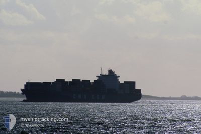
CMA CGM SAMBHAR
Container Ship
Current Trip
| Time Travelled | 4 days |
|---|---|
| Remaining Time | 3 days |
| Distance Travelled | 1826.54 nm |
| Remaining Distance | 1652.90 nm |
| AVG Speed | 18.5 Knop |
| MAX Speed | 20.2 Knop |
| AVG Wind | 11.1 knots |
| MAX Wind | 19 knots |
| MIN Temp | 13.1°C / 55.58°F |
| MAX Temp | 19.7°C / 67.46°F |
| Djupgående | 10.5 m |
| Position mottagen | 1 d sen |
Current Position
| Longitud | -30.62872° |
|---|---|
| Latitude | 38.69734° |
| Status | Under way using engine |
| Fart | 19 Knop |
| Kurs | 239° |
| Område | North Atlantic Ocean |
| Station | T-AIS |
| Position mottagen | 1 d sen |
Info
Information
The current position of CMA CGM SAMBHAR is in North Atlantic Ocean with coordinates 38.69734° / -30.62872° as reported on 2024-05-10 15:46 by AIS to our vessel tracker app. The vessel's current speed is 19 Knop and is heading at the port of POINTE A PITRE. The estimated time of arrival as calculated by MyShipTracking vessel tracking app is 2024-05-15 11:31 LT
The vessel CMA CGM SAMBHAR (IMO: 9295969, MMSI: 215648000) is a Container Ship that was built in 2006 ( 18 År gammal ). It's sailing under the flag of [MT] Malta.
In this page you can find informations about the vessels current position, last detected port calls, and current voyage information. If the vessels is not in coverage by AIS you will find the latest position.
The current position of CMA CGM SAMBHAR is detected by our AIS receivers and we are not responsible for the reliability of the data. The last position was recorded while the vessel was in Coverage by the Ais receivers of our vessel tracking app.
The current draught of CMA CGM SAMBHAR as reported by AIS is 10.5 meters
Weather
| Temperature | 19.4°C / 66.92°F |
|---|---|
| Wind Speed | 6 knots |
| Direction | 207° SSW |
| Pressure | 1026.8 hPa |
| Humidity | 74.8 % |
| Cloud Coverage | 100 % |
Featured Company
Last Port Calls
| Port | Arrival | Departure | Time In Port |
|---|---|---|---|
| 2024-05-06 09:59 | 2024-05-07 16:46 | 1 d | |
| 2024-05-03 22:34 | 2024-05-05 02:39 | 1 d | |
| 2024-05-02 01:26 | 2024-05-02 16:42 | 15 h | |
| 2024-05-01 01:50 | 2024-05-01 13:19 | 11 h | |
| 2024-04-29 04:12 | 2024-04-30 12:32 | 1 d | |
| 2024-04-20 09:18 | 2024-04-21 03:45 | 18 h | |
| 2024-04-19 09:25 | 2024-04-20 01:28 | 16 h | |
| 2024-04-17 06:11 | 2024-04-17 11:56 | 5 h | |
| 2024-04-16 05:42 | 2024-04-16 16:03 | 10 h | |
| 2024-04-10 21:35 | 2024-04-11 17:52 | 20 h |
Most Visited Ports (Last year)
| Port | Arrivals | |
|---|---|---|
| 21 | ||
| 17 | ||
| 9 | ||
| 9 | ||
| 9 | ||
| 9 |
Last Trips
| Origin | Departure | Destination | Arrival | Distance | |
|---|---|---|---|---|---|
| 2024-05-05 04:39 | 2024-05-06 11:59 | 470.27 nm | |||
| 2024-05-02 18:42 | 2024-05-04 00:34 | 272.01 nm | |||
| 2024-05-01 14:19 | 2024-05-02 03:26 | 160.75 nm | |||
| 2024-04-30 14:32 | 2024-05-01 02:50 | 163.07 nm | |||
| 2024-04-20 23:45 | 2024-04-29 06:12 | 3702.16 nm | |||
| 2024-04-19 21:28 | 2024-04-20 05:18 | 113.13 nm | |||
| 2024-04-17 06:56 | 2024-04-19 05:25 | 810.06 nm | |||
| 2024-04-16 11:03 | 2024-04-17 01:11 | 134.93 nm | |||
| 2024-04-11 12:52 | 2024-04-16 00:42 | 1096.26 nm | |||
| 2024-04-08 14:52 | 2024-04-10 16:35 | 940.40 nm |
Events
| Tid | Event | Detaljer | Position / Dest | Information |
|---|---|---|---|---|
| 2024-05-10 15:50 | Status ändrad | Default Under way using engine |
38.68667 / -30.65167
FRMTX-GPPTP
|
Fart: 19 kn Kurs: 239° |
| 2024-05-10 15:46 | UTANFÖR täckningsområde |
38.69734 / -30.62872
North Atlantic Ocean
FRMTX-GPPTP
|
Fart: 19 kn Kurs: 239° |
|
| 2024-05-10 15:23 | Status ändrad | Under way using engine Default |
38.75878 / -30.50005
FRMTX-GPPTP
|
Fart: 18 kn Kurs: 239° |
| 2024-05-10 15:05 | Status ändrad | Default Under way using engine |
38.80833 / -30.39500
FRMTX-GPPTP
|
Fart: 18.1 kn Kurs: 237.1° |
| 2024-05-10 14:36 | Status ändrad | Under way using engine Default |
38.88627 / -30.23762
FRMTX-GPPTP
|
Fart: 18 kn Kurs: 239° |
| 2024-05-10 14:29 | Status ändrad | Default Under way using engine |
38.90500 / -30.19667
FRMTX-GPPTP
|
Fart: 18.1 kn Kurs: 238.2° |
| 2024-05-10 08:53 | Byter havsområde | Portuguese (Azores) part of the North Atlantic Ocean Spanish part of the North Atlantic Ocean |
39.75822 / -28.31536
North Atlantic Ocean
FRMTX-GPPTP
|
Fart: 18.6 kn Kurs: 238° |
| 2024-05-10 08:53 | Status ändrad | Under way using engine Default |
39.75822 / -28.31536
FRMTX-GPPTP
|
Fart: 18 kn Kurs: 238° |
| 2024-05-10 08:38 | I täckningsområde |
39.75822 / -28.31536
North Atlantic Ocean
FRMTX-GPPTP
|
Fart: 18.6 kn Kurs: 238° |
|
| 2024-05-08 12:54 | UTANFÖR täckningsområde |
45.48406 / -10.89099
North Atlantic Ocean
FRMTX-GPPTP
|
Fart: 19.2 kn Kurs: 251.6° |