

CHIQUITA EXPLORER
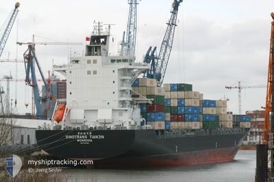
Container Ship

Current Trip
GTPBR
| Time Travelled | 16 h, 29 mins |
|---|---|
| Remaining Time | --- |
| Distance Travelled | 275.50 nm |
| Remaining Distance | --- |
| AVG Speed | 16 Knop |
| MAX Speed | 18.4 Knop |
| AVG Wind | 10.2 knots |
| MAX Wind | 15 knots |
| MIN Temp | 22.5°C / 72.5°F |
| MAX Temp | 27.1°C / 80.78°F |
| Djupgående | 10.7 m |
| Position mottagen | 4 d sen |
Current Position
| Longitud | --- |
|---|---|
| Latitude | --- |
| Status | Under way using engine |
| Fart | 16.5 Knop |
| Kurs | 191.2° |
| Område | North Atlantic Ocean |
| Station | T-AIS |
| Position mottagen | 4 d sen |
Information
The current position of CHIQUITA EXPLORER is in North Atlantic Ocean with coordinates 25.88090° / -79.52724° as reported on 2025-03-03 01:30 by AIS to our vessel tracker app. The vessel's current speed is 16.5 Knop
The vessel CHIQUITA EXPLORER (IMO: 9304966, MMSI: 636022893) is a Container Ship that was built in 2005 ( 20 År gammal ). It's sailing under the flag of [LR] Liberia.
In this page you can find informations about the vessels current position, last detected port calls, and current voyage information. If the vessels is not in coverage by AIS you will find the latest position.
The current position of CHIQUITA EXPLORER is detected by our AIS receivers and we are not responsible for the reliability of the data. The last position was recorded while the vessel was in Coverage by the Ais receivers of our vessel tracking app.
The current draught of CHIQUITA EXPLORER as reported by AIS is 10.7 meters
Weather
| Temperature | 27°C / 80.6°F |
|---|---|
| Wind Speed | 13 knots |
| Direction | 123° ESE |
| Pressure | 1014.8 hPa |
| Humidity | 73.5 % |
| Cloud Coverage | 1 % |


Featured Company
Last Port Calls
| Port | Arrival | Departure | Time In Port |
|---|---|---|---|
| 2025-03-05 03:43 | 2025-03-07 03:51 | 2 d | |
| 2025-02-26 16:28 | 2025-02-28 18:24 | 2 d | |
| 2025-02-21 03:11 | 2025-02-22 10:03 | 1 d | |
| 2025-02-20 10:35 | 2025-02-20 22:12 | 11 h | |
| 2025-02-13 18:51 | 2025-02-15 12:57 | 1 d | |
| 2025-02-08 12:33 | 2025-02-09 08:25 | 19 h | |
| 2025-02-04 17:17 | 2025-02-06 09:35 | 1 d | |
| 2025-02-02 01:24 | 2025-02-02 12:35 | 11 h | |
| 2025-02-02 00:59 | 2025-02-02 01:12 | 12 m | |
| 2025-01-28 17:23 | 2025-01-30 14:19 | 1 d |
Most Visited Ports (Last year)
| Port | Arrivals | |
|---|---|---|
| 28 | ||
| 26 | ||
| 25 | ||
| 17 | ||
| 13 |
Last Trips
| Origin | Departure | Destination | Arrival | Distance | |
|---|---|---|---|---|---|
| 2025-02-28 13:24 | 2025-03-04 21:43 | 1783.99 nm | |||
| 2025-02-22 04:03 | 2025-02-26 11:28 | 1777.12 nm | |||
| 2025-02-20 16:12 | 2025-02-20 21:11 | 62.61 nm | |||
| 2025-02-15 07:57 | 2025-02-20 04:35 | 1887.39 nm | |||
| 2025-02-09 02:25 | 2025-02-13 13:51 | 1725.12 nm | |||
| 2025-02-06 03:35 | 2025-02-08 06:33 | 141.03 nm | |||
| 2025-02-02 07:35 | 2025-02-04 11:17 | 893.42 nm | |||
| 2025-02-01 20:12 | 2025-02-01 20:24 | 0.87 nm | |||
| 2025-01-30 09:19 | 2025-02-01 19:59 | 900.48 nm | |||
| 2025-01-23 23:58 | 2025-01-28 12:23 | 1726.70 nm |
Events
| Tid | Event | Detaljer | Position / Dest | Information |
|---|---|---|---|---|
| 2025-03-07 03:59 | STARTAR förflyttning | 0.37 nm, North West of PUERTO BARRIOS |
15.73985 / -88.61321
GTPBR
|
Fart: 3.9 kn Kurs: 9° |
| 2025-03-07 03:51 | AVGÅTT HAMN |
|
15.73701 / -88.61371
GTPBR
|
Fart: 2.4 kn Kurs: 117° |
| 2025-03-05 03:51 | STOPPAR förflyttning |
15.73516 / -88.60817
[GT] PUERTO BARRIOS
|
Fart: 0.1 kn Kurs: 96° |
|
| 2025-03-05 03:43 | ANLÄNDER HAMN |
|
15.73586 / -88.60947
[GT] PUERTO BARRIOS
|
Fart: 2.9 kn Kurs: 113° |
| 2025-03-03 01:44 | Status ändrad | Default Under way using engine |
25.81833 / -79.53833
GTPBR
|
Fart: 16.5 kn Kurs: 191.2° |
| 2025-03-03 01:30 | Byter havsområde | Bahamas part of the North Atlantic Ocean United States part of the North Atlantic Ocean |
25.88090 / -79.52724
North Atlantic Ocean
GTPBR
|
Fart: 16.5 kn Kurs: 191.2° |
| 2025-03-03 01:30 | UTANFÖR täckningsområde |
25.88090 / -79.52724
North Atlantic Ocean
GTPBR
|
Fart: 16.5 kn Kurs: 191.2° |
|
| 2025-03-03 01:29 | Status ändrad | Under way using engine Default |
25.88547 / -79.52624
GTPBR
|
Fart: 16.5 kn Kurs: 185° |
| 2025-03-03 01:29 | I täckningsområde |
25.88090 / -79.52724
North Atlantic Ocean
GTPBR
|
Fart: 16.5 kn Kurs: 191.2° |
|
| 2025-03-01 07:12 | UTANFÖR täckningsområde |
36.83238 / -74.43876
North Atlantic Ocean
GTPBR
|
Fart: 17.5 kn Kurs: 181° |