
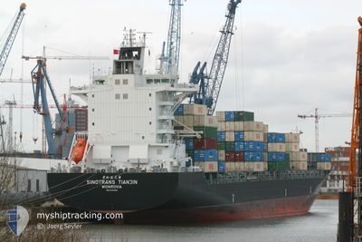
CHIQUITA EXPLORER
Container Ship
Current Trip
| Time Travelled | 4 days |
|---|---|
| Remaining Time | 10 h, 24 mins |
| Distance Travelled | 1671.14 nm |
| Remaining Distance | 129.89 nm |
| AVG Speed | 17.6 Knots |
| MAX Speed | 20.8 Knots |
| AVG Wind | 8.3 knots |
| MAX Wind | 19.7 knots |
| MIN Temp | 9.6°C / 49.28°F |
| MAX Temp | 27.1°C / 80.78°F |
| Dybgang | 10.5 m |
| Position Modtaget | 4 m siden |
Current Position
| Longitude | --- |
|---|---|
| Latitude | --- |
| Status | Under way using engine |
| Fart | 11.5 Knots |
| Kurs | 2.3° |
| Område | North Atlantic Ocean |
| Station | T-AIS |
| Position Modtaget | 4 m siden |
Info
Information
The current position of CHIQUITA EXPLORER is in North Atlantic Ocean with coordinates 37.98054° / -74.40500° as reported on 2025-03-11 04:50 by AIS to our vessel tracker app. The vessel's current speed is 11.5 Knots and is heading at the port of WILMINGTON. The estimated time of arrival as calculated by MyShipTracking vessel tracking app is 2025-03-11 15:19 LT
The vessel CHIQUITA EXPLORER (IMO: 9304966, MMSI: 636022893) is a Container Ship that was built in 2005 ( 20 år gamle ). It's sailing under the flag of [LR] Liberia.
In this page you can find informations about the vessels current position, last detected port calls, and current voyage information. If the vessels is not in coverage by AIS you will find the latest position.
The current position of CHIQUITA EXPLORER is detected by our AIS receivers and we are not responsible for the reliability of the data. The last position was recorded while the vessel was in Coverage by the Ais receivers of our vessel tracking app.
The current draught of CHIQUITA EXPLORER as reported by AIS is 10.5 meters
Weather
| Temperature | 9.7°C / 49.46°F |
|---|---|
| Wind Speed | 8 knots |
| Direction | 95° E |
| Pressure | 1010.8 hPa |
| Humidity | 69.9 % |
| Cloud Coverage | 39 % |
Featured Company
Last Port Calls
| Port | Arrival | Departure | Time In Port |
|---|---|---|---|
| 2025-03-05 03:43 | 2025-03-07 03:51 | 2 d | |
| 2025-02-26 16:28 | 2025-02-28 18:24 | 2 d | |
| 2025-02-21 03:11 | 2025-02-22 10:03 | 1 d | |
| 2025-02-20 10:35 | 2025-02-20 22:12 | 11 h | |
| 2025-02-13 18:51 | 2025-02-15 12:57 | 1 d | |
| 2025-02-08 12:33 | 2025-02-09 08:25 | 19 h | |
| 2025-02-04 17:17 | 2025-02-06 09:35 | 1 d | |
| 2025-02-02 01:24 | 2025-02-02 12:35 | 11 h | |
| 2025-02-02 00:59 | 2025-02-02 01:12 | 12 m | |
| 2025-01-28 17:23 | 2025-01-30 14:19 | 1 d |
Most Visited Ports (Last year)
| Port | Arrivals | |
|---|---|---|
| 28 | ||
| 26 | ||
| 25 | ||
| 17 | ||
| 13 |
Last Trips
| Origin | Departure | Destination | Arrival | Distance | |
|---|---|---|---|---|---|
| 2025-02-28 13:24 | 2025-03-04 21:43 | 1783.99 nm | |||
| 2025-02-22 04:03 | 2025-02-26 11:28 | 1777.12 nm | |||
| 2025-02-20 16:12 | 2025-02-20 21:11 | 62.61 nm | |||
| 2025-02-15 07:57 | 2025-02-20 04:35 | 1887.39 nm | |||
| 2025-02-09 02:25 | 2025-02-13 13:51 | 1725.12 nm | |||
| 2025-02-06 03:35 | 2025-02-08 06:33 | 141.03 nm | |||
| 2025-02-02 07:35 | 2025-02-04 11:17 | 893.42 nm | |||
| 2025-02-01 20:12 | 2025-02-01 20:24 | 0.87 nm | |||
| 2025-01-30 09:19 | 2025-02-01 19:59 | 900.48 nm | |||
| 2025-01-23 23:58 | 2025-01-28 12:23 | 1726.70 nm |
Events
| Tid | Hændelsen | Detaljer | Position / Dest | Info |
|---|---|---|---|---|
| 2025-03-11 04:48 | Status er ændret | Under way using engine Default |
37.97300 / -74.40534
USILG
|
Fart: 11.8 kn Kurs: 1° |
| 2025-03-11 04:14 | Status er ændret | Default Under way using engine |
37.86159 / -74.40913
USILG
|
Fart: 11.2 kn Kurs: 1.7° |
| 2025-03-11 04:08 | Status er ændret | Under way using engine Default |
37.84218 / -74.40999
USILG
|
Fart: 11.4 kn Kurs: 2° |
| 2025-03-11 04:08 | Indenfor Dækning |
37.84844 / -74.40969
North Atlantic Ocean
USILG
|
Fart: 11.2 kn Kurs: 1.2° |
|
| 2025-03-09 10:40 | Status er ændret | Default Under way using engine |
28.03179 / -79.41901
USILG
|
Fart: 19 kn Kurs: 16.2° |
| 2025-03-09 10:33 | Ændre havområde | United States part of the North Atlantic Ocean Bahamas part of the North Atlantic Ocean |
27.99736 / -79.43039
North Atlantic Ocean
USILG
|
Fart: 19 kn Kurs: 16.2° |
| 2025-03-09 10:33 | Status er ændret | Under way using engine Default |
27.99736 / -79.43039
USILG
|
Fart: 19.1 kn Kurs: 16° |
| 2025-03-09 10:33 | Udenfor Dækning |
27.99736 / -79.43039
North Atlantic Ocean
USILG
|
Fart: 19 kn Kurs: 16.2° |
|
| 2025-03-09 10:17 | Indenfor Dækning |
27.99736 / -79.43039
North Atlantic Ocean
USILG
|
Fart: 19 kn Kurs: 16.2° |
|
| 2025-03-09 08:24 | Udenfor Dækning |
27.34299 / -79.44137
North Atlantic Ocean
USILG
|
Fart: 16.6 kn Kurs: 358.3° |