

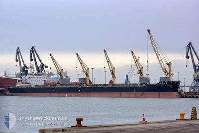
CHAYANEE NAREE
Bulk Carrier

Current Trip
VILA DO CONDE
| Time Travelled | 20 days |
|---|---|
| Remaining Time | --- |
| Distance Travelled | 4977.78 nm |
| Remaining Distance | --- |
| AVG Speed | 10.1 Knop |
| MAX Speed | 13 Knop |
| AVG Wind | 13 knots |
| MAX Wind | 21 knots |
| MIN Temp | 19.2°C / 66.56°F |
| MAX Temp | 28.1°C / 82.58°F |
| Djupgående | 10.8 m |
| Position mottagen | 2 d sen |
Current Position
| Longitud | --- |
|---|---|
| Latitude | --- |
| Status | Under way using engine |
| Fart | 10.7 Knop |
| Kurs | 126.2° |
| Område | South Atlantic Ocean |
| Station | T-AIS |
| Position mottagen | 2 d sen |
Information
The current position of CHAYANEE NAREE is in South Atlantic Ocean with coordinates -34.64925° / 18.22654° as reported on 2025-03-16 01:51 by AIS to our vessel tracker app. The vessel's current speed is 10.7 Knop
The vessel CHAYANEE NAREE (IMO: 9613434, MMSI: 566708000) is a Bulk Carrier that was built in 2012 ( 13 År gammal ). It's sailing under the flag of [SG] Singapore.
In this page you can find informations about the vessels current position, last detected port calls, and current voyage information. If the vessels is not in coverage by AIS you will find the latest position.
The current position of CHAYANEE NAREE is detected by our AIS receivers and we are not responsible for the reliability of the data. The last position was recorded while the vessel was in Coverage by the Ais receivers of our vessel tracking app.
The current draught of CHAYANEE NAREE as reported by AIS is 10.8 meters
Weather
| Temperature | 23.6°C / 74.48°F |
|---|---|
| Wind Speed | 17 knots |
| Direction | 226° SW |
| Pressure | 1018.7 hPa |
| Humidity | 81.6 % |
| Cloud Coverage | 84 % |


Featured Company
Last Port Calls
| Port | Arrival | Departure | Time In Port |
|---|---|---|---|
| 2025-02-22 08:57 | 2025-02-25 11:35 | 3 d | |
| 2025-01-29 17:27 | 2025-02-02 05:00 | 3 d | |
| 2025-01-24 08:21 | 2025-01-25 23:03 | 1 d | |
| 2025-01-18 06:06 | 2025-01-20 18:34 | 2 d | |
| 2025-01-14 10:41 | 2025-01-17 04:48 | 2 d | |
| 2025-01-04 08:14 |
Most Visited Ports (Last year)
| Port | Arrivals | |
|---|---|---|
| 2 | ||
| 2 | ||
| 1 | ||
| 1 | ||
| 1 | ||
| 1 |
Last Trips
| Origin | Departure | Destination | Arrival | Distance | |
|---|---|---|---|---|---|
| 2025-02-02 05:00 | 2025-02-22 08:57 | 1293.36 nm | |||
| 2025-01-25 23:03 | 2025-01-29 17:27 | 723.99 nm | |||
| 2025-01-20 18:34 | 2025-01-24 08:21 | 407.75 nm | |||
| 2025-01-17 04:48 | 2025-01-18 06:06 | 270.11 nm | |||
| 2025-01-04 08:14 | 2025-01-14 10:41 | 1905.35 nm |
Events
| Tid | Event | Detaljer | Position / Dest | Information |
|---|---|---|---|---|
| 2025-03-16 01:53 | Status ändrad | Default Under way using engine |
-34.65370 / 18.23388
VILA DO CONDE
|
Fart: 10.7 kn Kurs: 126.2° |
| 2025-03-16 01:51 | UTANFÖR täckningsområde |
-34.64925 / 18.22654
South Atlantic Ocean
|
Fart: 10.7 kn Kurs: 126.2° |
|
| 2025-03-16 01:40 | Status ändrad | Under way using engine Default |
-34.63338 / 18.19477
VILA DO CONDE
|
Fart: 10.9 kn Kurs: 121° |
| 2025-03-16 01:29 | I täckningsområde |
-34.63362 / 18.19531
South Atlantic Ocean
|
Fart: 10.7 kn Kurs: 119.8° |
|
| 2025-03-15 23:48 | Status ändrad | Default Under way using engine |
-34.48118 / 17.82432
VILA DO CONDE
|
Fart: 10.8 kn Kurs: 117.4° |
| 2025-03-15 23:41 | UTANFÖR täckningsområde |
-34.47297 / 17.80362
South Atlantic Ocean
|
Fart: 10.8 kn Kurs: 117.4° |
|
| 2025-03-15 23:31 | Byter havsområde | South African part of the South Atlantic Ocean Brazilian part of the South Atlantic Ocean |
-34.45926 / 17.76993
South Atlantic Ocean
|
Fart: 10.8 kn Kurs: 118.1° |
| 2025-03-15 23:31 | Status ändrad | Under way using engine Default |
-34.45926 / 17.76993
VILA DO CONDE
|
Fart: 10.9 kn Kurs: 117° |
| 2025-03-15 23:11 | I täckningsområde |
-34.45926 / 17.76993
South Atlantic Ocean
|
Fart: 10.8 kn Kurs: 118.1° |