
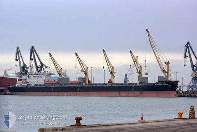
CHAYANEE NAREE
Bulk Carrier
Current Trip
| Time Travelled | 7 days |
|---|---|
| Remaining Time | 43 days |
| Distance Travelled | 1607.60 nm |
| Remaining Distance | 11444.09 nm |
| AVG Speed | 10.1 Knopen |
| MAX Speed | 11.6 Knopen |
| AVG Wind | 16 knots |
| MAX Wind | 24.9 knots |
| MIN Temp | 22°C / 71.6°F |
| MAX Temp | 27.4°C / 81.32°F |
| Diepgang | 13.2 M |
| Positie ontvangen | 2 d geleden |
Current Position
| Lengtegraad | -73.53615° |
|---|---|
| Breedtegraat | 20.66557° |
| Status | Under way using engine |
| Snelheid | 10.5 Knopen |
| Koers | 95° |
| Gebied | North Atlantic Ocean |
| Station | T-AIS |
| Positie ontvangen | 2 d geleden |
Info
Information
The current position of CHAYANEE NAREE is in North Atlantic Ocean with coordinates 20.66557° / -73.53615° as reported on 2024-04-30 15:47 by AIS to our vessel tracker app. The vessel's current speed is 10.5 Knopen and is heading at the port of SINGAPORE. The estimated time of arrival as calculated by MyShipTracking vessel tracking app is 2024-06-15 18:01 LT
The vessel CHAYANEE NAREE (IMO: 9613434, MMSI: 566708000) is a Bulk Carrier that was built in 2012 ( 12 Jaar oud ). It's sailing under the flag of [SG] Singapore.
In this page you can find informations about the vessels current position, last detected port calls, and current voyage information. If the vessels is not in coverage by AIS you will find the latest position.
The current position of CHAYANEE NAREE is detected by our AIS receivers and we are not responsible for the reliability of the data. The last position was recorded while the vessel was in Coverage by the Ais receivers of our vessel tracking app.
The current draught of CHAYANEE NAREE as reported by AIS is 13.2 meters
Weather
| Temperature | 27.3°C / 81.14°F |
|---|---|
| Wind Speed | 10 knots |
| Direction | 115° ESE |
| Pressure | 1008.2 hPa |
| Humidity | 79.9 % |
| Cloud Coverage | 53 % |
Featured Company
Last Port Calls
| Port | Arrival | Departure | Time In Port |
|---|---|---|---|
| 2024-04-22 05:42 | 2024-04-25 23:06 | 3 d | |
| 2024-04-17 06:52 | 2024-04-18 00:25 | 17 h | |
| 2024-04-12 23:22 | 2024-04-15 21:56 | 2 d | |
| 2024-03-03 01:53 |
Most Visited Ports (Last year)
| Port | Arrivals | |
|---|---|---|
| 1 | ||
| 1 | ||
| 1 | ||
| 1 | ||
| 1 | ||
| 1 |
Last Trips
| Origin | Departure | Destination | Arrival | Distance | |
|---|---|---|---|---|---|
| 2024-04-17 19:25 | 2024-04-22 00:42 | 695.31 nm | |||
| 2024-04-15 16:56 | 2024-04-17 01:52 | 258.49 nm | |||
| 2024-02-28 12:33 | 2024-03-03 10:53 | 323.68 nm |
Events
| Tijd | Evenement | Details | Positie / Bestemming | Info |
|---|---|---|---|---|
| 2024-04-30 16:02 | Status Changed | Default Under way using engine |
20.66199 / -73.49007
SGSIN
|
Snelheid: 10.5 kn Koers: 95° |
| 2024-04-30 15:47 | Buitenbereik |
20.66557 / -73.53615
North Atlantic Ocean
|
Snelheid: 10.5 kn Koers: 95° |
|
| 2024-04-30 15:34 | Gevonden in zee | Bahamas part of the North Atlantic Ocean |
20.66857 / -73.57646
North Atlantic Ocean
|
Snelheid: 10.5 kn Koers: 94.1° |
| 2024-04-30 15:34 | Binnenbereik |
20.66857 / -73.57646
North Atlantic Ocean
|
Snelheid: 10.5 kn Koers: 94.1° |
|
| 2024-04-26 12:50 | Status Changed | Default Under way using engine |
28.44687 / -87.25105
SGSIN
|
Snelheid: 10.9 kn Koers: 172.1° |
| 2024-04-26 12:36 | Buitenbereik |
28.49126 / -87.25761
Gulf of Mexico
|
Snelheid: 10.9 kn Koers: 172.1° |
|
| 2024-04-26 12:32 | Status Changed | Under way using engine Default |
28.50277 / -87.25925
SGSIN
|
Snelheid: 11 kn Koers: 167° |
| 2024-04-26 12:10 | Status Changed | Default Under way using engine |
28.56958 / -87.27528
SGSIN
|
Snelheid: 11.1 kn Koers: 167.6° |
| 2024-04-26 11:59 | Status Changed | Under way using engine Default |
28.60295 / -87.28342
SGSIN
|
Snelheid: 11.1 kn Koers: 168° |
| 2024-04-26 11:29 | Status Changed | Default Under way using engine |
28.69327 / -87.30564
SGSIN
|
Snelheid: 11.2 kn Koers: 167.5° |