
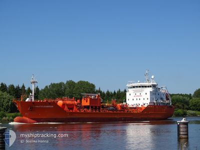
CHARLOTTE ESSBERGER
Chemical Tanker
Current Trip
| Time Travelled | 2 days |
|---|---|
| Remaining Time | 14 h, 21 mins |
| Distance Travelled | 499.03 nm |
| Remaining Distance | 213.54 nm |
| AVG Speed | 10.4 Knop |
| MAX Speed | 15.8 Knop |
| AVG Wind | 10.2 knots |
| MAX Wind | 23 knots |
| MIN Temp | -1°C / 30.2°F |
| MAX Temp | 3.7°C / 38.66°F |
| Djupgående | 6.5 m |
| Position mottagen | 1 m sen |
Current Position
| Longitud | --- |
|---|---|
| Latitude | --- |
| Status | Under way using engine |
| Fart | 14.8 Knop |
| Kurs | 284° |
| Område | North Sea |
| Station | T-AIS |
| Position mottagen | 1 m sen |
Info
Information
The current position of CHARLOTTE ESSBERGER is in North Sea with coordinates 53.98600° / 8.39850° as reported on 2025-03-18 06:21 by AIS to our vessel tracker app. The vessel's current speed is 14.8 Knop and is heading at the port of AMSTERDAM. The estimated time of arrival as calculated by MyShipTracking vessel tracking app is 2025-03-18 21:43 LT
The vessel CHARLOTTE ESSBERGER (IMO: 9294680, MMSI: 255806329) is a Chemical Tanker that was built in 2005 ( 20 År gammal ). It's sailing under the flag of [PT] Portugal.
In this page you can find informations about the vessels current position, last detected port calls, and current voyage information. If the vessels is not in coverage by AIS you will find the latest position.
The current position of CHARLOTTE ESSBERGER is detected by our AIS receivers and we are not responsible for the reliability of the data. The last position was recorded while the vessel was in Coverage by the Ais receivers of our vessel tracking app.
The current draught of CHARLOTTE ESSBERGER as reported by AIS is 6.5 meters
Weather
| Temperature | 3.7°C / 38.66°F |
|---|---|
| Wind Speed | 5 knots |
| Direction | 212° SSW |
| Pressure | 1031.8 hPa |
| Humidity | 52.3 % |
| Cloud Coverage | --- |
Featured Company
Last Port Calls
| Port | Arrival | Departure | Time In Port |
|---|---|---|---|
| 2025-03-15 06:42 | 2025-03-16 08:12 | 1 d | |
| 2025-03-11 13:10 | 2025-03-11 22:46 | 9 h | |
| 2025-03-10 16:25 | 2025-03-11 02:44 | 10 h | |
| 2025-03-07 16:17 | 2025-03-08 11:50 | 19 h | |
| 2025-03-02 07:15 | 2025-03-03 13:08 | 1 d | |
| 2025-02-26 07:53 | 2025-02-27 11:50 | 1 d | |
| 2025-02-24 03:09 | 2025-02-25 15:45 | 1 d | |
| 2025-02-18 21:43 | 2025-02-19 22:02 | 1 d | |
| 2025-02-13 21:51 | 2025-02-15 23:00 | 2 d | |
| 2025-02-09 09:32 | 2025-02-10 00:40 | 15 h |
Last Trips
| Origin | Departure | Destination | Arrival | Distance | |
|---|---|---|---|---|---|
| 2025-03-11 22:46 | 2025-03-15 06:42 | 501.64 nm | |||
| 2025-03-11 02:44 | 2025-03-11 13:10 | 123.95 nm | |||
| 2025-03-08 11:50 | 2025-03-10 16:25 | 132.78 nm | |||
| 2025-03-03 13:08 | 2025-03-07 16:17 | 1072.69 nm | |||
| 2025-02-27 11:50 | 2025-03-02 07:15 | 232.27 nm | |||
| 2025-02-25 15:45 | 2025-02-26 07:53 | 176.86 nm | |||
| 2025-02-19 22:02 | 2025-02-24 03:09 | 776.95 nm | |||
| 2025-02-15 23:00 | 2025-02-18 21:43 | 762.82 nm | |||
| 2025-02-10 00:40 | 2025-02-13 21:51 | 721.16 nm | |||
| 2025-02-04 23:53 | 2025-02-09 09:32 | 1182.80 nm |
Events
| Tid | Event | Detaljer | Position / Dest | Information |
|---|---|---|---|---|
| 2025-03-18 03:59 | STARTAR förflyttning | 0.85 nm, South West of BRUNSBUETTEL |
53.89267 / 9.14367
AMSTERDAM VIA NOK
|
Fart: 3.1 kn Kurs: 229° |
| 2025-03-18 03:58 | Byter havsområde | German part of the North Sea German part of the Baltic Sea |
53.89317 / 9.14483
North Sea
AMSTERDAM VIA NOK
|
Fart: 2.4 kn Kurs: 229° |
| 2025-03-18 03:26 | STOPPAR förflyttning | 0.71 nm, South West of BRUNSBUETTEL |
53.89417 / 9.14667
AMSTERDAM VIA NOK
|
Fart: 0.3 kn Kurs: 224° |
| 2025-03-17 21:02 | STARTAR förflyttning | 5.96 nm, East of BORGSTEDT |
54.35667 / 9.88150
AMSTERDAM VIA NOK
|
Fart: 5.1 kn Kurs: 302° |
| 2025-03-17 20:58 | STOPPAR förflyttning | 6.06 nm, East of BORGSTEDT |
54.35583 / 9.88467
AMSTERDAM VIA NOK
|
Fart: 0.3 kn Kurs: 296° |
| 2025-03-17 19:24 | STARTAR förflyttning | 1.41 nm, South West of STICKENHΟRN SPORT |
54.36650 / 10.13917
AMSTERDAM VIA NOK
|
Fart: 5.1 kn Kurs: 288° |
| 2025-03-17 19:00 | STOPPAR förflyttning | 1.35 nm, South West of STICKENHΟRN SPORT |
54.36600 / 10.14233
AMSTERDAM VIA NOK
|
Fart: 0.2 kn Kurs: 282° |
| 2025-03-17 16:53 | Byter havsområde | German part of the Baltic Sea Danish part of the Baltic Sea |
54.56417 / 10.55117
Baltic Sea
AMSTERDAM VIA NOK
|
Fart: 10.8 kn Kurs: 247° |
| 2025-03-17 16:02 | Byter havsområde | Danish part of the Baltic Sea German part of the Baltic Sea |
54.58633 / 10.80400
Baltic Sea
AMSTERDAM VIA NOK
|
Fart: 10.2 kn Kurs: 265° |
| 2025-03-17 14:32 | Byter havsområde | German part of the Baltic Sea Danish part of the Baltic Sea |
54.58250 / 11.26883
Baltic Sea
AMSTERDAM VIA NOK
|
Fart: 11.2 kn Kurs: 285° |