
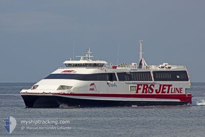
CEUTA JET
High speed craft
Current Trip
| Trip Time | 39 mins |
|---|---|
| Trip Distance | 16.86 nm |
| AVG Speed | 23.9 Knop |
| MAX Speed | 29.1 Knop |
| Djupgående | 2.4 m |
| AVG Wind | 9.6 knots |
| MAX Wind | 15.8 knots |
| MIN Temp | 12.3°C / 54.14°F |
| MAX Temp | 17.1°C / 62.78°F |
| Position mottagen | 1 m sen |
Current Position
| Longitud | --- |
|---|---|
| Latitude | --- |
| Status | Underway |
| Fart | 0.7 Knop |
| Kurs | 128° |
| Område | Strait of Gibraltar |
| Station | T-AIS |
| Position mottagen | 1 m sen |
Info
Information
The current position of CEUTA JET is in Strait of Gibraltar with coordinates 35.89337° / -5.31960° as reported on 2024-11-21 19:54 by AIS to our vessel tracker app. The vessel's current speed is 0.7 Knop and is currently inside the port of CEUTA.
The vessel CEUTA JET (IMO: 9174323, MMSI: 212561000) is a High speed craft that was built in 1998 ( 26 År gammal ). It's sailing under the flag of [CY] Cyprus.
In this page you can find informations about the vessels current position, last detected port calls, and current voyage information. If the vessels is not in coverage by AIS you will find the latest position.
The current position of CEUTA JET is detected by our AIS receivers and we are not responsible for the reliability of the data. The last position was recorded while the vessel was in Coverage by the Ais receivers of our vessel tracking app.
The current draught of CEUTA JET as reported by AIS is 2.4 meters
Weather
| Temperature | 17.1°C / 62.78°F |
|---|---|
| Wind Speed | 16 knots |
| Direction | 284° WNW |
| Pressure | 1020.8 hPa |
| Humidity | 69.8 % |
| Cloud Coverage | 90 % |
Featured Company
Last Port Calls
| Port | Arrival | Departure | Time In Port |
|---|---|---|---|
| 2024-11-21 19:48 | |||
| 2024-11-21 18:16 | 2024-11-21 19:09 | 52 m | |
| 2024-11-21 16:57 | 2024-11-21 17:33 | 35 m | |
| 2024-11-21 15:23 | 2024-11-21 16:13 | 49 m | |
| 2024-11-21 13:30 | 2024-11-21 14:39 | 1 h | |
| 2024-11-21 11:46 | 2024-11-21 12:45 | 58 m | |
| 2024-11-21 10:20 | 2024-11-21 11:06 | 46 m | |
| 2024-11-21 08:38 | 2024-11-21 09:42 | 1 h | |
| 2024-11-21 07:15 | 2024-11-21 07:56 | 41 m | |
| 2024-11-20 21:18 | 2024-11-21 06:36 | 9 h |
Last Trips
| Origin | Departure | Destination | Arrival | Distance | |
|---|---|---|---|---|---|
| 2024-11-21 20:09 | 2024-11-21 20:48 | 16.86 nm | |||
| 2024-11-21 18:33 | 2024-11-21 19:16 | 16.92 nm | |||
| 2024-11-21 17:13 | 2024-11-21 17:57 | 16.82 nm | |||
| 2024-11-21 15:39 | 2024-11-21 16:23 | 15.61 nm | |||
| 2024-11-21 13:45 | 2024-11-21 14:30 | 17.04 nm | |||
| 2024-11-21 12:06 | 2024-11-21 12:46 | 16.05 nm | |||
| 2024-11-21 10:42 | 2024-11-21 11:20 | 16.70 nm | |||
| 2024-11-21 08:56 | 2024-11-21 09:38 | 16.06 nm | |||
| 2024-11-21 07:36 | 2024-11-21 08:15 | 16.57 nm | |||
| 2024-11-20 21:41 | 2024-11-20 22:18 | 15.26 nm |
Events
| Tid | Event | Detaljer | Position / Dest | Information |
|---|---|---|---|---|
| 2024-11-21 19:48 | Status ändrad | Underway Default |
35.89465 / -5.31174
[ES] CEUTA
|
Fart: 23.5 kn Kurs: 176° |
| 2024-11-21 19:48 | ANLÄNDER HAMN |
|
35.89465 / -5.31174
[ES] CEUTA
|
Fart: 23.5 kn Kurs: 176° |
| 2024-11-21 19:36 | Status ändrad | Default Underway |
35.96473 / -5.33352
ESALG-ESCEU-ESALG
|
Fart: 29.4 kn Kurs: 156.6° |
| 2024-11-21 19:23 | Byter havsområde | Spanish part of the Strait of Gibraltar Gibraltarian part of the Strait of Gibraltar |
36.06662 / -5.37985
Strait of Gibraltar
ESALG-ESCEU-ESALG
|
Fart: 28.4 kn Kurs: 173.9° |
| 2024-11-21 19:17 | Byter havsområde | Gibraltarian part of the Strait of Gibraltar Spanish part of the Strait of Gibraltar |
36.11369 / -5.39301
Strait of Gibraltar
ESALG-ESCEU-ESALG
|
Fart: 29.1 kn Kurs: 163° |
| 2024-11-21 19:09 | AVGÅTT HAMN |
|
36.14860 / -5.42647
ESALG-ESCEU-ESALG
|
Fart: 8.3 kn Kurs: 107° |
| 2024-11-21 19:00 | ETA ändrat | 2024/11/21 20:00 2024/11/21 18:30 |
36.12953 / -5.43682
[ES] ALGECIRAS
|
Fart: 9.2 kn Kurs: 59° |
| 2024-11-21 19:00 | STARTAR förflyttning |
36.12912 / -5.43771
[ES] ALGECIRAS
|
Fart: 7.5 kn Kurs: 59° |
|
| 2024-11-21 18:27 | STOPPAR förflyttning |
36.12855 / -5.44026
[ES] ALGECIRAS
|
Fart: 0.3 kn Kurs: 235° |
|
| 2024-11-21 18:16 | ANLÄNDER HAMN |
|
36.14793 / -5.42977
[ES] ALGECIRAS
|
Fart: 8.9 kn Kurs: 226.8° |