
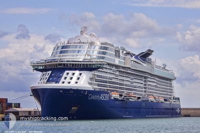
CELEBRITY ASCENT
Passenger
Current Trip
| Trip Time | 1 day |
|---|---|
| Trip Distance | 700.76 nm |
| AVG Speed | 18.9 Knop |
| MAX Speed | 23 Knop |
| Djupgående | 8.5 m |
| AVG Wind | 12.6 knots |
| MAX Wind | 19 knots |
| MIN Temp | 18.6°C / 65.48°F |
| MAX Temp | 25.8°C / 78.44°F |
| Position mottagen | 13 h, 22 m sen |
Current Position
| Longitud | --- |
|---|---|
| Latitude | --- |
| Status | Under way using engine |
| Fart | 16.2 Knop |
| Kurs | 131.6° |
| Område | North Atlantic Ocean |
| Station | T-AIS |
| Position mottagen | 13 h, 22 m sen |
Info
Information
The current position of CELEBRITY ASCENT is in North Atlantic Ocean with coordinates 21.46454° / -72.50696° as reported on 2025-03-03 23:41 by AIS to our vessel tracker app. The vessel's current speed is 16.2 Knop and is currently inside the port of PUERTO PLATA.
The vessel CELEBRITY ASCENT (IMO: 9838400, MMSI: 256191000) is a Passenger It's sailing under the flag of [MT] Malta.
In this page you can find informations about the vessels current position, last detected port calls, and current voyage information. If the vessels is not in coverage by AIS you will find the latest position.
The current position of CELEBRITY ASCENT is detected by our AIS receivers and we are not responsible for the reliability of the data. The last position was recorded while the vessel was in Coverage by the Ais receivers of our vessel tracking app.
The current draught of CELEBRITY ASCENT as reported by AIS is 8.5 meters
Weather
| Temperature | 20.6°C / 69.08°F |
|---|---|
| Wind Speed | 2 knots |
| Direction | 144° SE |
| Pressure | 1016.2 hPa |
| Humidity | 88.2 % |
| Cloud Coverage | 1 % |
Featured Company
Last Port Calls
| Port | Arrival | Departure | Time In Port |
|---|---|---|---|
| 2025-03-04 11:56 | |||
| 2025-03-02 11:29 | 2025-03-02 20:58 | 9 h | |
| 2025-02-28 12:12 | 2025-02-28 20:20 | 8 h | |
| 2025-02-24 12:11 | 2025-02-24 20:11 | 7 h | |
| 2025-02-23 11:30 | 2025-02-23 20:49 | 9 h | |
| 2025-02-20 11:41 | 2025-02-20 22:09 | 10 h | |
| 2025-02-18 11:05 | 2025-02-18 19:13 | 8 h | |
| 2025-02-16 11:37 | 2025-02-16 21:15 | 9 h | |
| 2025-02-12 11:40 | 2025-02-12 23:04 | 11 h | |
| 2025-02-09 11:30 | 2025-02-09 20:47 | 9 h |
Most Visited Ports (Last year)
| Port | Arrivals | |
|---|---|---|
| 23 | ||
| 14 | ||
| 13 | ||
| 11 | ||
| 9 | ||
| 9 |
Last Trips
| Origin | Departure | Destination | Arrival | Distance | |
|---|---|---|---|---|---|
| 2025-03-02 15:58 | 2025-03-04 07:56 | 700.76 nm | |||
| 2025-02-28 15:20 | 2025-03-02 06:29 | 768.91 nm | |||
| 2025-02-24 15:11 | 2025-02-28 07:12 | 1049.15 nm | |||
| 2025-02-23 15:49 | 2025-02-24 07:11 | 184.09 nm | |||
| 2025-02-20 18:09 | 2025-02-23 06:30 | 1082.30 nm | |||
| 2025-02-18 15:13 | 2025-02-20 07:41 | 469.06 nm | |||
| 2025-02-16 16:15 | 2025-02-18 07:05 | 701.64 nm | |||
| 2025-02-12 18:04 | 2025-02-16 06:37 | 1016.00 nm | |||
| 2025-02-09 15:47 | 2025-02-12 06:40 | 682.31 nm | |||
| 2025-02-06 18:01 | 2025-02-09 06:30 | 1124.70 nm |
Events
| Tid | Event | Detaljer | Position / Dest | Information |
|---|---|---|---|---|
| 2025-03-04 11:56 | ANLÄNDER HAMN |
|
19.80403 / -70.69994
[DO] PUERTO PLATA
|
Fart: 2 kn Kurs: 31° |
| 2025-03-04 00:30 | Status ändrad | Default Under way using engine |
21.31379 / -72.33048
DOPOP
|
Fart: 16.2 kn Kurs: 131.6° |
| 2025-03-03 23:41 | UTANFÖR täckningsområde |
21.46454 / -72.50696
North Atlantic Ocean
DOPOP
|
Fart: 16.2 kn Kurs: 131.6° |
|
| 2025-03-03 23:16 | Status ändrad | Under way using engine Default |
21.54695 / -72.59030
DOPOP
|
Fart: 22.1 kn Kurs: 185° |
| 2025-03-03 23:06 | Status ändrad | Default Under way using engine |
21.60448 / -72.59118
DOPOP
|
Fart: 22 kn Kurs: 180.3° |
| 2025-03-03 21:58 | Byter havsområde | Turks and Caicos part of the North Atlantic Ocean Bahamas part of the North Atlantic Ocean |
22.02785 / -72.55841
North Atlantic Ocean
DOPOP
|
Fart: 23 kn Kurs: 183.9° |
| 2025-03-03 21:56 | Status ändrad | Under way using engine Default |
22.03977 / -72.55744
DOPOP
|
Fart: 23 kn Kurs: 184° |
| 2025-03-03 21:42 | I täckningsområde |
22.02785 / -72.55841
North Atlantic Ocean
DOPOP
|
Fart: 23 kn Kurs: 183.9° |
|
| 2025-03-03 12:37 | Status ändrad | Default Under way using engine |
24.59046 / -74.69268
DOPOP
|
Fart: 21 kn Kurs: 117° |
| 2025-03-03 12:31 | UTANFÖR täckningsområde |
24.60702 / -74.72683
North Atlantic Ocean
DOPOP
|
Fart: 21 kn Kurs: 117° |