
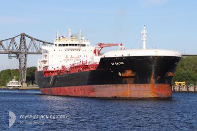
CB BALTIC
Tanker
Current Trip
| Time Travelled | 2 days |
|---|---|
| Remaining Time | --- |
| Distance Travelled | 638.76 nm |
| Remaining Distance | 612.06 nm |
| AVG Speed | 10.4 Knop |
| MAX Speed | 13.5 Knop |
| AVG Wind | 17.9 knots |
| MAX Wind | 34 knots |
| MIN Temp | 15.4°C / 59.72°F |
| MAX Temp | 20.1°C / 68.18°F |
| Djupgående | 9.8 m |
| Position mottagen | 2025-12-10 06:46 |
Current Position
| Longitud | --- |
|---|---|
| Latitude | --- |
| Status | Under way using engine |
| Fart | 13.6 Knop |
| Kurs | 234.5° |
| Område | Mediterranean Sea - Eastern Basin |
| Station | T-AIS |
| Position mottagen | 2025-12-10 06:46 |
Info
Information
The current position of CB BALTIC is in Mediterranean Sea - Eastern Basin with coordinates 34.30277° / 32.96165° as reported on 2025-12-10 06:46 by AIS to our vessel tracker app. The vessel's current speed is 13.6 Knop and is heading at the port of ALEXANDRIA.
The vessel CB BALTIC (IMO: 9851701, MMSI: 255806263) is a Tanker It's sailing under the flag of [PT] Portugal.
In this page you can find informations about the vessels current position, last detected port calls, and current voyage information. If the vessels is not in coverage by AIS you will find the latest position.
The current position of CB BALTIC is detected by our AIS receivers and we are not responsible for the reliability of the data. The last position was recorded while the vessel was in Coverage by the Ais receivers of our vessel tracking app.
The current draught of CB BALTIC as reported by AIS is 9.8 meters
Weather
| Temperature | 16.4°C / 61.52°F |
|---|---|
| Wind Speed | 26 knots |
| Direction | 266° W |
| Pressure | 1019.7 hPa |
| Humidity | 66.2 % |
| Cloud Coverage | --- |
Featured Company
Last Port Calls
| Port | Arrival | Departure | Time In Port |
|---|---|---|---|
| 2026-01-04 10:54 | 2026-01-07 00:33 | 2 d | |
| 2025-12-25 15:54 | 2025-12-30 05:52 | 4 d | |
| 2025-12-08 09:55 | 2025-12-10 06:16 | 1 d | |
| 2025-12-03 21:51 | 2025-12-07 09:15 | 3 d | |
| 2025-11-23 22:24 | 2025-11-26 02:21 | 2 d | |
| 2025-11-20 03:36 | 2025-11-21 08:29 | 1 d | |
| 2025-11-13 22:08 | 2025-11-15 16:37 | 1 d | |
| 2025-11-09 03:00 | 2025-11-11 14:52 | 2 d |
Last Trips
| Origin | Departure | Destination | Arrival | Distance | |
|---|---|---|---|---|---|
| 2025-12-30 05:52 | 2026-01-04 10:54 | 50.13 nm | |||
| 2025-12-10 06:16 | 2025-12-25 15:54 | 376.94 nm | |||
| 2025-12-07 09:15 | 2025-12-08 09:55 | 7.26 nm | |||
| 2025-11-26 02:21 | 2025-12-03 21:51 | 950.47 nm | |||
| 2025-11-21 08:29 | 2025-11-23 22:24 | 737.22 nm | |||
| 2025-11-15 16:37 | 2025-11-20 03:36 | 35.05 nm | |||
| 2025-11-11 14:52 | 2025-11-13 22:08 | 15.37 nm | |||
| 2025-10-31 06:27 | 2025-11-09 03:00 | 2148.47 nm |
Events
| Tid | Event | Detaljer | Position / Dest | Information |
|---|---|---|---|---|
| 2026-01-06 22:33 | AVGÅTT HAMN |
|
31.16444 / 29.80640
EG ALY
|
Fart: 6.8 kn Kurs: 349° |
| 2026-01-06 22:21 | STARTAR förflyttning |
31.14450 / 29.80959
[EG] EL DEKHEILA
|
Fart: 4.9 kn Kurs: 352° |
|
| 2026-01-04 09:19 | STOPPAR förflyttning |
31.13627 / 29.80619
[EG] EL DEKHEILA
|
Fart: 0.1 kn Kurs: 358° |
|
| 2026-01-04 08:54 | ANLÄNDER HAMN |
|
31.15313 / 29.80767
[EG] EL DEKHEILA
|
Fart: 4.9 kn Kurs: 172° |
| 2026-01-04 07:31 | STARTAR förflyttning | 7.13 nm, North West of EL DEKHEILA |
31.20446 / 29.68521
EG ALY
|
Fart: 8.8 kn Kurs: 121° |