
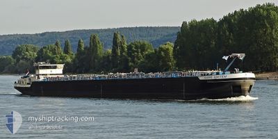
CARPE NOCTEM
Tanker
Current Trip
| Time Travelled | 1 day |
|---|---|
| Remaining Time | 19 h, 36 mins |
| Distance Travelled | 157.69 nm |
| Remaining Distance | 196.28 nm |
| AVG Speed | 9.4 Knop |
| MAX Speed | 12 Knop |
| AVG Wind | 4.1 knots |
| MAX Wind | 8 knots |
| MIN Temp | 8.8°C / 47.84°F |
| MAX Temp | 17.9°C / 64.22°F |
| Djupgående | 2.8 m |
| Position mottagen | Nu |
Current Position
| Longitud | --- |
|---|---|
| Latitude | --- |
| Status | Under way using engine |
| Fart | 10.1 Knop |
| Kurs | 331° |
| Område | North Sea |
| Station | T-AIS |
| Position mottagen | Nu |
Info
Information
The current position of CARPE NOCTEM is in North Sea with coordinates 50.88917° / 7.05027° as reported on 2025-03-25 17:48 by AIS to our vessel tracker app. The vessel's current speed is 10.1 Knop and is heading at the port of ANTWERP. The estimated time of arrival as calculated by MyShipTracking vessel tracking app is 2025-03-26 13:24 LT
The vessel CARPE NOCTEM (MMSI: 244660477) is a Tanker It's sailing under the flag of [NL] Netherlands.
In this page you can find informations about the vessels current position, last detected port calls, and current voyage information. If the vessels is not in coverage by AIS you will find the latest position.
The current position of CARPE NOCTEM is detected by our AIS receivers and we are not responsible for the reliability of the data. The last position was recorded while the vessel was in Coverage by the Ais receivers of our vessel tracking app.
The current draught of CARPE NOCTEM as reported by AIS is 2.8 meters
Weather
| Temperature | 12.4°C / 54.32°F |
|---|---|
| Wind Speed | 5 knots |
| Direction | 285° WNW |
| Pressure | 1019.4 hPa |
| Humidity | 54 % |
| Cloud Coverage | 78 % |
Featured Company
Last Port Calls
| Port | Arrival | Departure | Time In Port |
|---|---|---|---|
| 2025-03-22 19:59 | 2025-03-24 08:38 | 1 d | |
| 2025-03-17 11:33 | 2025-03-17 18:01 | 6 h | |
| 2025-03-15 03:14 | 2025-03-15 11:42 | 8 h | |
| 2025-03-03 23:33 | 2025-03-07 19:46 | 3 d | |
| 2025-03-02 11:55 | 2025-03-03 18:19 | 1 d | |
| 2025-03-02 03:49 | 2025-03-02 04:09 | 19 m | |
| 2025-02-27 17:33 | 2025-03-02 01:49 | 2 d | |
| 2025-02-27 09:10 | 2025-02-27 09:34 | 23 m | |
| 2025-02-26 15:59 | 2025-02-27 06:20 | 14 h | |
| 2025-02-24 19:28 | 2025-02-26 15:30 | 1 d |
Last Trips
| Origin | Departure | Destination | Arrival | Distance | |
|---|---|---|---|---|---|
| 2025-03-17 19:01 | 2025-03-22 20:59 | 324.12 nm | |||
| 2025-03-15 12:42 | 2025-03-17 12:33 | 9.24 nm | |||
| 2025-03-07 20:46 | 2025-03-15 04:14 | 570.51 nm | |||
| 2025-03-03 19:19 | 2025-03-04 00:33 | 35.94 nm | |||
| 2025-03-02 05:09 | 2025-03-02 12:55 | 57.54 nm | |||
| 2025-03-02 02:49 | 2025-03-02 04:49 | 12.56 nm | |||
| 2025-02-27 10:34 | 2025-02-27 18:33 | 65.79 nm | |||
| 2025-02-27 07:20 | 2025-02-27 10:10 | 23.72 nm | |||
| 2025-02-26 16:30 | 2025-02-26 16:59 | 3.30 nm | |||
| 2025-02-24 15:36 | 2025-02-24 20:28 | 36.21 nm |
Events
| Tid | Event | Detaljer | Position / Dest | Information |
|---|---|---|---|---|
| 2025-03-25 14:46 | I täckningsområde |
50.49348 / 7.32411
North Sea
ANTWERPEN 6E HAVEND
|
Fart: 10.4 kn Kurs: 320.1° |
|
| 2025-03-25 09:42 | UTANFÖR täckningsområde |
49.97270 / 7.91872
North Sea
ANTWERPEN 6E HAVEND
|
Fart: 7.5 kn Kurs: 279.4° |
|
| 2025-03-25 05:23 | I täckningsområde |
49.73564 / 8.45080
North Sea
ANTWERPEN 6E HAVEND
|
Fart: 9.1 kn Kurs: 21.4° |
|
| 2025-03-25 03:57 | UTANFÖR täckningsområde |
49.55715 / 8.41338
North Sea
ANTWERPEN 6E HAVEND
|
Fart: 10 kn Kurs: 355.9° |
|
| 2025-03-25 03:40 | STARTAR förflyttning | 2.52 nm, North of MANNHEIM |
49.53260 / 8.44344
ANTWERPEN 6E HAVEND
|
Fart: 3.6 kn Kurs: 322° |
| 2025-03-25 03:38 | Status ändrad | Under way using engine Moored |
49.53128 / 8.44395
ANTWERPEN 6E HAVEND
|
Fart: 0.4 kn Kurs: 344° |
| 2025-03-25 01:20 | Status ändrad | Moored Default |
49.53076 / 8.44398
ANTWERPEN 6E HAVEND
|
Fart: 0.4 kn Kurs: 345° |
| 2025-03-25 01:14 | Status ändrad | Default Moored |
49.53084 / 8.44407
ANTWERPEN 6E HAVEND
|
Fart: 0.5 kn Kurs: 344° |
| 2025-03-24 23:15 | Status ändrad | Moored Default |
49.53086 / 8.44404
ANTWERPEN 6E HAVEND
|
Fart: 0.3 kn Kurs: 345° |
| 2025-03-24 23:03 | Status ändrad | Default Moored |
49.53085 / 8.44402
ANTWERPEN 6E HAVEND
|
Fart: 0.4 kn Kurs: 346° |