

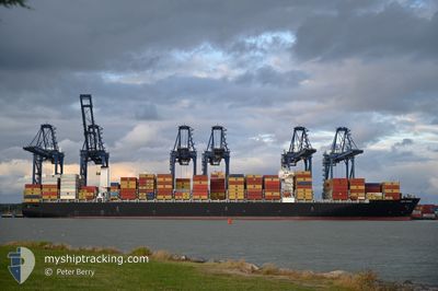
CAPE TAINARO
Cargo

Current Trip
| Time Travelled | 1 day |
|---|---|
| Remaining Time | --- |
| Distance Travelled | 822.01 nm |
| Remaining Distance | --- |
| AVG Speed | 16.9 Knop |
| MAX Speed | 19.7 Knop |
| AVG Wind | 18.5 knots |
| MAX Wind | 28 knots |
| MIN Temp | 25.1°C / 77.18°F |
| MAX Temp | 27.4°C / 81.32°F |
| Djupgående | 13.3 m |
| Position mottagen | 1 d sen |
Current Position
| Longitud | --- |
|---|---|
| Latitude | --- |
| Status | Under way using engine |
| Fart | 18 Knop |
| Kurs | 67.9° |
| Område | Caribbean Sea |
| Station | T-AIS |
| Position mottagen | 1 d sen |
Information
The current position of CAPE TAINARO is in Caribbean Sea with coordinates 10.97871° / -76.55992° as reported on 2025-03-27 20:36 by AIS to our vessel tracker app. The vessel's current speed is 18 Knop and is heading at the port of RODMAN. The estimated time of arrival as calculated by MyShipTracking vessel tracking app is 2025-03-19 06:00 LT
The vessel CAPE TAINARO (IMO: 9706205, MMSI: 249982000) is a Cargo It's sailing under the flag of [MT] Malta.
In this page you can find informations about the vessels current position, last detected port calls, and current voyage information. If the vessels is not in coverage by AIS you will find the latest position.
The current position of CAPE TAINARO is detected by our AIS receivers and we are not responsible for the reliability of the data. The last position was recorded while the vessel was in Coverage by the Ais receivers of our vessel tracking app.
The current draught of CAPE TAINARO as reported by AIS is 13.3 meters
Weather
| Temperature | 26.7°C / 80.06°F |
|---|---|
| Wind Speed | 17 knots |
| Direction | 80° E |
| Pressure | 1013.9 hPa |
| Humidity | 73.9 % |
| Cloud Coverage | 44 % |


Featured Company
Last Port Calls
| Port | Arrival | Departure | Time In Port |
|---|---|---|---|
| 2025-03-23 06:45 | 2025-03-27 02:55 | 3 d | |
| 2025-03-19 11:11 | 2025-03-22 06:34 | 2 d | |
| 2025-03-12 12:48 | 2025-03-13 08:08 | 19 h | |
| 2025-03-06 05:40 | 2025-03-07 20:33 | 1 d | |
| 2025-03-03 16:41 | 2025-03-04 19:46 | 1 d | |
| 2025-02-26 05:01 | 2025-02-28 09:08 | 2 d | |
| 2025-02-24 12:58 | 2025-02-25 18:15 | 1 d | |
| 2025-02-16 11:07 | 2025-02-17 19:41 | 1 d | |
| 2025-02-10 15:04 | 2025-02-12 05:26 | 1 d | |
| 2025-02-06 10:48 | 2025-02-07 13:28 | 1 d |
Most Visited Ports (Last year)
| Port | Arrivals | |
|---|---|---|
| 9 | ||
| 7 | ||
| 6 | ||
| 4 | ||
| 4 | ||
| 4 |
Last Trips
| Origin | Departure | Destination | Arrival | Distance | |
|---|---|---|---|---|---|
| 2025-03-22 06:34 | 2025-03-23 06:45 | 56.41 nm | |||
| 2025-03-13 08:08 | 2025-03-19 11:11 | 1615.61 nm | |||
| 2025-03-07 20:33 | 2025-03-12 12:48 | 1372.12 nm | |||
| 2025-03-04 19:46 | 2025-03-06 05:40 | 398.18 nm | |||
| 2025-02-28 09:08 | 2025-03-03 16:41 | 955.95 nm | |||
| 2025-02-25 18:15 | 2025-02-26 05:01 | 163.28 nm | |||
| 2025-02-17 19:41 | 2025-02-24 12:58 | 1252.79 nm | |||
| 2025-02-12 05:26 | 2025-02-16 11:07 | 406.00 nm | |||
| 2025-02-07 13:28 | 2025-02-10 15:04 | 1215.68 nm | |||
| 2025-02-02 09:37 | 2025-02-06 10:48 | 1749.99 nm |
Events
| Tid | Event | Detaljer | Position / Dest | Information |
|---|---|---|---|---|
| 2025-03-27 20:41 | Status ändrad | Default Under way using engine |
10.98886 / -76.53445
PAROD
|
Fart: 18 kn Kurs: 67.9° |
| 2025-03-27 20:36 | UTANFÖR täckningsområde |
10.97871 / -76.55992
Caribbean Sea
|
Fart: 18 kn Kurs: 67.9° |
|
| 2025-03-27 18:01 | Byter havsområde | Colombian part of the Caribbean Sea Panamanian part of the Caribbean Sea |
10.67336 / -77.29895
Caribbean Sea
|
Fart: 18.5 kn Kurs: 68.6° |
| 2025-03-27 17:40 | Status ändrad | Under way using engine Default |
10.63189 / -77.40067
PAROD
|
Fart: 18.7 kn Kurs: 67° |
| 2025-03-27 17:24 | I täckningsområde |
10.63189 / -77.40067
Caribbean Sea
|
Fart: 18.7 kn Kurs: 67° |
|
| 2025-03-27 16:14 | Status ändrad | Default Under way using engine |
10.46564 / -77.82639
PAROD
|
Fart: 18.9 kn Kurs: 68.8° |
| 2025-03-27 16:00 | Status ändrad | Under way using engine Default |
10.43988 / -77.89364
PAROD
|
Fart: 18.9 kn Kurs: 69° |
| 2025-03-27 16:00 | UTANFÖR täckningsområde |
10.43988 / -77.89364
Caribbean Sea
|
Fart: 18.9 kn Kurs: 68.8° |
|
| 2025-03-27 15:49 | I täckningsområde |
10.43988 / -77.89364
Caribbean Sea
|
Fart: 18.9 kn Kurs: 68.8° |
|
| 2025-03-27 08:46 | UTANFÖR täckningsområde |
9.46750 / -79.89336
Caribbean Sea
|
Fart: 15.3 kn Kurs: 45.1° |