
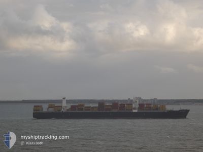
CAPE TAINARO
Cargo
Current Trip
| Time Travelled | 1 day |
|---|---|
| Remaining Time | --- |
| Distance Travelled | 697.52 nm |
| Remaining Distance | --- |
| AVG Speed | 16.6 Knots |
| MAX Speed | 18.4 Knots |
| AVG Wind | 17.6 knots |
| MAX Wind | 26 knots |
| MIN Temp | 17.6°C / 63.68°F |
| MAX Temp | 23°C / 73.4°F |
| Draught | 10.7 m |
| Position Received | 3 h, 17 m ago |
Current Position
| Longitude | -48.43344° |
|---|---|
| Latitude | -26.89288° |
| Status | Under way using engine |
| Speed | 0.6 Knots |
| Course | 358° |
| Area | South Atlantic Ocean |
| Station | T-AIS |
| Position Received | 3 h, 17 m ago |
Info
Information
The current position of CAPE TAINARO is in South Atlantic Ocean with coordinates -26.89288° / -48.43344° as reported on 2024-04-19 03:10 by AIS to our vessel tracker app. The vessel's current speed is 0.6 Knots
The vessel CAPE TAINARO (IMO: 9706205, MMSI: 249982000) is a Cargo It's sailing under the flag of [MT] Malta.
In this page you can find informations about the vessels current position, last detected port calls, and current voyage information. If the vessels is not in coverage by AIS you will find the latest position.
The current position of CAPE TAINARO is detected by our AIS receivers and we are not responsible for the reliability of the data. The last position was recorded while the vessel was in Coverage by the Ais receivers of our vessel tracking app.
The current draught of CAPE TAINARO as reported by AIS is 10.7 meters
Weather
| Temperature | 18.8°C / 65.84°F |
|---|---|
| Wind Speed | 7 knots |
| Direction | 269° W |
| Pressure | 1018 hPa |
| Humidity | 68.2 % |
| Cloud Coverage | --- |
Featured Company
Last Port Calls
| Port | Arrival | Departure | Time In Port |
|---|---|---|---|
| 2024-04-16 01:00 | 2024-04-17 08:01 | 1 d | |
| 2024-04-12 14:11 | 2024-04-13 07:11 | 17 h | |
| 2024-04-08 13:22 | 2024-04-09 10:58 | 21 h | |
| 2024-04-04 11:02 | 2024-04-05 04:25 | 17 h | |
| 2024-04-02 13:56 | 2024-04-02 14:01 | 5 m | |
| 2024-03-30 15:33 | 2024-03-31 10:30 | 18 h | |
| 2024-03-28 14:18 | 2024-03-29 11:50 | 21 h | |
| 2024-03-19 20:50 | 2024-03-20 21:02 | 1 d | |
| 2024-03-16 19:52 | 2024-03-17 23:06 | 1 d | |
| 2024-03-14 04:10 | 2024-03-15 07:02 | 1 d |
Last Trips
| Origin | Departure | Destination | Arrival | Distance | |
|---|---|---|---|---|---|
| 2024-04-13 04:11 | 2024-04-15 22:00 | 823.13 nm | |||
| 2024-04-09 07:58 | 2024-04-12 11:11 | 71.04 nm | |||
| 2024-04-05 01:25 | 2024-04-08 10:22 | 265.54 nm | |||
| 2024-04-02 11:01 | 2024-04-04 08:02 | 227.22 nm | |||
| 2024-03-31 07:30 | 2024-04-02 10:56 | 768.68 nm | |||
| 2024-03-29 08:50 | 2024-03-30 12:33 | 395.46 nm | |||
| 2024-03-20 21:02 | 2024-03-28 11:18 | 3168.60 nm | |||
| 2024-03-18 00:06 | 2024-03-19 20:50 | 673.39 nm | |||
| 2024-03-15 08:02 | 2024-03-16 20:52 | 9.50 nm | |||
| 2024-03-11 11:01 | 2024-03-14 05:10 | 528.41 nm |
Events
| Time | Event | Details | Position / Dest | Info |
|---|---|---|---|---|
| 2024-04-19 03:19 | Status Changed | Default Under way using engine |
-26.89453 / -48.43332
BRNVT
|
Speed: 0.6 kn Course: 358° |
| 2024-04-19 03:10 | OUT of Coverage |
-26.89288 / -48.43344
South Atlantic Ocean
BRNVT
|
Speed: 0.6 kn Course: 187.9° |
|
| 2024-04-19 02:39 | Status Changed | Under way using engine Default |
-26.88747 / -48.43272
BRNVT
|
Speed: 0.4 kn Course: 12° |
| 2024-04-19 02:29 | IN Coverage |
-26.88762 / -48.43278
South Atlantic Ocean
BRNVT
|
Speed: 0.5 kn Course: 180.7° |
|
| 2024-04-19 02:00 | STOP Moving | 11.62 nm, North East of CAMBORIU |
-26.88466 / -48.43077
BRNVT
|
Speed: 0.1 kn Course: 11° |
| 2024-04-18 23:08 | Status Changed | Default Under way using engine |
-27.49610 / -48.26603
BRNVT
|
Speed: 16.6 kn Course: 14° |
| 2024-04-18 22:48 | OUT of Coverage |
-27.59025 / -48.29068
South Atlantic Ocean
BRNVT
|
Speed: 16.6 kn Course: 14° |
|
| 2024-04-18 22:44 | Status Changed | Under way using engine Default |
-27.60510 / -48.29466
BRNVT
|
Speed: 16.6 kn Course: 14° |
| 2024-04-18 22:38 | Status Changed | Default Under way using engine |
-27.63419 / -48.30255
BRNVT
|
Speed: 16.6 kn Course: 14.1° |
| 2024-04-18 22:17 | Change Sea Area | Brazilian part of the South Atlantic Ocean Uruguayan part of the South Atlantic Ocean |
-27.72770 / -48.32800
South Atlantic Ocean
BRNVT
|
Speed: 16.4 kn Course: 13.9° |