

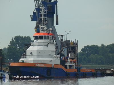
BUZZARD
Articulated Pusher Tug

Current Trip
R
| Time Travelled | 32 days |
|---|---|
| Remaining Time | --- |
| Distance Travelled | 3794.54 nm |
| Remaining Distance | --- |
| AVG Speed | 6.9 Knop |
| MAX Speed | 9.7 Knop |
| AVG Wind | 10.8 knots |
| MAX Wind | 28 knots |
| MIN Temp | 16.2°C / 61.16°F |
| MAX Temp | 28.5°C / 83.3°F |
| Djupgående | 4.1 m |
| Position mottagen | Nu |
Current Position
| Longitud | --- |
|---|---|
| Latitude | --- |
| Status | Under way using engine |
| Fart | 6.4 Knop |
| Kurs | 42.5° |
| Område | Persian Gulf |
| Station | T-AIS |
| Position mottagen | Nu |
Information
The current position of BUZZARD is in Persian Gulf with coordinates 24.17425° / 52.68015° as reported on 2025-03-24 10:50 by AIS to our vessel tracker app. The vessel's current speed is 6.4 Knop
The vessel BUZZARD (IMO: 9524528, MMSI: 246564000) is a Articulated Pusher Tug that was built in 2009 ( 16 År gammal ). It's sailing under the flag of [NL] Netherlands.
In this page you can find informations about the vessels current position, last detected port calls, and current voyage information. If the vessels is not in coverage by AIS you will find the latest position.
The current position of BUZZARD is detected by our AIS receivers and we are not responsible for the reliability of the data. The last position was recorded while the vessel was in Coverage by the Ais receivers of our vessel tracking app.
The current draught of BUZZARD as reported by AIS is 4.1 meters
Weather
| Temperature | 20.9°C / 69.62°F |
|---|---|
| Wind Speed | 24 knots |
| Direction | 330° NNW |
| Pressure | 1018.8 hPa |
| Humidity | 55.3 % |
| Cloud Coverage | 10 % |


Featured Company
Most Visited Ports (Last year)
| Port | Arrivals | |
|---|---|---|
| 654 | ||
| 2 | ||
| 2 | ||
| 2 |
Events
| Tid | Event | Detaljer | Position / Dest | Information |
|---|---|---|---|---|
| 2025-03-24 10:39 | STARTAR förflyttning | 3.11 nm, West of RUWAIS |
24.15603 / 52.67231
R
|
Fart: 4.5 kn Kurs: 25° |
| 2025-03-24 09:28 | STOPPAR förflyttning | 3.2 nm, West of RUWAIS |
24.15499 / 52.67069
R
|
Fart: 0.2 kn Kurs: 178° |
| 2025-03-24 09:09 | Status ändrad | Under way using engine Default |
24.18422 / 52.68901
R
|
Fart: 8.1 kn Kurs: 218° |
| 2025-03-24 09:01 | I täckningsområde |
24.18273 / 52.68830
Persian Gulf
|
Fart: 8.5 kn Kurs: 203.9° |
|
| 2025-03-24 06:16 | Status ändrad | Default Under way using engine |
24.19250 / 52.69662
R
|
Fart: 6.9 kn Kurs: 39.9° |
| 2025-03-24 06:13 | UTANFÖR täckningsområde |
24.18807 / 52.69178
Persian Gulf
|
Fart: 6.9 kn Kurs: 39.9° |
|
| 2025-03-24 05:52 | STARTAR förflyttning | 3.07 nm, West of RUWAIS |
24.15733 / 52.67274
R
|
Fart: 3.2 kn Kurs: 35° |
| 2025-03-24 04:38 | STOPPAR förflyttning | 3.11 nm, West of RUWAIS |
24.15514 / 52.67240
R
|
Fart: 0.3 kn Kurs: 158° |
| 2025-03-24 04:07 | Status ändrad | Under way using engine Default |
24.20936 / 52.70639
R
|
Fart: 8 kn Kurs: 199° |
| 2025-03-24 03:45 | Status ändrad | Default Under way using engine |
24.25582 / 52.72465
R
|
Fart: 8.3 kn Kurs: 200.9° |