
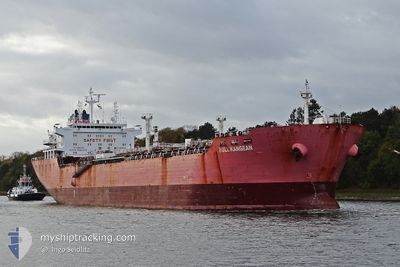
BULL KANGEAN
Oil/Chemical Tanker
Current Trip
| Trip Time | 23 days |
|---|---|
| Trip Distance | 4113.03 nm |
| AVG Speed | 10.9 Knop |
| MAX Speed | 14.5 Knop |
| Djupgående | 8.2 m |
| AVG Wind | 16 knots |
| MAX Wind | 32.2 knots |
| MIN Temp | 14°C / 57.2°F |
| MAX Temp | 28.8°C / 83.84°F |
| Position mottagen | 2 d sen |
Current Position
| Longitud | 29.72424° |
|---|---|
| Latitude | 31.23603° |
| Status | At anchor |
| Fart | 0.1 Knop |
| Kurs | 328° |
| Område | Mediterranean Sea - Eastern Basin |
| Station | T-AIS |
| Position mottagen | 2 d sen |
Info
Information
The current position of BULL KANGEAN is in Mediterranean Sea - Eastern Basin with coordinates 31.23603° / 29.72424° as reported on 2024-04-27 23:55 by AIS to our vessel tracker app. The vessel's current speed is 0.1 Knop and is currently inside the port of EL DEKHEILA.
The vessel BULL KANGEAN (IMO: 9267027, MMSI: 525107008) is a Oil/Chemical Tanker that was built in 2004 ( 20 År gammal ). It's sailing under the flag of [ID] Indonesia.
In this page you can find informations about the vessels current position, last detected port calls, and current voyage information. If the vessels is not in coverage by AIS you will find the latest position.
The current position of BULL KANGEAN is detected by our AIS receivers and we are not responsible for the reliability of the data. The last position was recorded while the vessel was in Coverage by the Ais receivers of our vessel tracking app.
The current draught of BULL KANGEAN as reported by AIS is 8.2 meters
Weather
| Temperature | 19.6°C / 67.28°F |
|---|---|
| Wind Speed | 12 knots |
| Direction | 327° NNW |
| Pressure | 1012.8 hPa |
| Humidity | 82.7 % |
| Cloud Coverage | 22 % |
Featured Company
Last Port Calls
| Port | Arrival | Departure | Time In Port |
|---|---|---|---|
| 2024-04-29 05:04 | |||
| 2024-04-03 11:39 | 2024-04-05 16:11 | 2 d | |
| 2024-03-25 10:56 | 2024-03-26 18:19 | 1 d | |
| 2024-03-18 14:47 | 2024-03-20 14:20 | 1 d | |
| 2024-02-11 14:29 | 2024-02-15 14:57 | 4 d |
Most Visited Ports (Last year)
| Port | Arrivals | |
|---|---|---|
| 3 | ||
| 2 | ||
| 2 | ||
| 2 | ||
| 2 | ||
| 1 |
Last Trips
| Origin | Departure | Destination | Arrival | Distance | |
|---|---|---|---|---|---|
| 2024-04-05 16:11 | 2024-04-29 07:04 | 4113.03 nm | |||
| 2024-03-26 18:19 | 2024-04-03 11:39 | 109.47 nm | |||
| 2024-03-20 14:20 | 2024-03-25 10:56 | 373.04 nm | |||
| 2024-02-15 16:57 | 2024-03-18 14:47 | 4733.07 nm | |||
| 2024-01-23 15:17 | 2024-02-11 16:29 | 1275.86 nm |
Events
| Tid | Event | Detaljer | Position / Dest | Information |
|---|---|---|---|---|
| 2024-04-29 05:42 | STOPPAR förflyttning |
31.13646 / 29.80632
[EG] EL DEKHEILA
|
Fart: 0.2 kn Kurs: 358° |
|
| 2024-04-29 05:04 | ANLÄNDER HAMN |
|
31.15370 / 29.80853
[EG] EL DEKHEILA
|
Fart: 3 kn Kurs: 175° |
| 2024-04-29 04:06 | STARTAR förflyttning | 3.23 nm, North West of ALEXANDRIA |
31.20465 / 29.80595
EG EDK
|
Fart: 3.7 kn Kurs: 123° |
| 2024-04-29 03:36 | STOPPAR förflyttning | 3.04 nm, North of EL DEKHEILA |
31.19667 / 29.79833
EG EDK
|
Fart: Kurs: -1° |
| 2024-04-29 02:37 | STARTAR förflyttning | 7.03 nm, North West of EL DEKHEILA |
31.24178 / 29.72631
EG EDK
|
Fart: 3.9 kn Kurs: 20° |
| 2024-04-27 23:58 | Status ändrad | Default At anchor |
31.23603 / 29.72437
EG EDK
|
Fart: 0.1 kn Kurs: 328° |
| 2024-04-27 23:55 | UTANFÖR täckningsområde |
31.23603 / 29.72424
Mediterranean Sea - Eastern Basin
|
Fart: 0.1 kn Kurs: 38° |
|
| 2024-04-27 23:49 | Status ändrad | At anchor Default |
31.23589 / 29.72420
EG EDK
|
Fart: Kurs: -1° |
| 2024-04-27 23:28 | Status ändrad | Default At anchor |
31.23596 / 29.72422
EG EDK
|
Fart: 0.1 kn Kurs: 314° |
| 2024-04-27 23:22 | Status ändrad | At anchor Default |
31.23610 / 29.72441
EG EDK
|
Fart: Kurs: -1° |