

BROOKLYN BRIDGE
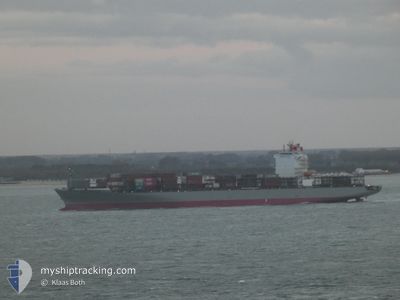
Container Ship

Current Trip
| Time Travelled | 2 days |
|---|---|
| Remaining Time | --- |
| Distance Travelled | 1046.73 nm |
| Remaining Distance | 3352.72 nm |
| AVG Speed | 17 Knop |
| MAX Speed | 20.1 Knop |
| AVG Wind | 14.9 knots |
| MAX Wind | 21 knots |
| MIN Temp | 11.4°C / 52.52°F |
| MAX Temp | 19.2°C / 66.56°F |
| Djupgående | 12.4 m |
| Position mottagen | 2 d sen |
Current Position
| Longitud | --- |
|---|---|
| Latitude | --- |
| Status | Under way using engine |
| Fart | 17.4 Knop |
| Kurs | 266.8° |
| Område | Strait of Gibraltar |
| Station | T-AIS |
| Position mottagen | 2 d sen |
Information
The current position of BROOKLYN BRIDGE is in Strait of Gibraltar with coordinates 35.94431° / -5.83235° as reported on 2025-03-16 02:56 by AIS to our vessel tracker app. The vessel's current speed is 17.4 Knop and is heading at the port of SANTOS. The estimated time of arrival as calculated by MyShipTracking vessel tracking app is 2025-03-27 05:00 LT
The vessel BROOKLYN BRIDGE (IMO: 9458999, MMSI: 431187000) is a Container Ship that was built in 2010 ( 15 År gammal ). It's sailing under the flag of [JP] Japan.
In this page you can find informations about the vessels current position, last detected port calls, and current voyage information. If the vessels is not in coverage by AIS you will find the latest position.
The current position of BROOKLYN BRIDGE is detected by our AIS receivers and we are not responsible for the reliability of the data. The last position was recorded while the vessel was in Coverage by the Ais receivers of our vessel tracking app.
The current draught of BROOKLYN BRIDGE as reported by AIS is 12.4 meters
Weather
| Temperature | 18°C / 64.4°F |
|---|---|
| Wind Speed | 19 knots |
| Direction | 40° NE |
| Pressure | 1018.7 hPa |
| Humidity | 77.8 % |
| Cloud Coverage | 2 % |


Featured Company
Last Port Calls
| Port | Arrival | Departure | Time In Port |
|---|---|---|---|
| 2025-03-15 07:23 | 2025-03-16 02:06 | 18 h | |
| 2025-03-11 18:07 | 2025-03-12 20:16 | 1 d | |
| 2025-03-04 18:05 | 2025-03-05 14:09 | 20 h | |
| 2025-02-25 17:42 | 2025-02-26 14:41 | 20 h | |
| 2025-02-23 05:20 | 2025-02-24 08:23 | 1 d | |
| 2025-02-20 23:40 | 2025-02-21 20:48 | 21 h | |
| 2025-02-15 19:17 | 2025-02-16 13:05 | 17 h | |
| 2025-02-03 06:50 | 2025-02-03 06:54 | 4 m | |
| 2025-01-31 16:59 | 2025-02-01 17:12 | 1 d | |
| 2025-01-30 13:13 | 2025-01-31 01:00 | 11 h |
Last Trips
| Origin | Departure | Destination | Arrival | Distance | |
|---|---|---|---|---|---|
| 2025-03-12 20:16 | 2025-03-15 07:23 | 445.26 nm | |||
| 2025-03-05 14:09 | 2025-03-11 18:07 | 1176.84 nm | |||
| 2025-02-26 14:41 | 2025-03-04 18:05 | 161.48 nm | |||
| 2025-02-24 08:23 | 2025-02-25 17:42 | 364.47 nm | |||
| 2025-02-21 20:48 | 2025-02-23 05:20 | 412.14 nm | |||
| 2025-02-16 13:05 | 2025-02-20 23:40 | 1449.89 nm | |||
| 2025-02-03 06:54 | 2025-02-15 19:17 | 4270.20 nm | |||
| 2025-02-01 17:12 | 2025-02-03 06:50 | 234.30 nm | |||
| 2025-01-31 01:00 | 2025-01-31 16:59 | 181.17 nm | |||
| 2025-01-29 20:38 | 2025-01-30 13:13 | 69.55 nm |
Events
| Tid | Event | Detaljer | Position / Dest | Information |
|---|---|---|---|---|
| 2025-03-16 03:04 | Status ändrad | Default Under way using engine |
35.94118 / -5.88209
BR SSZ
|
Fart: 17.4 kn Kurs: 266.8° |
| 2025-03-16 02:56 | UTANFÖR täckningsområde |
35.94431 / -5.83235
Strait of Gibraltar
BR SSZ
|
Fart: 17.4 kn Kurs: 266.8° |
|
| 2025-03-16 02:52 | Byter havsområde | Moroccan part of the Strait of Gibraltar Spanish part of the Strait of Gibraltar |
35.94516 / -5.81454
Strait of Gibraltar
BR SSZ
|
Fart: 17.2 kn Kurs: 267.7° |
| 2025-03-16 01:06 | AVGÅTT HAMN |
|
36.11258 / -5.41363
BR SSZ
|
Fart: 5.7 kn Kurs: 119° |
| 2025-03-16 00:55 | STARTAR förflyttning |
36.12557 / -5.42143
[ES] ALGECIRAS
|
Fart: 4 kn Kurs: 171° |
|
| 2025-03-16 00:49 | Status ändrad | Under way using engine Moored |
36.12723 / -5.42249
[ES] ALGECIRAS
|
Fart: Kurs: 179° |
| 2025-03-15 23:26 | ETA ändrat | 2025/03/27 08:00 2025/03/25 05:00 |
36.12727 / -5.42239
[ES] ALGECIRAS
|
Fart: Kurs: 179° |
| 2025-03-15 23:20 | Djupgående ändrat | 12.4 12 |
36.12723 / -5.42244
[ES] ALGECIRAS
|
Fart: Kurs: 179° |
| 2025-03-15 22:58 | ETA ändrat | 2025/03/25 05:00 2025/03/15 05:00 |
36.12737 / -5.42242
[ES] ALGECIRAS
|
Fart: Kurs: 179° |
| 2025-03-15 22:52 | Destination ändrad | BR SSZ ESALG |
36.12728 / -5.42239
[ES] ALGECIRAS
|
Fart: Kurs: 179° |