
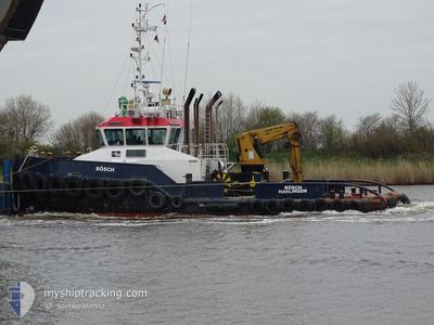
BOSCH
Tug
Current Trip
| Time Travelled | 7 days |
|---|---|
| Remaining Time | --- |
| Distance Travelled | 400.04 nm |
| Remaining Distance | --- |
| AVG Speed | 6.8 Knop |
| MAX Speed | 13.9 Knop |
| AVG Wind | 9.6 knots |
| MAX Wind | 17 knots |
| MIN Temp | 1.7°C / 35.06°F |
| MAX Temp | 13.8°C / 56.84°F |
| Djupgående | 2.8 m |
| Position mottagen | 15 m sen |
Current Position
| Longitud | --- |
|---|---|
| Latitude | --- |
| Status | Moored |
| Fart | |
| Kurs | 214° |
| Område | North Sea |
| Station | T-AIS |
| Position mottagen | 15 m sen |
Info
Information
The current position of BOSCH is in North Sea with coordinates 53.89731° / 9.15624° as reported on 2025-03-07 06:29 by AIS to our vessel tracker app. The vessel's current speed is 0 Knop
The vessel BOSCH (IMO: 9429986, MMSI: 244677000) is a Tug It's sailing under the flag of [NL] Netherlands.
In this page you can find informations about the vessels current position, last detected port calls, and current voyage information. If the vessels is not in coverage by AIS you will find the latest position.
The current position of BOSCH is detected by our AIS receivers and we are not responsible for the reliability of the data. The last position was recorded while the vessel was in Coverage by the Ais receivers of our vessel tracking app.
The current draught of BOSCH as reported by AIS is 2.8 meters
Weather
| Temperature | 5.5°C / 41.9°F |
|---|---|
| Wind Speed | 6 knots |
| Direction | 185° S |
| Pressure | 1016.5 hPa |
| Humidity | 77.4 % |
| Cloud Coverage | 3 % |
Featured Company
Last Port Calls
| Port | Arrival | Departure | Time In Port |
|---|---|---|---|
| 2025-02-27 13:57 | 2025-02-27 14:59 | 1 h | |
| 2025-02-17 13:13 | 2025-02-17 13:21 | 8 m | |
| 2025-02-17 12:47 | |||
| 2025-02-16 11:20 | 2025-02-16 12:58 | 1 h | |
| 2025-02-13 13:39 |
Most Visited Ports (Last year)
| Port | Arrivals | |
|---|---|---|
| 82 | ||
| 7 | ||
| 5 | ||
| 4 | ||
| 4 | ||
| 4 |
Last Trips
| Origin | Departure | Destination | Arrival | Distance | |
|---|---|---|---|---|---|
| 2025-02-17 14:21 | 2025-02-27 14:57 | 44.06 nm | |||
| 2025-02-16 13:58 | 2025-02-17 14:13 | 3.00 nm | |||
| 2025-02-16 13:58 | 2025-02-17 13:47 | 2.27 nm | |||
| 2025-02-13 14:39 | 2025-02-16 12:20 | 83.81 nm |
Events
| Tid | Event | Detaljer | Position / Dest | Information |
|---|---|---|---|---|
| 2025-03-07 06:44 | Status ändrad | Moored Default |
53.89734 / 9.15624
DEBRB
|
Fart: Kurs: 217° |
| 2025-03-07 06:32 | Status ändrad | Default Moored |
53.89732 / 9.15623
DEBRB
|
Fart: Kurs: 214° |
| 2025-03-07 05:44 | Status ändrad | Moored Default |
53.89731 / 9.15622
DEBRB
|
Fart: Kurs: 215° |
| 2025-03-07 05:41 | Status ändrad | Default Moored |
53.89730 / 9.15624
DEBRB
|
Fart: Kurs: 215° |
| 2025-03-07 02:32 | Status ändrad | Moored Under way using engine |
53.89734 / 9.15622
DEBRB
|
Fart: Kurs: 217° |
| 2025-03-07 02:32 | ETA ändrat | 2025/03/07 03:45 2025/03/07 02:00 |
53.89733 / 9.15624
DEBRB
|
Fart: Kurs: 217° |
| 2025-03-07 02:28 | STOPPAR förflyttning | 0.36 nm, South of BRUNSBUETTEL |
53.89736 / 9.15622
DEBRB
|
Fart: 0.2 kn Kurs: 217° |
| 2025-03-07 02:23 | STARTAR förflyttning | 0.66 nm, South West of BRUNSBUETTEL |
53.89382 / 9.14958
DEBRB
|
Fart: 6.8 kn Kurs: 41.9° |
| 2025-03-07 02:14 | STOPPAR förflyttning | 0.78 nm, South West of BRUNSBUETTEL |
53.89231 / 9.14760
DEBRB
|
Fart: 0.3 kn Kurs: 36° |
| 2025-03-06 23:43 | Destination ändrad | DEBRB ELBE 1 |
53.93631 / 8.65426
DEBRB
|
Fart: 8 kn Kurs: 147.9° |