
BOOST
Cargo
Current Trip
BOOST is out of coverage. Learn how you can join the community and extend the coverage to your area by clicking here!
MAASBRACHT
Unknown Port
ETA*
2024-12-10 07:00 UTC
| Time Travelled | 2 days |
|---|---|
| Remaining Time | --- |
| Distance Travelled | 9.62 nm |
| Remaining Distance | --- |
| AVG Speed | 5.4 Knop |
| MAX Speed | 7 Knop |
| AVG Wind | 5.7 knots |
| MAX Wind | 7.8 knots |
| MIN Temp | 7.6°C / 45.68°F |
| MAX Temp | 13.3°C / 55.94°F |
| Djupgående | 0 m |
| Position mottagen | 1 d sen |
Current Position
| Longitud | 5.82859° |
|---|---|
| Latitude | 51.20189° |
| Status | Under way using engine |
| Fart | 5.9 Knop |
| Kurs | 149.9° |
| Område | North Sea |
| Station | T-AIS |
| Position mottagen | 1 d sen |
Info
info
Information
The current position of BOOST is in North Sea with coordinates 51.20189° / 5.82859° as reported on 2024-05-04 06:02 by AIS to our vessel tracker app. The vessel's current speed is 5.9 Knop
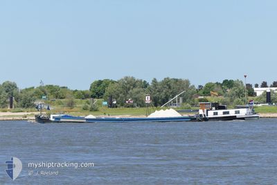
The vessel BOOST (MMSI: 244314873) is a Cargo It's sailing under the flag of [NL] Netherlands.
In this page you can find informations about the vessels current position, last detected port calls, and current voyage information. If the vessels is not in coverage by AIS you will find the latest position.
The current position of BOOST is detected by our AIS receivers and we are not responsible for the reliability of the data. The last position was recorded while the vessel was in Coverage by the Ais receivers of our vessel tracking app.
Weather
| Temperature | 11°C / 51.8°F |
|---|---|
| Wind Speed | 5 knots |
| Direction | 84° E |
| Pressure | 1006.8 hPa |
| Humidity | 78.9 % |
| Cloud Coverage | 100 % |
Featured Company
Limited time offer - Install a base station receiver to your area and list your company on MyShipTracking Free forever!
Most Visited Ports (Last year)
| Port | Arrivals | |
|---|---|---|
| 14 | ||
| 10 | ||
| 2 | ||
| 2 | ||
| 2 | ||
| 1 |
Last Trips
| Origin | Departure | Destination | Arrival | Distance |
|---|
Events
| Tid | Event | Detaljer | Position / Dest | Information |
|---|---|---|---|---|
| 2024-05-04 06:21 | Status ändrad | Default Under way using engine |
51.17500 / 5.85333
MAASBRACHT
|
Fart: 5.9 kn Kurs: 149.9° |
| 2024-05-04 06:02 | UTANFÖR täckningsområde |
51.20189 / 5.82860
North Sea
|
Fart: 5.9 kn Kurs: 149.9° |
|
| 2024-05-04 04:32 | STARTAR förflyttning | 9.63 nm, South of HELMOND |
51.32490 / 5.74766
MAASBRACHT
|
Fart: 5 kn Kurs: 173.1° |
| 2024-05-04 04:30 | Status ändrad | Under way using engine Moored |
51.32717 / 5.74728
MAASBRACHT
|
Fart: Kurs: 511° |
| 2024-05-03 20:46 | Status ändrad | Moored Under way using engine |
51.32738 / 5.74735
MAASBRACHT
|
Fart: Kurs: 511° |
| 2024-05-03 18:38 | STOPPAR förflyttning | 9.49 nm, South of HELMOND |
51.32743 / 5.74735
MAASBRACHT
|
Fart: 0.2 kn Kurs: 511° |
| 2024-05-03 18:10 | STARTAR förflyttning | 8.27 nm, South East of HELMOND |
51.34848 / 5.74361
MAASBRACHT
|
Fart: 4.1 kn Kurs: 175.5° |
| 2024-05-03 18:00 | STOPPAR förflyttning | 8.16 nm, South East of HELMOND |
51.35034 / 5.74330
MAASBRACHT
|
Fart: 0.1 kn Kurs: 511° |
| 2024-05-03 17:56 | Status ändrad | Under way using engine Default |
51.35359 / 5.74279
MAASBRACHT
|
Fart: 5 kn Kurs: -1° |
| 2024-05-03 17:56 | I täckningsområde |
51.35125 / 5.74314
North Sea
|
Fart: 2.9 kn Kurs: 174.7° |