
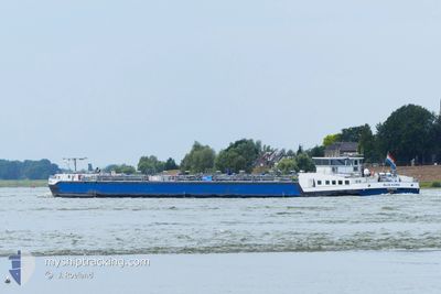
BLUE KARIN
Tanker
Current Trip
HAM ALBERTKANAAL LI
| Time Travelled | 13 h, 18 mins |
|---|---|
| Remaining Time | --- |
| Distance Travelled | 6.69 nm |
| Remaining Distance | --- |
| AVG Speed | 7.3 Knop |
| MAX Speed | 7.7 Knop |
| AVG Wind | 4 knots |
| MAX Wind | 4 knots |
| MIN Temp | 3.4°C / 38.12°F |
| MAX Temp | 4.4°C / 39.92°F |
| Djupgående | 1.9 m |
| Position mottagen | 12 h, 36 m sen |
Current Position
| Longitud | --- |
|---|---|
| Latitude | --- |
| Status | Under way using engine |
| Fart | 6.7 Knop |
| Kurs | 117.5° |
| Område | North Sea |
| Station | T-AIS |
| Position mottagen | 12 h, 36 m sen |
Info
Information
The current position of BLUE KARIN is in North Sea with coordinates 51.21672° / 4.56997° as reported on 2025-03-16 22:55 by AIS to our vessel tracker app. The vessel's current speed is 6.7 Knop
The vessel BLUE KARIN (MMSI: 244830333) is a Tanker It's sailing under the flag of [NL] Netherlands.
In this page you can find informations about the vessels current position, last detected port calls, and current voyage information. If the vessels is not in coverage by AIS you will find the latest position.
The current position of BLUE KARIN is detected by our AIS receivers and we are not responsible for the reliability of the data. The last position was recorded while the vessel was in Coverage by the Ais receivers of our vessel tracking app.
The current draught of BLUE KARIN as reported by AIS is 1.9 meters
Weather
| Temperature | 4.7°C / 40.46°F |
|---|---|
| Wind Speed | 5 knots |
| Direction | 5° N |
| Pressure | 1025.4 hPa |
| Humidity | 83.9 % |
| Cloud Coverage | 100 % |
Featured Company
Last Port Calls
| Port | Arrival | Departure | Time In Port |
|---|---|---|---|
| 2025-03-16 22:22 | 2025-03-16 23:13 | 51 m | |
| 2025-03-15 14:28 | 2025-03-16 21:55 | 1 d | |
| 2025-03-14 09:42 | 2025-03-15 01:22 | 15 h | |
| 2025-03-13 04:27 | 2025-03-13 14:31 | 10 h | |
| 2025-03-12 23:01 | 2025-03-12 23:49 | 48 m | |
| 2025-03-12 07:23 | 2025-03-12 19:48 | 12 h | |
| 2025-03-10 19:05 | 2025-03-12 06:42 | 1 d | |
| 2025-03-10 14:17 | 2025-03-10 15:07 | 49 m | |
| 2025-03-09 11:22 | 2025-03-10 03:21 | 15 h | |
| 2025-03-09 09:07 | 2025-03-09 11:10 | 2 h |
Most Visited Ports (Last year)
| Port | Arrivals | |
|---|---|---|
| 38 | ||
| 30 | ||
| 22 | ||
| 22 | ||
| 16 | ||
| 16 |
Last Trips
| Origin | Departure | Destination | Arrival | Distance | |
|---|---|---|---|---|---|
| 2025-03-16 21:55 | 2025-03-16 22:22 | 1.35 nm | |||
| 2025-03-15 01:22 | 2025-03-15 14:28 | 101.14 nm | |||
| 2025-03-13 14:31 | 2025-03-14 09:42 | 62.30 nm | |||
| 2025-03-12 23:49 | 2025-03-13 04:27 | 32.69 nm | |||
| 2025-03-12 19:48 | 2025-03-12 23:01 | 23.30 nm | |||
| 2025-03-12 06:42 | 2025-03-12 07:23 | 2.32 nm | |||
| 2025-03-10 15:07 | 2025-03-10 19:05 | 29.09 nm | |||
| 2025-03-10 03:21 | 2025-03-10 14:17 | 83.54 nm | |||
| 2025-03-09 11:10 | 2025-03-09 11:22 | 2.38 nm | |||
| 2025-03-09 08:09 | 2025-03-09 09:07 | 8.11 nm |
Events
| Tid | Event | Detaljer | Position / Dest | Information |
|---|---|---|---|---|
| 2025-03-16 23:01 | Status ändrad | Default Under way using engine |
51.21091 / 4.58801
HAM ALBERTKANAAL LI
|
Fart: 6.7 kn Kurs: 117.5° |
| 2025-03-16 22:55 | Status ändrad | Under way using engine Default |
51.21672 / 4.56997
HAM ALBERTKANAAL LI
|
Fart: 6.6 kn Kurs: 116° |
| 2025-03-16 22:55 | UTANFÖR täckningsområde |
51.21672 / 4.56997
North Sea
|
Fart: 6.7 kn Kurs: 117.5° |
|
| 2025-03-16 22:54 | Status ändrad | Default Under way using engine |
51.21772 / 4.56689
HAM ALBERTKANAAL LI
|
Fart: 5.2 kn Kurs: 116.8° |
| 2025-03-16 22:42 | Status ändrad | Under way using engine Default |
51.22504 / 4.54395
HAM ALBERTKANAAL LI
|
Fart: 1.2 kn Kurs: -1° |
| 2025-03-16 22:42 | STARTAR förflyttning | 1.34 nm, South East of WIJNEGEM |
51.22504 / 4.54395
HAM ALBERTKANAAL LI
|
Fart: 4.6 kn Kurs: 117.7° |
| 2025-03-16 22:37 | I täckningsområde |
51.22418 / 4.54664
North Sea
|
Fart: 4.2 kn Kurs: 116.3° |
|
| 2025-03-16 22:13 | AVGÅTT HAMN |
|
51.22742 / 4.53673
HAM ALBERTKANAAL LI
|
Fart: 0.6 kn Kurs: -1° |
| 2025-03-16 21:24 | STOPPAR förflyttning |
51.23248 / 4.52030
[BE] WIJNEGEM
|
Fart: 0.1 kn Kurs: -1° |
|
| 2025-03-16 21:12 | UTANFÖR täckningsområde |
51.23411 / 4.51561
North Sea
[BE] WIJNEGEM
|
Fart: 1.9 kn Kurs: 115° |