
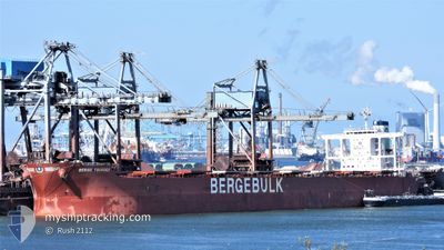
BERGE TSURUGI
Bulk Carrier
Current Trip
| Time Travelled | --- |
|---|---|
| Remaining Time | 4 days |
| Distance Travelled | 10066.81 nm |
| Remaining Distance | 991.34 nm |
| AVG Speed | 9.9 Knop |
| MAX Speed | 13.8 Knop |
| AVG Wind | 11.1 knots |
| MAX Wind | 24 knots |
| MIN Temp | 19.9°C / 67.82°F |
| MAX Temp | 29.8°C / 85.64°F |
| Djupgående | 9.9 m |
| Position mottagen | Nu |
Current Position
| Longitud | 119.50783° |
|---|---|
| Latitude | -35.52701° |
| Status | Under way using engine |
| Fart | 9.5 Knop |
| Kurs | 86.5° |
| Område | Great Australian Bight |
| Station | T-AIS |
| Position mottagen | Nu |
Info
Information
The current position of BERGE TSURUGI is in Great Australian Bight with coordinates -35.52701° / 119.50783° as reported on 2024-05-17 00:10 by AIS to our vessel tracker app. The vessel's current speed is 9.5 Knop and is heading at the port of WHYALLA. The estimated time of arrival as calculated by MyShipTracking vessel tracking app is 2024-05-21 19:45 LT
The vessel BERGE TSURUGI (IMO: 9599810, MMSI: 636019376) is a Bulk Carrier that was built in 2012 ( 12 År gammal ). It's sailing under the flag of [LR] Liberia.
In this page you can find informations about the vessels current position, last detected port calls, and current voyage information. If the vessels is not in coverage by AIS you will find the latest position.
The current position of BERGE TSURUGI is detected by our AIS receivers and we are not responsible for the reliability of the data. The last position was recorded while the vessel was in Coverage by the Ais receivers of our vessel tracking app.
The current draught of BERGE TSURUGI as reported by AIS is 9.9 meters
Weather
| Temperature | 16.9°C / 62.42°F |
|---|---|
| Wind Speed | 13 knots |
| Direction | 86° E |
| Pressure | 1033 hPa |
| Humidity | 86.1 % |
| Cloud Coverage | 7 % |
Featured Company
Last Port Calls
Last Trips
| Origin | Departure | Destination | Arrival | Distance |
|---|
Events
| Tid | Event | Detaljer | Position / Dest | Information |
|---|---|---|---|---|
| 2024-05-16 23:59 | Status ändrad | Under way using engine Default |
-35.52738 / 119.47455
AU WYA
|
Fart: 9.5 kn Kurs: 91° |
| 2024-05-16 23:49 | Status ändrad | Default Under way using engine |
-35.52761 / 119.44131
AU WYA
|
Fart: 9.5 kn Kurs: 84.5° |
| 2024-05-16 23:45 | Status ändrad | Under way using engine Default |
-35.52772 / 119.42689
AU WYA
|
Fart: 9.5 kn Kurs: 86° |
| 2024-05-16 23:41 | Status ändrad | Default Under way using engine |
-35.52775 / 119.41633
AU WYA
|
Fart: 9.4 kn Kurs: 94.3° |
| 2024-05-16 22:07 | Status ändrad | Under way using engine Default |
-35.52564 / 119.11804
AU WYA
|
Fart: 9.5 kn Kurs: 83° |
| 2024-05-16 22:02 | Status ändrad | Default Under way using engine |
-35.52599 / 119.10170
AU WYA
|
Fart: 9.4 kn Kurs: 86.9° |
| 2024-05-16 21:51 | Status ändrad | Under way using engine Default |
-35.52672 / 119.06820
AU WYA
|
Fart: 9.4 kn Kurs: 89° |
| 2024-05-16 21:46 | Status ändrad | Default Under way using engine |
-35.52697 / 119.05231
AU WYA
|
Fart: 9.3 kn Kurs: 82.4° |
| 2024-05-16 21:11 | Byter havsområde | Australian part of the Great Australian Bight Australian part of the Indian Ocean |
-35.52854 / 118.93908
Great Australian Bight
AU WYA
|
Fart: 9.5 kn Kurs: 89.3° |
| 2024-05-16 09:28 | Status ändrad | Under way using engine Default |
-35.54142 / 116.65323
AU WYA
|
Fart: 11.9 kn Kurs: 95° |