

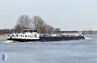
BELLATOR
Other Type

Current Trip
| Time Travelled | 1 day |
|---|---|
| Remaining Time | 1 h, 12 mins |
| Distance Travelled | 15.14 nm |
| Remaining Distance | 10.12 nm |
| AVG Speed | 4.6 Knop |
| MAX Speed | 5.9 Knop |
| AVG Wind | 14.2 knots |
| MAX Wind | 15.2 knots |
| MIN Temp | 2.6°C / 36.68°F |
| MAX Temp | 12.6°C / 54.68°F |
| Djupgående | 2.5 m |
| Position mottagen | 1 h, 43 m sen |
Current Position
| Longitud | --- |
|---|---|
| Latitude | --- |
| Status | Under way using engine |
| Fart | 3.2 Knop |
| Kurs | 322.7° |
| Område | North Sea |
| Station | T-AIS |
| Position mottagen | 1 h, 43 m sen |
Information
The current position of BELLATOR is in North Sea with coordinates 51.17571° / 3.23593° as reported on 2025-04-01 04:29 by AIS to our vessel tracker app. The vessel's current speed is 3.2 Knop and is heading at the port of OOSTENDE. The estimated time of arrival as calculated by MyShipTracking vessel tracking app is 2025-04-01 09:24 LT
The vessel BELLATOR (MMSI: 205404090) is a Other Type It's sailing under the flag of [BE] Belgium.
In this page you can find informations about the vessels current position, last detected port calls, and current voyage information. If the vessels is not in coverage by AIS you will find the latest position.
The current position of BELLATOR is detected by our AIS receivers and we are not responsible for the reliability of the data. The last position was recorded while the vessel was in Coverage by the Ais receivers of our vessel tracking app.
The current draught of BELLATOR as reported by AIS is 2.5 meters
Weather
| Temperature | 2.6°C / 36.68°F |
|---|---|
| Wind Speed | 7 knots |
| Direction | 77° ENE |
| Pressure | 1027.2 hPa |
| Humidity | 92.7 % |
| Cloud Coverage | 39 % |


Featured Company
Last Port Calls
| Port | Arrival | Departure | Time In Port |
|---|---|---|---|
| 2025-03-30 09:59 | 2025-03-30 11:57 | 1 h | |
| 2025-03-29 19:51 | 2025-03-30 07:00 | 10 h | |
| 2025-03-29 03:29 | 2025-03-29 11:46 | 8 h | |
| 2025-03-27 11:41 | 2025-03-29 02:56 | 1 d | |
| 2025-03-26 18:53 | 2025-03-26 19:09 | 15 m | |
| 2025-03-26 16:38 | 2025-03-26 17:27 | 48 m | |
| 2025-03-26 13:19 | 2025-03-26 15:12 | 1 h | |
| 2025-03-26 08:23 | 2025-03-26 09:37 | 1 h | |
| 2025-03-25 13:11 | 2025-03-26 06:47 | 17 h | |
| 2025-03-25 10:23 | 2025-03-25 11:25 | 1 h |
Last Trips
| Origin | Departure | Destination | Arrival | Distance | |
|---|---|---|---|---|---|
| 2025-03-30 07:00 | 2025-03-30 09:59 | 21.04 nm | |||
| 2025-03-29 11:46 | 2025-03-29 19:51 | 53.85 nm | |||
| 2025-03-29 02:56 | 2025-03-29 03:29 | 3.32 nm | |||
| 2025-03-26 19:09 | 2025-03-27 11:41 | 50.08 nm | |||
| 2025-03-26 17:27 | 2025-03-26 18:53 | 11.13 nm | |||
| 2025-03-26 15:12 | 2025-03-26 16:38 | 9.16 nm | |||
| 2025-03-26 09:37 | 2025-03-26 13:19 | 18.32 nm | |||
| 2025-03-26 06:47 | 2025-03-26 08:23 | 7.86 nm | |||
| 2025-03-25 11:25 | 2025-03-25 13:11 | 7.75 nm | |||
| 2025-03-25 05:35 | 2025-03-25 10:23 | 18.53 nm |
Events
| Tid | Event | Detaljer | Position / Dest | Information |
|---|---|---|---|---|
| 2025-04-01 04:29 | UTANFÖR täckningsområde |
51.17571 / 3.23593
North Sea
|
Fart: 3.2 kn Kurs: 322.7° |
|
| 2025-04-01 04:11 | I täckningsområde |
51.16424 / 3.25522
North Sea
|
Fart: 3.4 kn Kurs: 322.2° |
|
| 2025-03-31 17:37 | UTANFÖR täckningsområde |
51.15885 / 3.26288
North Sea
OOSTENDE KANAAL GEN
|
Fart: Kurs: 511° |
|
| 2025-03-31 16:37 | I täckningsområde |
51.15889 / 3.26288
North Sea
OOSTENDE KANAAL GEN
|
Fart: Kurs: 511° |
|
| 2025-03-31 06:14 | UTANFÖR täckningsområde |
51.15887 / 3.26290
North Sea
OOSTENDE KANAAL GEN
|
Fart: Kurs: 511° |
|
| 2025-03-31 05:42 | I täckningsområde |
51.15885 / 3.26291
North Sea
OOSTENDE KANAAL GEN
|
Fart: Kurs: 511° |
|
| 2025-03-31 04:26 | UTANFÖR täckningsområde |
51.15887 / 3.26288
North Sea
OOSTENDE KANAAL GEN
|
Fart: Kurs: 511° |
|
| 2025-03-31 04:05 | I täckningsområde |
51.15886 / 3.26289
North Sea
OOSTENDE KANAAL GEN
|
Fart: Kurs: 511° |
|
| 2025-03-30 22:36 | UTANFÖR täckningsområde |
51.15886 / 3.26286
North Sea
OOSTENDE KANAAL GEN
|
Fart: Kurs: 511° |
|
| 2025-03-30 22:36 | I täckningsområde |
51.15886 / 3.26286
North Sea
OOSTENDE KANAAL GEN
|
Fart: Kurs: 511° |