
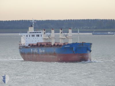
BC MIRABEL
Cargo
Current Trip
IN HZA
| Time Travelled | 19 days |
|---|---|
| Remaining Time | --- |
| Distance Travelled | 4447.59 nm |
| Remaining Distance | --- |
| AVG Speed | 10.7 Knop |
| MAX Speed | 15 Knop |
| AVG Wind | 12.1 knots |
| MAX Wind | 31.9 knots |
| MIN Temp | 2.7°C / 36.86°F |
| MAX Temp | 21.5°C / 70.7°F |
| Djupgående | 12.5 m |
| Position mottagen | 2 h, 53 m sen |
Current Position
| Longitud | 25.63244° |
|---|---|
| Latitude | 33.51139° |
| Status | Under way using engine |
| Fart | 11.5 Knop |
| Kurs | 107.8° |
| Område | Mediterranean Sea - Eastern Basin |
| Station | T-AIS |
| Position mottagen | 2 h, 53 m sen |
Info
Information
The current position of BC MIRABEL is in Mediterranean Sea - Eastern Basin with coordinates 33.51139° / 25.63244° as reported on 2024-05-23 18:05 by AIS to our vessel tracker app. The vessel's current speed is 11.5 Knop
The vessel BC MIRABEL (IMO: 9531662, MMSI: 357028000) is a Cargo It's sailing under the flag of [PA] Panama.
In this page you can find informations about the vessels current position, last detected port calls, and current voyage information. If the vessels is not in coverage by AIS you will find the latest position.
The current position of BC MIRABEL is detected by our AIS receivers and we are not responsible for the reliability of the data. The last position was recorded while the vessel was in Coverage by the Ais receivers of our vessel tracking app.
The current draught of BC MIRABEL as reported by AIS is 12.5 meters
Weather
| Temperature | 21°C / 69.8°F |
|---|---|
| Wind Speed | 21 knots |
| Direction | 300° WNW |
| Pressure | 1014.9 hPa |
| Humidity | 73.5 % |
| Cloud Coverage | 2 % |
Featured Company
Most Visited Ports (Last year)
| Port | Arrivals | |
|---|---|---|
| 2 | ||
| 1 | ||
| 1 | ||
| 1 | ||
| 1 | ||
| 1 |
Events
| Tid | Event | Detaljer | Position / Dest | Information |
|---|---|---|---|---|
| 2024-05-23 18:09 | Status ändrad | Default Under way using engine |
33.50741 / 25.64625
IN HZA
|
Fart: 11.5 kn Kurs: 107.8° |
| 2024-05-23 18:05 | UTANFÖR täckningsområde |
33.51139 / 25.63244
Mediterranean Sea - Eastern Basin
IN HZA
|
Fart: 11.5 kn Kurs: 107.8° |
|
| 2024-05-23 15:06 | Status ändrad | Under way using engine Default |
33.67498 / 25.02799
IN HZA
|
Fart: 10.2 kn Kurs: 106° |
| 2024-05-23 14:56 | I täckningsområde |
33.67469 / 25.02894
Mediterranean Sea - Eastern Basin
IN HZA
|
Fart: 10.2 kn Kurs: 110.1° |
|
| 2024-05-23 09:11 | Status ändrad | Default Under way using engine |
34.00618 / 23.79819
IN HZA
|
Fart: 11.3 kn Kurs: 108° |
| 2024-05-23 09:05 | UTANFÖR täckningsområde |
34.01201 / 23.77776
Mediterranean Sea - Eastern Basin
IN HZA
|
Fart: 11.3 kn Kurs: 108° |
|
| 2024-05-23 08:31 | Status ändrad | Under way using engine Default |
34.04704 / 23.65392
IN HZA
|
Fart: 11.5 kn Kurs: 109° |
| 2024-05-23 08:14 | I täckningsområde |
34.04704 / 23.65392
Mediterranean Sea - Eastern Basin
IN HZA
|
Fart: 11.4 kn Kurs: 107° |
|
| 2024-05-22 23:46 | UTANFÖR täckningsområde |
34.55837 / 21.75120
Mediterranean Sea - Eastern Basin
IN HZA
|
Fart: 11.1 kn Kurs: 109.1° |
|
| 2024-05-22 23:46 | Upptäckt i hav | Greek part of the Mediterranean Sea - Eastern Basin |
34.55837 / 21.75120
Mediterranean Sea - Eastern Basin
IN HZA
|
Fart: 11.1 kn Kurs: 109.1° |