

BC CALLISTO
General Cargo

Current Trip
GT PRQ
| Time Travelled | 23 days |
|---|---|
| Remaining Time | --- |
| Distance Travelled | 871.66 nm |
| Remaining Distance | --- |
| AVG Speed | 12.8 Knop |
| MAX Speed | 13.9 Knop |
| AVG Wind | 6 knots |
| MAX Wind | 15.5 knots |
| MIN Temp | 20.3°C / 68.54°F |
| MAX Temp | 33.5°C / 92.3°F |
| Djupgående | 6.2 m |
| Position mottagen | 4 d sen |
Current Position
| Longitud | --- |
|---|---|
| Latitude | --- |
| Status | At anchor |
| Fart | 0.1 Knop |
| Kurs | 225° |
| Område | North Pacific Ocean |
| Station | T-AIS |
| Position mottagen | 4 d sen |
Information
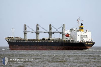
The current position of BC CALLISTO is in North Pacific Ocean with coordinates 13.89864° / -90.79116° as reported on 2025-03-24 21:26 by AIS to our vessel tracker app. The vessel's current speed is 0.1 Knop
The vessel BC CALLISTO (IMO: 9400916, MMSI: 314560000) is a General Cargo that was built in 2010 ( 15 År gammal ). It's sailing under the flag of [BB] Barbados.
In this page you can find informations about the vessels current position, last detected port calls, and current voyage information. If the vessels is not in coverage by AIS you will find the latest position.
The current position of BC CALLISTO is detected by our AIS receivers and we are not responsible for the reliability of the data. The last position was recorded while the vessel was in Coverage by the Ais receivers of our vessel tracking app.
The current draught of BC CALLISTO as reported by AIS is 6.2 meters
Weather
| Temperature | 32.3°C / 90.14°F |
|---|---|
| Wind Speed | 15 knots |
| Direction | 202° SSW |
| Pressure | 1009.1 hPa |
| Humidity | 48.9 % |
| Cloud Coverage | 100 % |


Featured Company
Last Port Calls
| Port | Arrival | Departure | Time In Port |
|---|---|---|---|
| 2025-03-02 11:04 | 2025-03-06 01:59 | 3 d | |
| 2025-02-26 21:43 | 2025-02-28 13:55 | 1 d | |
| 2025-01-16 15:05 | 2025-01-17 03:45 | 12 h | |
| 2025-01-10 12:49 |
Last Trips
| Origin | Departure | Destination | Arrival | Distance | |
|---|---|---|---|---|---|
| 2025-02-28 13:55 | 2025-03-02 11:04 | 494.75 nm | |||
| 2025-01-17 03:45 | 2025-02-26 21:43 | 8613.21 nm | |||
| 2025-01-10 12:49 | 2025-01-16 15:05 | 732.50 nm |
Events
| Tid | Event | Detaljer | Position / Dest | Information |
|---|---|---|---|---|
| 2025-03-24 21:32 | Status ändrad | Default At anchor |
13.89859 / -90.79115
GT PRQ
|
Fart: 0.1 kn Kurs: 225° |
| 2025-03-24 21:26 | UTANFÖR täckningsområde |
13.89864 / -90.79116
North Pacific Ocean
|
Fart: 0.1 kn Kurs: 209.3° |
|
| 2025-03-24 21:20 | Status ändrad | At anchor Default |
13.89867 / -90.79118
GT PRQ
|
Fart: 0.1 kn Kurs: 221° |
| 2025-03-24 21:05 | Status ändrad | Default At anchor |
13.89872 / -90.79126
GT PRQ
|
Fart: 0.1 kn Kurs: 222° |
| 2025-03-24 20:29 | Status ändrad | At anchor Default |
13.89864 / -90.79122
GT PRQ
|
Fart: 0.2 kn Kurs: 240° |
| 2025-03-24 20:23 | Status ändrad | Default At anchor |
13.89852 / -90.79108
GT PRQ
|
Fart: 0.3 kn Kurs: 245° |
| 2025-03-24 20:20 | Status ändrad | At anchor Default |
13.89841 / -90.79109
GT PRQ
|
Fart: 0.1 kn Kurs: 232° |
| 2025-03-24 20:14 | Status ändrad | Default At anchor |
13.89851 / -90.79111
GT PRQ
|
Fart: 0.2 kn Kurs: 216° |
| 2025-03-24 19:17 | Status ändrad | At anchor Default |
13.89897 / -90.79144
GT PRQ
|
Fart: 0.3 kn Kurs: 221° |
| 2025-03-24 19:13 | Status ändrad | Default At anchor |
13.89889 / -90.79140
GT PRQ
|
Fart: 0.1 kn Kurs: 219° |