
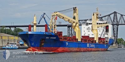
BBC VIRGINIA
General Cargo
Current Trip
| Trip Time | 4 days |
|---|---|
| Trip Distance | 103.46 nm |
| AVG Speed | 9.9 Knop |
| MAX Speed | 12 Knop |
| Djupgående | 6.6 m |
| AVG Wind | 6.8 knots |
| MAX Wind | 13 knots |
| MIN Temp | 15.5°C / 59.9°F |
| MAX Temp | 18.2°C / 64.76°F |
| Position mottagen | 14 d sen |
Current Position
| Longitud | -71.69257° |
|---|---|
| Latitude | -32.49308° |
| Status | Under way using engine |
| Fart | 13.3 Knop |
| Kurs | 353.7° |
| Område | South Pacific Ocean |
| Station | T-AIS |
| Position mottagen | 14 d sen |
Info
Information
The current position of BBC VIRGINIA is in South Pacific Ocean with coordinates -32.49308° / -71.69257° as reported on 2024-04-16 21:04 by AIS to our vessel tracker app. The vessel's current speed is 13.3 Knop and is currently inside the port of ANTOFAGASTA.
The vessel BBC VIRGINIA (IMO: 9501277, MMSI: 305463000) is a General Cargo that was built in 2010 ( 14 År gammal ). It's sailing under the flag of [AG] Antigua Barbuda.
In this page you can find informations about the vessels current position, last detected port calls, and current voyage information. If the vessels is not in coverage by AIS you will find the latest position.
The current position of BBC VIRGINIA is detected by our AIS receivers and we are not responsible for the reliability of the data. The last position was recorded while the vessel was in Coverage by the Ais receivers of our vessel tracking app.
The current draught of BBC VIRGINIA as reported by AIS is 6.6 meters
Weather
| Temperature | 16.9°C / 62.42°F |
|---|---|
| Wind Speed | 12 knots |
| Direction | 214° SW |
| Pressure | 1011.8 hPa |
| Humidity | 83.4 % |
| Cloud Coverage | 4 % |
Featured Company
Last Port Calls
| Port | Arrival | Departure | Time In Port |
|---|---|---|---|
| 2024-04-30 18:22 | |||
| 2024-04-25 01:46 | 2024-04-26 10:15 | 1 d | |
| 2024-04-18 23:35 | 2024-04-24 01:39 | 5 d | |
| 2024-04-15 20:25 | 2024-04-16 18:32 | 22 h | |
| 2024-04-11 19:26 | 2024-04-12 18:29 | 23 h | |
| 2024-04-10 18:32 | 2024-04-11 04:17 | 9 h | |
| 2024-04-06 17:33 | 2024-04-07 01:40 | 8 h | |
| 2024-03-25 04:43 | 2024-03-26 20:07 | 1 d | |
| 2024-03-17 23:02 | 2024-03-23 10:05 | 5 d | |
| 2024-03-08 09:02 | 2024-03-09 02:41 | 17 h |
Last Trips
| Origin | Departure | Destination | Arrival | Distance | |
|---|---|---|---|---|---|
| 2024-04-26 06:15 | 2024-04-30 14:22 | 103.46 nm | |||
| 2024-04-23 21:39 | 2024-04-24 21:46 | 5.16 nm | |||
| 2024-04-16 14:32 | 2024-04-18 19:35 | 637.53 nm | |||
| 2024-04-12 13:29 | 2024-04-15 16:25 | 930.66 nm | |||
| 2024-04-10 23:17 | 2024-04-11 14:26 | 65.47 nm | |||
| 2024-04-06 20:40 | 2024-04-10 13:32 | 488.56 nm | |||
| 2024-03-26 15:07 | 2024-04-06 12:33 | 2817.60 nm | |||
| 2024-03-23 05:05 | 2024-03-24 23:43 | 563.67 nm | |||
| 2024-03-08 21:41 | 2024-03-17 18:02 | 1367.43 nm | |||
| 2024-03-08 03:39 | 2024-03-08 04:02 | 0.83 nm |
Events
| Tid | Event | Detaljer | Position / Dest | Information |
|---|---|---|---|---|
| 2024-04-30 18:39 | STOPPAR förflyttning |
-23.65337 / -70.40569
[CL] ANTOFAGASTA
|
Fart: 0.3 kn Kurs: 294° |
|
| 2024-04-30 18:22 | ANLÄNDER HAMN |
|
-23.65010 / -70.40606
[CL] ANTOFAGASTA
|
Fart: 3 kn Kurs: -1° |
| 2024-04-30 18:04 | STARTAR förflyttning | 0.71 nm, North West of ANTOFAGASTA |
-23.63918 / -70.41250
CLMJS
|
Fart: 3.5 kn Kurs: 118° |
| 2024-04-26 17:12 | STOPPAR förflyttning | 0.55 nm, South West of ANTOFAGASTA |
-23.65667 / -70.41333
CLMJS
|
Fart: Kurs: -1° |
| 2024-04-26 10:15 | AVGÅTT HAMN |
|
-23.04833 / -70.41833
CLMJS
|
Fart: 9.6 kn Kurs: 312° |
| 2024-04-26 10:03 | STARTAR förflyttning |
-23.06333 / -70.39333
[CL] MEJILLONES
|
Fart: 5 kn Kurs: -1° |
|
| 2024-04-25 02:11 | STOPPAR förflyttning |
-23.06831 / -70.38670
[CL] MEJILLONES
|
Fart: 0.1 kn Kurs: 184° |
|
| 2024-04-25 01:46 | ANLÄNDER HAMN |
|
-23.06080 / -70.39146
[CL] MEJILLONES
|
Fart: 4.1 kn Kurs: 190° |
| 2024-04-25 01:36 | STARTAR förflyttning | 2.03 nm, North East of MEJILLONES |
-23.04772 / -70.38986
CLMJS
|
Fart: 4.1 kn Kurs: 190° |
| 2024-04-24 01:56 | STOPPAR förflyttning | 2.24 nm, North East of MEJILLONES |
-23.04312 / -70.38993
CLMJS
|
Fart: 0.2 kn Kurs: 175° |