
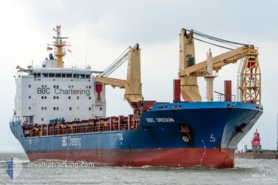
BBC OREGON
General Cargo
Current Trip
| Time Travelled | 3 days |
|---|---|
| Remaining Time | --- |
| Distance Travelled | 772.78 nm |
| Remaining Distance | --- |
| AVG Speed | 13.4 Knop |
| MAX Speed | 16.6 Knop |
| AVG Wind | 11.2 knots |
| MAX Wind | 22.9 knots |
| MIN Temp | 15.5°C / 59.9°F |
| MAX Temp | 21.1°C / 69.98°F |
| Djupgående | 6.6 m |
| Position mottagen | 3 d sen |
Current Position
| Longitud | 134.90125° |
|---|---|
| Latitude | 33.88002° |
| Status | Under way using engine |
| Fart | 13.7 Knop |
| Kurs | 189.9° |
| Område | Philippine Sea |
| Station | T-AIS |
| Position mottagen | 3 d sen |
Info
Information
The current position of BBC OREGON is in Philippine Sea with coordinates 33.88002° / 134.90125° as reported on 2024-04-26 07:18 by AIS to our vessel tracker app. The vessel's current speed is 13.7 Knop
The vessel BBC OREGON (IMO: 9501265, MMSI: 305462000) is a General Cargo that was built in 2010 ( 14 År gammal ). It's sailing under the flag of [AG] Antigua Barbuda.
In this page you can find informations about the vessels current position, last detected port calls, and current voyage information. If the vessels is not in coverage by AIS you will find the latest position.
The current position of BBC OREGON is detected by our AIS receivers and we are not responsible for the reliability of the data. The last position was recorded while the vessel was in Coverage by the Ais receivers of our vessel tracking app.
The current draught of BBC OREGON as reported by AIS is 6.6 meters
Weather
| Temperature | 15.6°C / 60.08°F |
|---|---|
| Wind Speed | 11 knots |
| Direction | 27° NNE |
| Pressure | 1009.8 hPa |
| Humidity | 86.8 % |
| Cloud Coverage | 100 % |
Featured Company
Most Visited Ports (Last year)
| Port | Arrivals | |
|---|---|---|
| 3 | ||
| 2 | ||
| 2 | ||
| 1 | ||
| 1 | ||
| 1 |
Events
| Tid | Event | Detaljer | Position / Dest | Information |
|---|---|---|---|---|
| 2024-04-28 13:13 | STOPPAR förflyttning | 19.94 nm, North East of SHENGSI |
30.99768 / 122.66786
CN SHG
|
Fart: Kurs: 54° |
| 2024-04-28 12:47 | STARTAR förflyttning | 20.44 nm, North East of SHENGSI |
30.99035 / 122.69229
CN SHG
|
Fart: 5 kn Kurs: 290° |
| 2024-04-28 12:18 | STOPPAR förflyttning | 20.63 nm, North East of SHENGSI |
30.98477 / 122.70448
CN SHG
|
Fart: Kurs: 9° |
| 2024-04-26 07:22 | Status ändrad | Default Under way using engine |
33.86689 / 134.89854
CN SHG
|
Fart: 13.7 kn Kurs: 189.9° |
| 2024-04-26 07:18 | Status ändrad | Under way using engine Default |
33.88002 / 134.90125
CN SHG
|
Fart: 13.7 kn Kurs: 190° |
| 2024-04-26 07:18 | UTANFÖR täckningsområde |
33.88002 / 134.90125
Philippine Sea
CN SHG
|
Fart: 13.7 kn Kurs: 189.9° |
|
| 2024-04-26 07:16 | I täckningsområde |
33.88002 / 134.90125
Philippine Sea
CN SHG
|
Fart: 13.7 kn Kurs: 189.9° |
|
| 2024-04-26 06:16 | Status ändrad | Default Under way using engine |
34.11636 / 134.95030
CN SHG
|
Fart: 14.2 kn Kurs: 190.6° |
| 2024-04-26 06:11 | Status ändrad | Under way using engine Default |
34.13619 / 134.95474
CN SHG
|
Fart: 14.2 kn Kurs: 191° |
| 2024-04-26 06:11 | UTANFÖR täckningsområde |
34.13619 / 134.95474
Philippine Sea
CN SHG
|
Fart: 14.2 kn Kurs: 190.6° |