
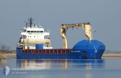
BBC MARMARA
General Cargo
Current Trip
ID AMA
| Time Travelled | 9 days |
|---|---|
| Remaining Time | --- |
| Distance Travelled | 1876.53 nm |
| Remaining Distance | --- |
| AVG Speed | 10.7 Knop |
| MAX Speed | 14.9 Knop |
| AVG Wind | 18.7 knots |
| MAX Wind | 25.9 knots |
| MIN Temp | 21.5°C / 70.7°F |
| MAX Temp | 28.6°C / 83.48°F |
| Djupgående | 5 m |
| Position mottagen | 5 d sen |
Current Position
| Longitud | 145.73818° |
|---|---|
| Latitude | -16.66699° |
| Status | Under way using engine |
| Fart | 11.5 Knop |
| Kurs | 335.8° |
| Område | Coral Sea |
| Station | T-AIS |
| Position mottagen | 5 d sen |
Info
Information
The current position of BBC MARMARA is in Coral Sea with coordinates -16.66699° / 145.73818° as reported on 2024-05-10 12:49 by AIS to our vessel tracker app. The vessel's current speed is 11.5 Knop
The vessel BBC MARMARA (IMO: 9454228, MMSI: 255806141) is a General Cargo that was built in 2010 ( 14 År gammal ). It's sailing under the flag of [PT] Portugal.
In this page you can find informations about the vessels current position, last detected port calls, and current voyage information. If the vessels is not in coverage by AIS you will find the latest position.
The current position of BBC MARMARA is detected by our AIS receivers and we are not responsible for the reliability of the data. The last position was recorded while the vessel was in Coverage by the Ais receivers of our vessel tracking app.
The current draught of BBC MARMARA as reported by AIS is 5 meters
Weather
| Temperature | 27.9°C / 82.22°F |
|---|---|
| Wind Speed | 7 knots |
| Direction | 110° ESE |
| Pressure | 1009.8 hPa |
| Humidity | 77.4 % |
| Cloud Coverage | 99 % |
Featured Company
Last Port Calls
| Port | Arrival | Departure | Time In Port |
|---|---|---|---|
| 2024-05-06 04:17 | 2024-05-07 07:12 | 1 d | |
| 2024-05-02 16:47 | 2024-05-04 04:19 | 1 d | |
| 2024-04-11 07:20 | 2024-04-12 11:17 | 1 d | |
| 2024-04-06 23:50 | 2024-04-07 20:44 | 20 h | |
| 2024-03-17 16:51 | 2024-03-18 23:24 | 1 d | |
| 2024-03-14 00:35 | 2024-03-14 21:21 | 20 h |
Last Trips
| Origin | Departure | Destination | Arrival | Distance | |
|---|---|---|---|---|---|
| 2024-05-04 14:19 | 2024-05-06 14:17 | 465.90 nm | |||
| 2024-04-12 21:17 | 2024-05-03 02:47 | 4128.44 nm | |||
| 2024-04-08 06:44 | 2024-04-11 17:20 | 473.35 nm | |||
| 2024-03-19 09:24 | 2024-04-07 09:50 | 4109.58 nm | |||
| 2024-03-15 08:21 | 2024-03-18 02:51 | 461.79 nm | |||
| 2024-02-22 01:09 | 2024-03-14 11:35 | 4056.01 nm |
Events
| Tid | Event | Detaljer | Position / Dest | Information |
|---|---|---|---|---|
| 2024-05-16 09:52 | STARTAR förflyttning |
-4.98833 / 136.66167
ID AMA
|
Fart: 9 kn Kurs: 44° |
|
| 2024-05-14 09:16 | STOPPAR förflyttning |
-4.99667 / 136.65500
ID AMA
|
Fart: Kurs: -1° |
|
| 2024-05-10 12:55 | Status ändrad | Default Under way using engine |
-16.64860 / 145.72902
ID AMA
|
Fart: 11.5 kn Kurs: 335.8° |
| 2024-05-10 12:49 | UTANFÖR täckningsområde |
-16.66699 / 145.73818
Coral Sea
ID AMA
|
Fart: 11.5 kn Kurs: 335.8° |
|
| 2024-05-10 12:18 | Status ändrad | Under way using engine Default |
-16.74305 / 145.78094
ID AMA
|
Fart: 9.4 kn Kurs: 293° |
| 2024-05-10 12:15 | Status ändrad | Default Under way using engine |
-16.74501 / 145.78601
ID AMA
|
Fart: 9.4 kn Kurs: 291.6° |
| 2024-05-10 12:10 | Status ändrad | Under way using engine Default |
-16.75060 / 145.80041
ID AMA
|
Fart: 9.5 kn Kurs: 293° |
| 2024-05-10 12:08 | Status ändrad | Default Under way using engine |
-16.75285 / 145.80627
ID AMA
|
Fart: 9.5 kn Kurs: 291.4° |
| 2024-05-10 12:02 | Status ändrad | Under way using engine Default |
-16.75850 / 145.82088
ID AMA
|
Fart: 9.6 kn Kurs: 292° |
| 2024-05-10 12:00 | Status ändrad | Default Under way using engine |
-16.76082 / 145.82686
ID AMA
|
Fart: 9.5 kn Kurs: 291.4° |