
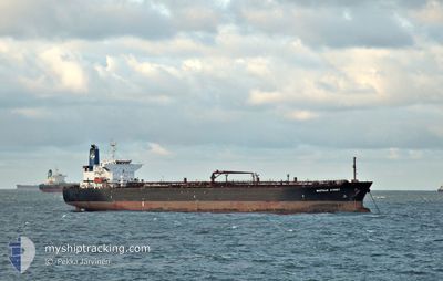
BASTILLE STREET
Tanker
Current Trip
| Time Travelled | 5 days |
|---|---|
| Remaining Time | --- |
| Distance Travelled | 618.21 nm |
| Remaining Distance | --- |
| AVG Speed | 8.3 Knop |
| MAX Speed | 14.7 Knop |
| AVG Wind | 6.8 knots |
| MAX Wind | 16.8 knots |
| MIN Temp | 25.1°C / 77.18°F |
| MAX Temp | 30.1°C / 86.18°F |
| Djupgående | 11 m |
| Position mottagen | 7 h, 13 m sen |
Current Position
| Longitud | -75.68060° |
|---|---|
| Latitude | 11.03991° |
| Status | Under way using engine |
| Fart | 8.5 Knop |
| Kurs | 35.9° |
| Område | Caribbean Sea |
| Station | T-AIS |
| Position mottagen | 7 h, 13 m sen |
Info
Information
The current position of BASTILLE STREET is in Caribbean Sea with coordinates 11.03991° / -75.68060° as reported on 2024-07-01 16:10 by AIS to our vessel tracker app. The vessel's current speed is 8.5 Knop and is heading at the port of YABUCOA. The estimated time of arrival as calculated by MyShipTracking vessel tracking app is 2024-07-04 17:00 LT
The vessel BASTILLE STREET (IMO: 957370100, MMSI: 636015161) is a Tanker It's sailing under the flag of [LR] Liberia.
In this page you can find informations about the vessels current position, last detected port calls, and current voyage information. If the vessels is not in coverage by AIS you will find the latest position.
The current position of BASTILLE STREET is detected by our AIS receivers and we are not responsible for the reliability of the data. The last position was recorded while the vessel was in Coverage by the Ais receivers of our vessel tracking app.
The current draught of BASTILLE STREET as reported by AIS is 11 meters
Weather
| Temperature | 29.3°C / 84.74°F |
|---|---|
| Wind Speed | 17 knots |
| Direction | 55° NE |
| Pressure | 1007.2 hPa |
| Humidity | 79.3 % |
| Cloud Coverage | 83 % |
Featured Company
Last Port Calls
| Port | Arrival | Departure | Time In Port |
|---|---|---|---|
| 2024-06-24 16:07 | 2024-06-26 04:28 | 1 d | |
| 2024-06-13 11:59 | 2024-06-16 20:23 | 3 d | |
| 2024-06-07 17:39 | 2024-06-09 00:49 | 1 d | |
| 2024-06-02 09:43 | 2024-06-05 01:51 | 2 d | |
| 2024-05-22 15:00 | |||
| 2024-05-12 15:07 | 2024-05-15 14:22 | 2 d | |
| 2024-05-01 17:17 | 2024-05-04 02:20 | 2 d |
Most Visited Ports (Last year)
| Port | Arrivals | |
|---|---|---|
| 15 | ||
| 13 | ||
| 8 | ||
| 4 | ||
| 1 | ||
| 1 |
Last Trips
| Origin | Departure | Destination | Arrival | Distance | |
|---|---|---|---|---|---|
| 2024-06-16 15:23 | 2024-06-24 10:07 | 1743.71 nm | |||
| 2024-06-08 19:49 | 2024-06-13 06:59 | 983.81 nm | |||
| 2024-06-04 20:51 | 2024-06-07 12:39 | 670.70 nm | |||
| 2024-05-15 09:22 | 2024-06-02 04:43 | 3352.58 nm | |||
| 2024-05-15 09:22 | 2024-05-22 09:00 | 1686.00 nm | |||
| 2024-05-03 20:20 | 2024-05-12 10:07 | 1686.93 nm | |||
| 2024-04-25 01:11 | 2024-05-01 11:17 | 1696.92 nm |
Events
| Tid | Event | Detaljer | Position / Dest | Information |
|---|---|---|---|---|
| 2024-07-01 21:42 | STOPPAR förflyttning |
11.44916 / -75.32339
PRPYA
|
Fart: 0.2 kn Kurs: 91° |
|
| 2024-07-01 16:27 | Status ändrad | Default Under way using engine |
11.07075 / -75.65620
PRPYA
|
Fart: 8.5 kn Kurs: 35.9° |
| 2024-07-01 16:10 | UTANFÖR täckningsområde |
11.03991 / -75.68060
Caribbean Sea
PRPYA
|
Fart: 8.5 kn Kurs: 35.9° |
|
| 2024-07-01 11:42 | ETA ändrat | 2024/07/04 17:00 2024/07/04 15:00 |
10.36089 / -75.71263
PRPYA
|
Fart: 11.1 kn Kurs: 321.4° |
| 2024-07-01 10:31 | STARTAR förflyttning | 4.52 nm, South of CARTAGENA |
10.31411 / -75.54779
PRPYA
|
Fart: 3.1 kn Kurs: 337° |
| 2024-07-01 09:53 | Destination ändrad | PRPYA COMAM |
10.30329 / -75.55286
PRPYA
|
Fart: 1.2 kn Kurs: 117° |
| 2024-07-01 09:53 | ETA ändrat | 2024/07/04 15:00 2025/06/30 01:00 |
10.30329 / -75.55286
PRPYA
|
Fart: 1.2 kn Kurs: 117° |
| 2024-07-01 09:53 | Status ändrad | Under way using engine At anchor |
10.30329 / -75.55286
COMAM
|
Fart: 0.7 kn Kurs: 136° |
| 2024-07-01 08:06 | Djupgående ändrat | 11 8.4 |
10.30474 / -75.55401
COMAM
|
Fart: 0.1 kn Kurs: 134° |
| 2024-07-01 07:50 | Status ändrad | At anchor Under way using engine |
10.30433 / -75.55353
COMAM
|
Fart: 0.3 kn Kurs: 139° |