
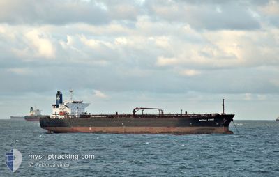
BASTILLE STREET
Tanker
Current Trip
| Time Travelled | 25 days |
|---|---|
| Remaining Time | --- |
| Distance Travelled | 5449.32 nm |
| Remaining Distance | --- |
| AVG Speed | 11.6 Knopen |
| MAX Speed | 14.4 Knopen |
| AVG Wind | 9.4 knots |
| MAX Wind | 18 knots |
| MIN Temp | 7.6°C / 45.68°F |
| MAX Temp | 29.7°C / 85.46°F |
| Diepgang | 7.1 M |
| Positie ontvangen | 15 m geleden |
Current Position
| Lengtegraad | --- |
|---|---|
| Breedtegraat | --- |
| Status | At anchor |
| Snelheid | |
| Koers | 14° |
| Gebied | North Pacific Ocean |
| Station | T-AIS |
| Positie ontvangen | 15 m geleden |
Info
Information
The current position of BASTILLE STREET is in North Pacific Ocean with coordinates 8.84655° / -79.49899° as reported on 2026-01-06 01:42 by AIS to our vessel tracker app. The vessel's current speed is 0 Knopen
The vessel BASTILLE STREET (IMO: 957370100, MMSI: 636015161) is a Tanker It's sailing under the flag of [LR] Liberia.
In this page you can find informations about the vessels current position, last detected port calls, and current voyage information. If the vessels is not in coverage by AIS you will find the latest position.
The current position of BASTILLE STREET is detected by our AIS receivers and we are not responsible for the reliability of the data. The last position was recorded while the vessel was in Coverage by the Ais receivers of our vessel tracking app.
The current draught of BASTILLE STREET as reported by AIS is 7.1 meters
Weather
| Temperature | 26.4°C / 79.52°F |
|---|---|
| Wind Speed | 12 knots |
| Direction | 340° NNW |
| Pressure | 1011.9 hPa |
| Humidity | 75.9 % |
| Cloud Coverage | 8 % |
Featured Company
Last Port Calls
| Port | Arrival | Departure | Time In Port |
|---|---|---|---|
| 2025-12-08 23:47 | 2025-12-10 22:15 | 1 d | |
| 2025-12-07 22:27 | 2025-12-08 13:55 | 15 h | |
| 2025-11-21 22:29 | 2025-11-21 23:03 | 34 m | |
| 2025-11-12 10:03 | 2025-11-14 02:51 | 1 d | |
| 2025-11-08 23:22 | 2025-11-10 11:46 | 1 d |
Most Visited Ports (Last year)
| Port | Arrivals | |
|---|---|---|
| 7 | ||
| 5 | ||
| 5 | ||
| 2 | ||
| 2 | ||
| 1 |
Last Trips
| Origin | Departure | Destination | Arrival | Distance | |
|---|---|---|---|---|---|
| 2025-12-08 13:55 | 2025-12-08 23:47 | 95.81 nm | |||
| 2025-11-21 23:03 | 2025-12-07 22:27 | 1497.39 nm | |||
| 2025-11-14 02:51 | 2025-11-21 22:29 | 1975.16 nm | |||
| 2025-11-10 11:46 | 2025-11-12 10:03 | 560.13 nm | |||
| 2025-10-30 12:32 | 2025-11-08 23:22 | 2391.83 nm |
Events
| Tijd | Evenement | Details | Positie / Bestemming | Info |
|---|---|---|---|---|
| 2026-01-06 01:51 | Status Changed | Default At anchor |
8.84653 / -79.49899
PABLB
|
Snelheid: Koers: 14° |
| 2026-01-06 01:42 | Status Changed | At anchor Default |
8.84655 / -79.49899
PABLB
|
Snelheid: Koers: 15° |
| 2026-01-06 01:09 | Status Changed | Default At anchor |
8.84657 / -79.49908
PABLB
|
Snelheid: Koers: 22° |
| 2026-01-06 01:06 | Status Changed | At anchor Default |
8.84657 / -79.49913
PABLB
|
Snelheid: Koers: 22° |
| 2026-01-06 00:42 | Status Changed | Default At anchor |
8.84657 / -79.49903
PABLB
|
Snelheid: Koers: 23° |
| 2026-01-06 00:36 | Status Changed | At anchor Default |
8.84656 / -79.49908
PABLB
|
Snelheid: Koers: 23° |
| 2026-01-06 00:30 | Status Changed | Default At anchor |
8.84655 / -79.49905
PABLB
|
Snelheid: Koers: 19° |
| 2026-01-06 00:24 | Status Changed | At anchor Default |
8.84655 / -79.49901
PABLB
|
Snelheid: 0.1 kn Koers: 24° |
| 2026-01-06 00:21 | Status Changed | Default At anchor |
8.84661 / -79.49908
PABLB
|
Snelheid: Koers: 24° |
| 2026-01-05 23:59 | Status Changed | At anchor Default |
8.84651 / -79.49895
PABLB
|
Snelheid: 0.1 kn Koers: 11° |