
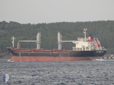
ASH BALTIC
Cargo
Current Trip
| Trip Time | 12 days |
|---|---|
| Trip Distance | 926.48 nm |
| AVG Speed | 9.5 Knop |
| MAX Speed | 9.5 Knop |
| Djupgående | 4.6 m |
| AVG Wind | 19.1 knots |
| MAX Wind | 44.3 knots |
| MIN Temp | -13.6°C / 7.52°F |
| MAX Temp | 7.6°C / 45.68°F |
| Position mottagen | 4 d sen |
Current Position
| Longitud | --- |
|---|---|
| Latitude | --- |
| Status | At anchor |
| Fart | 0.1 Knop |
| Kurs | 168° |
| Område | Gulf of Finland |
| Station | T-AIS |
| Position mottagen | 4 d sen |
Info
Information
The current position of ASH BALTIC is in Gulf of Finland with coordinates 60.01116° / 29.32817° as reported on 2026-01-01 16:02 by AIS to our vessel tracker app. The vessel's current speed is 0.1 Knop and is currently inside the port of ST PETERSBURG.
The vessel ASH BALTIC (IMO: 9606493, MMSI: 538009981) is a Cargo It's sailing under the flag of [MH] Marshall Is.
In this page you can find informations about the vessels current position, last detected port calls, and current voyage information. If the vessels is not in coverage by AIS you will find the latest position.
The current position of ASH BALTIC is detected by our AIS receivers and we are not responsible for the reliability of the data. The last position was recorded while the vessel was in Coverage by the Ais receivers of our vessel tracking app.
The current draught of ASH BALTIC as reported by AIS is 4.6 meters
Weather
| Temperature | -11.3°C / 11.66°F |
|---|---|
| Wind Speed | 4 knots |
| Direction | 132° SE |
| Pressure | 1024.4 hPa |
| Humidity | 71.3 % |
| Cloud Coverage | 100 % |
Featured Company
Last Trips
| Origin | Departure | Destination | Arrival | Distance | |
|---|---|---|---|---|---|
| 2025-12-24 09:49 | 2026-01-06 05:29 | 926.48 nm | |||
| 2025-12-01 03:41 | 2025-12-19 16:01 | 4224.57 nm | |||
| 2025-11-23 07:28 | 2025-11-29 18:46 | 1121.80 nm | |||
| 2025-11-13 04:16 | 2025-11-17 15:59 | 1114.31 nm | |||
| 2025-10-30 10:08 | 2025-11-11 01:48 | 1203.06 nm |
Events
| Tid | Event | Detaljer | Position / Dest | Information |
|---|---|---|---|---|
| 2026-01-06 07:53 | STOPPAR förflyttning |
59.91243 / 30.23266
[RU] ST PETERSBURG
|
Fart: 0.3 kn Kurs: 207° |
|
| 2026-01-06 02:29 | ANLÄNDER HAMN |
|
59.90906 / 30.22968
[RU] ST PETERSBURG
|
Fart: 5.2 kn Kurs: 346° |
| 2026-01-01 16:05 | Status ändrad | Default At anchor |
60.01122 / 29.32833
RU LED
|
Fart: 0.1 kn Kurs: 168° |
| 2026-01-01 16:02 | Status ändrad | At anchor Default |
60.01116 / 29.32817
RU LED
|
Fart: 0.1 kn Kurs: 178° |
| 2026-01-01 16:02 | UTANFÖR täckningsområde |
60.01116 / 29.32817
Gulf of Finland
|
Fart: 0.1 kn Kurs: 35.5° |
|
| 2026-01-01 15:52 | I täckningsområde |
60.01116 / 29.32817
Gulf of Finland
|
Fart: 0.1 kn Kurs: 35.5° |
|
| 2026-01-01 11:37 | STOPPAR förflyttning | 11.75 nm, West of BRONKA |
60.00991 / 29.32794
RU LED
|
Fart: Kurs: 126° |
| 2025-12-31 07:50 | STOPPAR förflyttning | 11.68 nm, West of BRONKA |
60.00797 / 29.32889
RU LED
|
Fart: 0.1 kn Kurs: 15° |
| 2025-12-30 17:42 | STARTAR förflyttning | 8.33 nm, North West of BRONKA |
60.03423 / 29.49185
RU LED
|
Fart: 42.5 kn Kurs: 110° |
| 2025-12-30 09:51 | STOPPAR förflyttning | 11.76 nm, West of BRONKA |
60.00859 / 29.32651
RU LED
|
Fart: 0.2 kn Kurs: 57° |