
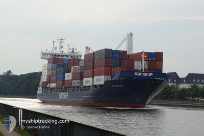
ARNARFELL
Container Ship
Current Trip
| Trip Time | 1 day |
|---|---|
| Trip Distance | 659.37 nm |
| AVG Speed | 14.7 Knop |
| MAX Speed | 17.2 Knop |
| Djupgående | 8.1 m |
| AVG Wind | 20.4 knots |
| MAX Wind | 49 knots |
| MIN Temp | 1.7°C / 35.06°F |
| MAX Temp | 7.1°C / 44.78°F |
| Position mottagen | 21 h, 49 m sen |
Current Position
| Longitud | --- |
|---|---|
| Latitude | --- |
| Status | Under way using engine |
| Fart | 16.8 Knop |
| Kurs | 309.2° |
| Område | North Sea |
| Station | T-AIS |
| Position mottagen | 21 h, 49 m sen |
Info
Information
The current position of ARNARFELL is in North Sea with coordinates 60.04063° / 1.43744° as reported on 2024-11-23 20:21 by AIS to our vessel tracker app. The vessel's current speed is 16.8 Knop and is currently inside the port of RUNAVIK.
The vessel ARNARFELL (IMO: 9306005, MMSI: 231355000) is a Container Ship that was built in 2005 ( 19 År gammal ). It's sailing under the flag of [FO] Faroe Is.
In this page you can find informations about the vessels current position, last detected port calls, and current voyage information. If the vessels is not in coverage by AIS you will find the latest position.
The current position of ARNARFELL is detected by our AIS receivers and we are not responsible for the reliability of the data. The last position was recorded while the vessel was in Coverage by the Ais receivers of our vessel tracking app.
The current draught of ARNARFELL as reported by AIS is 8.1 meters
Weather
| Temperature | 3.6°C / 38.48°F |
|---|---|
| Wind Speed | 34 knots |
| Direction | 28° NNE |
| Pressure | 969.5 hPa |
| Humidity | 95.5 % |
| Cloud Coverage | 100 % |
Featured Company
Last Port Calls
| Port | Arrival | Departure | Time In Port |
|---|---|---|---|
| 2024-11-24 15:05 | |||
| 2024-11-22 08:20 | 2024-11-22 19:38 | 11 h | |
| 2024-11-21 10:54 | 2024-11-21 22:17 | 11 h | |
| 2024-11-19 23:23 | 2024-11-20 13:21 | 13 h | |
| 2024-11-18 13:20 | 2024-11-19 02:39 | 13 h | |
| 2024-11-15 10:25 | 2024-11-16 10:32 | 1 d | |
| 2024-11-14 04:14 | 2024-11-14 06:51 | 2 h | |
| 2024-11-13 10:06 | 2024-11-13 19:36 | 9 h | |
| 2024-11-12 22:09 | 2024-11-13 08:31 | 10 h | |
| 2024-11-12 06:17 | 2024-11-12 19:16 | 12 h |
Last Trips
| Origin | Departure | Destination | Arrival | Distance | |
|---|---|---|---|---|---|
| 2024-11-22 20:38 | 2024-11-24 15:05 | 659.37 nm | |||
| 2024-11-21 23:17 | 2024-11-22 09:20 | 141.25 nm | |||
| 2024-11-20 14:21 | 2024-11-21 11:54 | 203.73 nm | |||
| 2024-11-19 03:39 | 2024-11-20 00:23 | 261.71 nm | |||
| 2024-11-16 10:32 | 2024-11-18 14:20 | 769.38 nm | |||
| 2024-11-14 06:51 | 2024-11-15 10:25 | 401.25 nm | |||
| 2024-11-13 19:36 | 2024-11-14 04:14 | 118.39 nm | |||
| 2024-11-13 08:31 | 2024-11-13 10:06 | 15.27 nm | |||
| 2024-11-12 19:16 | 2024-11-12 22:09 | 11.65 nm | |||
| 2024-11-10 10:29 | 2024-11-12 06:17 | 541.97 nm |
Events
| Tid | Event | Detaljer | Position / Dest | Information |
|---|---|---|---|---|
| 2024-11-24 15:13 | STOPPAR förflyttning |
62.11619 / -6.72538
[FO] RUNAVIK
|
Fart: 0.1 kn Kurs: 358° |
|
| 2024-11-24 15:05 | ANLÄNDER HAMN |
|
62.11535 / -6.72595
[FO] RUNAVIK
|
Fart: 3.8 kn Kurs: 69° |
| 2024-11-23 20:32 | Status ändrad | Default Under way using engine |
60.07270 / 1.37023
RUNAVIK
|
Fart: 16.8 kn Kurs: 309.2° |
| 2024-11-23 20:21 | Upptäckt i hav | United Kingdom part of the North Sea |
60.04063 / 1.43744
North Sea
RUNAVIK
|
Fart: 16.8 kn Kurs: 309.2° |
| 2024-11-23 20:21 | Status ändrad | Under way using engine Default |
60.04063 / 1.43744
RUNAVIK
|
Fart: 16.7 kn Kurs: 308° |
| 2024-11-23 20:21 | I täckningsområde |
60.04063 / 1.43744
North Sea
RUNAVIK
|
Fart: 16.8 kn Kurs: 309.2° |
|
| 2024-11-23 20:21 | UTANFÖR täckningsområde |
60.04063 / 1.43744
North Sea
RUNAVIK
|
Fart: 16.8 kn Kurs: 309.2° |
|
| 2024-11-23 18:07 | Status ändrad | Default Under way using engine |
59.63740 / 2.34186
RUNAVIK
|
Fart: 16.7 kn Kurs: 312.6° |
| 2024-11-23 18:01 | Status ändrad | Under way using engine Default |
59.62034 / 2.38488
RUNAVIK
|
Fart: 16.1 kn Kurs: 310° |
| 2024-11-23 18:01 | UTANFÖR täckningsområde |
59.62034 / 2.38488
North Sea
RUNAVIK
|
Fart: 16.7 kn Kurs: 312.6° |