
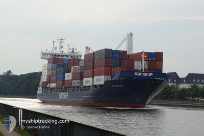
ARNARFELL
Container Ship
Current Trip
| Trip Time | 21 h, 33 mins |
|---|---|
| Trip Distance | 203.73 nm |
| AVG Speed | 9.7 Noeuds |
| MAX Speed | 9.7 Noeuds |
| Tirant d eau | 6.9 m |
| AVG Wind | 6.4 knots |
| MAX Wind | 16.8 knots |
| MIN Temp | -1.8°C / 28.76°F |
| MAX Temp | 4.8°C / 40.64°F |
| Position reçue | 1 m depuis |
Current Position
| Longitude | --- |
|---|---|
| Latitude | --- |
| Etat | Under way using engine |
| Vitesse | |
| Parcours | 42° |
| Zone | Kattegat |
| Station | T-AIS |
| Position reçue | 1 m depuis |
Info
Information
The current position of ARNARFELL is in Kattegat with coordinates 56.14957° / 10.23319° as reported on 2024-11-21 17:31 by AIS to our vessel tracker app. The vessel's current speed is 0 Noeuds and is currently inside the port of AARHUS.
The vessel ARNARFELL (IMO: 9306005, MMSI: 231355000) is a Container Ship that was built in 2005 ( 19 Age ). It's sailing under the flag of [FO] Faroe Is.
In this page you can find informations about the vessels current position, last detected port calls, and current voyage information. If the vessels is not in coverage by AIS you will find the latest position.
The current position of ARNARFELL is detected by our AIS receivers and we are not responsible for the reliability of the data. The last position was recorded while the vessel was in Coverage by the Ais receivers of our vessel tracking app.
The current draught of ARNARFELL as reported by AIS is 6.9 meters
Weather
| Temperature | -1.5°C / 29.3°F |
|---|---|
| Wind Speed | 5 knots |
| Direction | 321° NW |
| Pressure | 990 hPa |
| Humidity | 66.4 % |
| Cloud Coverage | 23 % |
Featured Company
Last Port Calls
| Port | Arrival | Departure | Time In Port |
|---|---|---|---|
| 2024-11-21 10:54 | |||
| 2024-11-19 23:23 | 2024-11-20 13:21 | 13 h | |
| 2024-11-18 13:20 | 2024-11-19 02:39 | 13 h | |
| 2024-11-15 10:25 | 2024-11-16 10:32 | 1 d | |
| 2024-11-14 04:14 | 2024-11-14 06:51 | 2 h | |
| 2024-11-13 10:06 | 2024-11-13 19:36 | 9 h | |
| 2024-11-12 22:09 | 2024-11-13 08:31 | 10 h | |
| 2024-11-12 06:17 | 2024-11-12 19:16 | 12 h | |
| 2024-11-10 04:38 | 2024-11-10 10:29 | 5 h | |
| 2024-11-07 15:11 | 2024-11-08 02:37 | 11 h |
Last Trips
| Origin | Departure | Destination | Arrival | Distance | |
|---|---|---|---|---|---|
| 2024-11-20 14:21 | 2024-11-21 11:54 | 203.73 nm | |||
| 2024-11-19 03:39 | 2024-11-20 00:23 | 261.71 nm | |||
| 2024-11-16 10:32 | 2024-11-18 14:20 | 769.38 nm | |||
| 2024-11-14 06:51 | 2024-11-15 10:25 | 401.25 nm | |||
| 2024-11-13 19:36 | 2024-11-14 04:14 | 118.39 nm | |||
| 2024-11-13 08:31 | 2024-11-13 10:06 | 15.27 nm | |||
| 2024-11-12 19:16 | 2024-11-12 22:09 | 11.65 nm | |||
| 2024-11-10 10:29 | 2024-11-12 06:17 | 541.97 nm | |||
| 2024-11-08 03:37 | 2024-11-10 04:38 | 780.42 nm | |||
| 2024-11-07 07:22 | 2024-11-07 16:11 | 140.42 nm |
Events
| Heure | Evenement | Détails | Position/ Destination | Info |
|---|---|---|---|---|
| 2024-11-21 11:13 | Arret |
56.14981 / 10.23315
[DK] AARHUS
|
Vitesse: 0.3 kn Parcours: 37° |
|
| 2024-11-21 10:54 | Port d'arrivée |
|
56.15838 / 10.24889
[DK] AARHUS
|
Vitesse: 4.7 kn Parcours: 294° |
| 2024-11-21 04:34 | Changement de zone | Danish part of the Kattegat Danish part of the Baltic Sea |
54.74863 / 10.88251
Kattegat
AARHUS
|
Vitesse: 15.1 kn Parcours: 354° |
| 2024-11-21 03:32 | Changement de zone | Danish part of the Baltic Sea German part of the Baltic Sea |
54.56282 / 10.59650
Baltic Sea
AARHUS
|
Vitesse: 16.6 kn Parcours: 58.5° |
| 2024-11-21 02:40 | Changement de zone | German part of the Baltic Sea German part of the North Sea |
54.46305 / 10.26930
Baltic Sea
AARHUS
|
Vitesse: 16.5 kn Parcours: 38.8° |
| 2024-11-21 02:01 | Démarrage | 1.31 nm, South West of STICKENHΟRN SPORT |
54.36482 / 10.14702
AARHUS
|
Vitesse: 3.3 kn Parcours: 103° |
| 2024-11-21 01:23 | Arret | 1.38 nm, South West of STICKENHΟRN SPORT |
54.36562 / 10.14208
AARHUS
|
Vitesse: 0.3 kn Parcours: 104° |
| 2024-11-20 19:26 | Démarrage | 2.54 nm, North East of FISCHERHUTTE |
54.17109 / 9.43933
AARHUS
|
Vitesse: 3.1 kn Parcours: 57° |
| 2024-11-20 19:08 | Arret | 2.4 nm, North East of FISCHERHUTTE |
54.16998 / 9.43570
AARHUS
|
Vitesse: 0.3 kn Parcours: 63° |
| 2024-11-20 15:49 | Démarrage | 0.61 nm, South West of BRUNSBUETTEL |
53.89575 / 9.14785
AARHUS
|
Vitesse: 3.1 kn Parcours: 51° |