
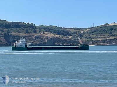
ARKLOW GRACE
Cargo
Current Trip
| Time Travelled | 2 days |
|---|---|
| Remaining Time | 10 h, 37 mins |
| Distance Travelled | 481.35 nm |
| Remaining Distance | 268.39 nm |
| AVG Speed | 10.3 Knop |
| MAX Speed | 12.4 Knop |
| AVG Wind | 11.2 knots |
| MAX Wind | 19.3 knots |
| MIN Temp | -8.7°C / 16.34°F |
| MAX Temp | 5.6°C / 42.08°F |
| Djupgående | 3.9 m |
| Position mottagen | 15 h, 31 m sen |
Current Position
| Longitud | --- |
|---|---|
| Latitude | --- |
| Status | Under way using engine |
| Fart | 10.5 Knop |
| Kurs | 219.7° |
| Område | North Sea |
| Station | T-AIS |
| Position mottagen | 15 h, 31 m sen |
Info
Information
The current position of ARKLOW GRACE is in North Sea with coordinates 60.91229° / 2.49321° as reported on 2024-11-21 07:10 by AIS to our vessel tracker app. The vessel's current speed is 10.5 Knop and is heading at the port of ABERDEEN. The estimated time of arrival as calculated by MyShipTracking vessel tracking app is 2024-11-22 09:19 LT
The vessel ARKLOW GRACE (IMO: 9874117, MMSI: 244635000) is a Cargo It's sailing under the flag of [NL] Netherlands.
In this page you can find informations about the vessels current position, last detected port calls, and current voyage information. If the vessels is not in coverage by AIS you will find the latest position.
The current position of ARKLOW GRACE is detected by our AIS receivers and we are not responsible for the reliability of the data. The last position was recorded while the vessel was in Coverage by the Ais receivers of our vessel tracking app.
The current draught of ARKLOW GRACE as reported by AIS is 3.9 meters
Weather
| Temperature | 5.2°C / 41.36°F |
|---|---|
| Wind Speed | 9 knots |
| Direction | 63° ENE |
| Pressure | 992.4 hPa |
| Humidity | 59 % |
| Cloud Coverage | 100 % |
Featured Company
Last Port Calls
| Port | Arrival | Departure | Time In Port |
|---|---|---|---|
| 2024-11-17 19:12 | 2024-11-19 07:16 | 1 d | |
| 2024-11-02 07:06 | 2024-11-03 08:52 | 1 d | |
| 2024-10-23 21:59 | 2024-10-28 14:09 | 4 d | |
| 2024-10-14 19:45 | 2024-10-16 20:16 | 2 d | |
| 2024-10-13 12:56 | 2024-10-14 18:19 | 1 d | |
| 2024-10-09 05:10 | 2024-10-13 07:23 | 4 d | |
| 2024-09-29 23:48 | 2024-10-03 00:34 | 3 d | |
| 2024-09-27 00:31 | 2024-09-28 20:48 | 1 d | |
| 2024-09-16 08:15 | 2024-09-19 10:43 | 3 d | |
| 2024-09-11 19:47 | 2024-09-14 12:06 | 2 d |
Last Trips
| Origin | Departure | Destination | Arrival | Distance | |
|---|---|---|---|---|---|
| 2024-11-03 09:52 | 2024-11-17 20:12 | 2338.59 nm | |||
| 2024-10-28 15:09 | 2024-11-02 08:06 | 243.81 nm | |||
| 2024-10-16 21:16 | 2024-10-23 23:59 | 1673.07 nm | |||
| 2024-10-13 08:23 | 2024-10-14 20:45 | 64.30 nm | |||
| 2024-10-13 08:23 | 2024-10-13 13:56 | 57.50 nm | |||
| 2024-10-03 01:34 | 2024-10-09 06:10 | 1385.30 nm | |||
| 2024-09-28 22:48 | 2024-09-30 00:48 | 300.03 nm | |||
| 2024-09-19 12:43 | 2024-09-27 02:31 | 1850.56 nm | |||
| 2024-09-14 13:06 | 2024-09-16 10:15 | 457.84 nm | |||
| 2024-09-06 11:35 | 2024-09-11 20:47 | 1267.65 nm |
Events
| Tid | Event | Detaljer | Position / Dest | Information |
|---|---|---|---|---|
| 2024-11-21 07:10 | UTANFÖR täckningsområde |
60.91229 / 2.49321
North Sea
ABERDEEN
|
Fart: 10.5 kn Kurs: 219.7° |
|
| 2024-11-21 06:31 | Upptäckt i hav | Norwegian part of the North Sea |
60.99768 / 2.63741
North Sea
ABERDEEN
|
Fart: 10.4 kn Kurs: 217.3° |
| 2024-11-19 17:23 | Destination ändrad | ABERDEEN FOR ORDERS |
65.94272 / 10.86069
ABERDEEN
|
Fart: 9.1 kn Kurs: 222.5° |
| 2024-11-19 17:23 | ETA ändrat | 2024/11/22 14:00 2024/11/19 20:00 |
65.94272 / 10.86069
ABERDEEN
|
Fart: 9.1 kn Kurs: 222.5° |
| 2024-11-19 07:41 | Djupgående ändrat | 3.9 6.2 |
66.82046 / 13.72316
FOR ORDERS
|
Fart: 12.2 kn Kurs: 285.8° |
| 2024-11-19 07:41 | Destination ändrad | FOR ORDERS NOGLO |
66.82046 / 13.72316
FOR ORDERS
|
Fart: 12.2 kn Kurs: 285.8° |
| 2024-11-19 07:41 | ETA ändrat | 2024/11/19 20:00 2024/11/13 06:00 |
66.82046 / 13.72316
FOR ORDERS
|
Fart: 12.2 kn Kurs: 285.8° |
| 2024-11-19 07:35 | Status ändrad | Under way using engine Moored |
66.81567 / 13.75690
NOGLO
|
Fart: 12.2 kn Kurs: 289.4° |
| 2024-11-19 07:16 | AVGÅTT HAMN |
|
66.80512 / 13.91752
NOGLO
|
Fart: 5.5 kn Kurs: 249° |
| 2024-11-19 07:13 | I täckningsområde |
66.80512 / 13.91752
Norwegian Sea
|
Fart: 10.6 kn Kurs: 257.1° |