
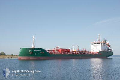
APATYTH
Tanker
Current Trip
| Time Travelled | 2 days |
|---|---|
| Remaining Time | 1 day |
| Distance Travelled | 535.94 nm |
| Remaining Distance | 304.97 nm |
| AVG Speed | 6.2 Knop |
| MAX Speed | 13.3 Knop |
| AVG Wind | 22.6 knots |
| MAX Wind | 29.8 knots |
| MIN Temp | 1.3°C / 34.34°F |
| MAX Temp | 10.4°C / 50.72°F |
| Djupgående | 5.9 m |
| Position mottagen | 1 h, 13 m sen |
Current Position
| Longitud | --- |
|---|---|
| Latitude | --- |
| Status | Under way using engine |
| Fart | 9.9 Knop |
| Kurs | 40.4° |
| Område | North Sea |
| Station | T-AIS |
| Position mottagen | 1 h, 13 m sen |
Info
Information
The current position of APATYTH is in North Sea with coordinates 52.05972° / 3.02501° as reported on 2025-02-16 13:22 by AIS to our vessel tracker app. The vessel's current speed is 9.9 Knop and is heading at the port of HAMBURG. The estimated time of arrival as calculated by MyShipTracking vessel tracking app is 2025-02-17 23:05 LT
The vessel APATYTH (IMO: 9970739, MMSI: 210765000) is a Tanker It's sailing under the flag of [CY] Cyprus.
In this page you can find informations about the vessels current position, last detected port calls, and current voyage information. If the vessels is not in coverage by AIS you will find the latest position.
The current position of APATYTH is detected by our AIS receivers and we are not responsible for the reliability of the data. The last position was recorded while the vessel was in Coverage by the Ais receivers of our vessel tracking app.
The current draught of APATYTH as reported by AIS is 5.9 meters
Weather
| Temperature | 2.6°C / 36.68°F |
|---|---|
| Wind Speed | 16 knots |
| Direction | 94° E |
| Pressure | 1022 hPa |
| Humidity | 61.8 % |
| Cloud Coverage | 12 % |
Featured Company
Last Port Calls
| Port | Arrival | Departure | Time In Port |
|---|---|---|---|
| 2025-02-12 16:30 | 2025-02-13 21:20 | 1 d | |
| 2025-02-12 15:49 | 2025-02-12 16:00 | 10 m | |
| 2025-02-06 14:15 | 2025-02-07 11:22 | 21 h | |
| 2025-02-05 05:17 | 2025-02-05 19:25 | 14 h | |
| 2025-01-30 19:45 | 2025-02-01 17:13 | 1 d | |
| 2025-01-28 22:57 | 2025-01-30 10:55 | 1 d | |
| 2025-01-24 15:06 | 2025-01-27 01:05 | 2 d | |
| 2025-01-16 00:35 | 2025-01-17 14:47 | 1 d | |
| 2025-01-13 18:50 | 2025-01-15 23:07 | 2 d | |
| 2025-01-09 23:48 | 2025-01-11 04:59 | 1 d |
Last Trips
| Origin | Departure | Destination | Arrival | Distance | |
|---|---|---|---|---|---|
| 2025-02-12 16:00 | 2025-02-12 16:30 | 3.28 nm | |||
| 2025-02-07 12:22 | 2025-02-12 15:49 | 1432.38 nm | |||
| 2025-02-05 21:25 | 2025-02-06 15:15 | 135.83 nm | |||
| 2025-02-01 18:13 | 2025-02-05 07:17 | 825.72 nm | |||
| 2025-01-30 11:55 | 2025-01-30 20:45 | 53.32 nm | |||
| 2025-01-27 02:05 | 2025-01-28 23:57 | 403.64 nm | |||
| 2025-01-17 15:47 | 2025-01-24 16:06 | 955.55 nm | |||
| 2025-01-16 00:07 | 2025-01-16 01:35 | 11.76 nm | |||
| 2025-01-11 05:59 | 2025-01-13 19:50 | 193.84 nm | |||
| 2025-01-07 21:32 | 2025-01-10 00:48 | 404.50 nm |
Events
| Tid | Event | Detaljer | Position / Dest | Information |
|---|---|---|---|---|
| 2025-02-16 13:22 | UTANFÖR täckningsområde |
52.05972 / 3.02501
North Sea
DE HAM
|
Fart: 9.9 kn Kurs: 40.4° |
|
| 2025-02-16 11:10 | Upptäckt i hav | Dutch part of the North Sea |
51.80698 / 2.66048
North Sea
DE HAM
|
Fart: 8.8 kn Kurs: 41.7° |
| 2025-02-16 08:40 | Upptäckt i hav | Belgian part of the North Sea |
51.52440 / 2.25825
North Sea
DE HAM
|
Fart: 9.6 kn Kurs: 42.5° |
| 2025-02-16 05:34 | Byter havsområde | French part of the North Sea United Kingdom part of the North Sea |
51.12725 / 1.77476
North Sea
DE HAM
|
Fart: 11.8 kn Kurs: 61.1° |
| 2025-02-16 05:22 | Upptäckt i hav | United Kingdom part of the North Sea |
51.10555 / 1.72340
North Sea
DE HAM
|
Fart: 12 kn Kurs: 44.5° |
| 2025-02-16 04:46 | Byter havsområde | French part of the North Sea French part of the English Channel |
51.01733 / 1.58566
North Sea
DE HAM
|
Fart: 12.3 kn Kurs: 44.1° |
| 2025-02-16 02:48 | Upptäckt i hav | French part of the English Channel |
50.66792 / 1.25148
English Channel
DE HAM
|
Fart: 12.1 kn Kurs: 48.7° |
| 2025-02-16 02:48 | I täckningsområde |
50.66792 / 1.25148
English Channel
DE HAM
|
Fart: 12.1 kn Kurs: 48.7° |
|
| 2025-02-16 00:33 | UTANFÖR täckningsområde |
50.45679 / .64836
English Channel
DE HAM
|
Fart: 11.8 kn Kurs: 74.6° |
|
| 2025-02-15 18:35 | Byter havsområde | United Kingdom part of the English Channel French part of the English Channel |
50.13832 / -1.21881
English Channel
DE HAM
|
Fart: 10.1 kn Kurs: 76.1° |