

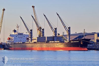
AMIRA MARYANA
General Cargo

Current Trip
| Time Travelled | 15 days |
|---|---|
| Remaining Time | 6 h, 33 mins |
| Distance Travelled | 2124.22 nm |
| Remaining Distance | 80.72 nm |
| AVG Speed | 9.5 Knop |
| MAX Speed | 14 Knop |
| AVG Wind | 14.2 knots |
| MAX Wind | 27.8 knots |
| MIN Temp | -0.9°C / 30.38°F |
| MAX Temp | 15.8°C / 60.44°F |
| Djupgående | 9.6 m |
| Position mottagen | 17 h, 25 m sen |
Current Position
| Longitud | --- |
|---|---|
| Latitude | --- |
| Status | Under way using engine |
| Fart | 11.3 Knop |
| Kurs | 161.8° |
| Område | Mediterranean Sea - Eastern Basin |
| Station | T-AIS |
| Position mottagen | 17 h, 25 m sen |
Information
The current position of AMIRA MARYANA is in Mediterranean Sea - Eastern Basin with coordinates 35.29041° / 27.78723° as reported on 2025-02-18 10:29 by AIS to our vessel tracker app. The vessel's current speed is 11.3 Knop and is heading at the port of EL DEKHEILA. The estimated time of arrival as calculated by MyShipTracking vessel tracking app is 2025-02-19 10:27 LT
The vessel AMIRA MARYANA (IMO: 9379650, MMSI: 268237000) is a General Cargo that was built in 2007 ( 18 År gammal ). It's sailing under the flag of [SM] San Marino.
In this page you can find informations about the vessels current position, last detected port calls, and current voyage information. If the vessels is not in coverage by AIS you will find the latest position.
The current position of AMIRA MARYANA is detected by our AIS receivers and we are not responsible for the reliability of the data. The last position was recorded while the vessel was in Coverage by the Ais receivers of our vessel tracking app.
The current draught of AMIRA MARYANA as reported by AIS is 9.6 meters
Weather
| Temperature | 16.3°C / 61.34°F |
|---|---|
| Wind Speed | 6 knots |
| Direction | 325° NW |
| Pressure | 1016.7 hPa |
| Humidity | 69.2 % |
| Cloud Coverage | 100 % |


Featured Company
Events
| Tid | Event | Detaljer | Position / Dest | Information |
|---|---|---|---|---|
| 2025-02-18 10:29 | UTANFÖR täckningsområde |
35.29041 / 27.78723
Mediterranean Sea - Eastern Basin
EG EDK
|
Fart: 11.3 kn Kurs: 161.8° |
|
| 2025-02-18 10:08 | Status ändrad | Under way using engine Default |
35.35146 / 27.75606
EG EDK
|
Fart: 11.3 kn Kurs: 155° |
| 2025-02-18 10:02 | Status ändrad | Default Under way using engine |
35.37120 / 27.74563
EG EDK
|
Fart: 11.3 kn Kurs: 154.6° |
| 2025-02-18 07:43 | Byter havsområde | Greek part of the Mediterranean Sea - Eastern Basin Greek part of the Aegean Sea |
35.76904 / 27.53999
Mediterranean Sea - Eastern Basin
EG EDK
|
Fart: 10.7 kn Kurs: 157.1° |
| 2025-02-18 03:46 | Status ändrad | Under way using engine Default |
36.33608 / 26.99679
EG EDK
|
Fart: 10.8 kn Kurs: 146° |
| 2025-02-18 03:34 | Status ändrad | Default Under way using engine |
36.36591 / 26.96924
EG EDK
|
Fart: 11.2 kn Kurs: 145.1° |
| 2025-02-17 16:39 | Status ändrad | Under way using engine Default |
37.93108 / 25.55102
EG EDK
|
Fart: 11.6 kn Kurs: 159° |
| 2025-02-17 16:22 | Status ändrad | Default Under way using engine |
37.98134 / 25.52429
EG EDK
|
Fart: 11.6 kn Kurs: 159.4° |
| 2025-02-17 16:10 | Status ändrad | Under way using engine Default |
38.01758 / 25.50621
EG EDK
|
Fart: 11.6 kn Kurs: 158° |
| 2025-02-17 16:01 | I täckningsområde |
38.01758 / 25.50621
Aegean Sea
EG EDK
|
Fart: 11.7 kn Kurs: 157.6° |