

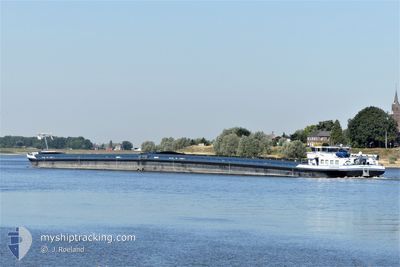
AMETHYST
Cargo

Current Trip
| Time Travelled | 11 h, 5 mins |
|---|---|
| Remaining Time | 1 day |
| Distance Travelled | 67.42 nm |
| Remaining Distance | 263.21 nm |
| AVG Speed | 6.4 Knop |
| MAX Speed | 8.2 Knop |
| AVG Wind | 9.7 knots |
| MAX Wind | 13 knots |
| MIN Temp | 6.9°C / 44.42°F |
| MAX Temp | 10°C / 50°F |
| Djupgående | 0.2 m |
| Position mottagen | Nu |
Current Position
| Longitud | --- |
|---|---|
| Latitude | --- |
| Status | Under way using engine |
| Fart | 6.4 Knop |
| Kurs | 110.5° |
| Område | North Sea |
| Station | T-AIS |
| Position mottagen | Nu |
Information
The current position of AMETHYST is in North Sea with coordinates 51.84474° / 6.14861° as reported on 2025-02-25 01:09 by AIS to our vessel tracker app. The vessel's current speed is 6.4 Knop and is heading at the port of KARLSRUHE. The estimated time of arrival as calculated by MyShipTracking vessel tracking app is 2025-02-26 15:13 LT
The vessel AMETHYST (MMSI: 244710305) is a Cargo It's sailing under the flag of [NL] Netherlands.
In this page you can find informations about the vessels current position, last detected port calls, and current voyage information. If the vessels is not in coverage by AIS you will find the latest position.
The current position of AMETHYST is detected by our AIS receivers and we are not responsible for the reliability of the data. The last position was recorded while the vessel was in Coverage by the Ais receivers of our vessel tracking app.
The current draught of AMETHYST as reported by AIS is 0.2 meters
Weather
| Temperature | 6.8°C / 44.24°F |
|---|---|
| Wind Speed | 8 knots |
| Direction | 221° SW |
| Pressure | 1014.9 hPa |
| Humidity | 96.3 % |
| Cloud Coverage | 25 % |


Featured Company
Last Port Calls
| Port | Arrival | Departure | Time In Port |
|---|---|---|---|
| 2025-02-24 08:06 | 2025-02-24 14:05 | 5 h | |
| 2025-02-24 06:38 | 2025-02-24 07:22 | 43 m | |
| 2025-02-21 10:15 | 2025-02-21 10:39 | 23 m | |
| 2025-02-19 08:30 | 2025-02-19 08:56 | 25 m | |
| 2025-02-14 20:30 | 2025-02-17 09:13 | 2 d | |
| 2025-02-11 12:19 | 2025-02-11 12:47 | 28 m | |
| 2025-02-11 01:28 | 2025-02-11 07:27 | 5 h | |
| 2025-02-06 06:32 | 2025-02-06 07:05 | 32 m | |
| 2025-02-01 02:29 | 2025-02-03 14:13 | 2 d | |
| 2025-01-29 15:03 | 2025-01-29 15:14 | 10 m |
Last Trips
| Origin | Departure | Destination | Arrival | Distance | |
|---|---|---|---|---|---|
| 2025-02-24 08:22 | 2025-02-24 09:06 | 5.06 nm | |||
| 2025-02-21 11:39 | 2025-02-24 07:38 | 52.84 nm | |||
| 2025-02-19 09:56 | 2025-02-21 11:15 | 82.51 nm | |||
| 2025-02-17 10:13 | 2025-02-19 09:30 | 317.80 nm | |||
| 2025-02-11 13:47 | 2025-02-14 21:30 | 287.88 nm | |||
| 2025-02-11 08:27 | 2025-02-11 13:19 | 31.11 nm | |||
| 2025-02-06 08:05 | 2025-02-11 02:28 | 141.57 nm | |||
| 2025-02-03 15:13 | 2025-02-06 07:32 | 318.42 nm | |||
| 2025-01-29 16:14 | 2025-02-01 03:29 | 289.94 nm | |||
| 2025-01-29 11:02 | 2025-01-29 16:03 | 31.17 nm |
Events
| Tid | Event | Detaljer | Position / Dest | Information |
|---|---|---|---|---|
| 2025-02-24 20:25 | STARTAR förflyttning | 0.94 nm, North East of TIEL |
51.90075 / 5.45514
HAFEN KARLSRUHE
|
Fart: 3.2 kn Kurs: 160° |
| 2025-02-24 20:23 | Status ändrad | Under way using engine Moored |
51.90214 / 5.45425
HAFEN KARLSRUHE
|
Fart: Kurs: 159° |
| 2025-02-24 20:19 | ETA ändrat | 2025/02/26 03:26 2025/02/26 00:54 |
51.90250 / 5.45404
HAFEN KARLSRUHE
|
Fart: 0.1 kn Kurs: 156° |
| 2025-02-24 20:14 | Status ändrad | Moored Under way using engine |
51.90242 / 5.45400
HAFEN KARLSRUHE
|
Fart: 0.2 kn Kurs: 157° |
| 2025-02-24 20:12 | STOPPAR förflyttning | 1.02 nm, North East of TIEL |
51.90251 / 5.45406
HAFEN KARLSRUHE
|
Fart: 0.2 kn Kurs: 160° |
| 2025-02-24 20:05 | STARTAR förflyttning | 1.26 nm, North of TIEL |
51.90736 / 5.45109
HAFEN KARLSRUHE
|
Fart: 3.1 kn Kurs: 159° |
| 2025-02-24 19:55 | STOPPAR förflyttning | 1.38 nm, North of TIEL |
51.90944 / 5.45027
HAFEN KARLSRUHE
|
Fart: 0.3 kn Kurs: 160° |
| 2025-02-24 14:05 | AVGÅTT HAMN |
|
52.36496 / 4.95744
HAFEN KARLSRUHE
|
Fart: 6.6 kn Kurs: 168° |
| 2025-02-24 12:35 | STARTAR förflyttning |
52.42052 / 4.74775
[NL] AMSTERDAM
|
Fart: 3.2 kn Kurs: 348° |
|
| 2025-02-24 12:26 | Status ändrad | Under way using engine Moored |
52.41995 / 4.74421
[NL] AMSTERDAM
|
Fart: Kurs: 259° |