
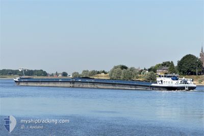
AMETHYST
Cargo
Current Trip
| Time Travelled | 1 day |
|---|---|
| Remaining Time | 1 day |
| Distance Travelled | 40.45 nm |
| Remaining Distance | 259.31 nm |
| AVG Speed | 6.1 Noeuds |
| MAX Speed | 8 Noeuds |
| AVG Wind | 11.6 knots |
| MAX Wind | 13 knots |
| MIN Temp | 2.3°C / 36.14°F |
| MAX Temp | 7.4°C / 45.32°F |
| Tirant d eau | 0.2 m |
| Position reçue | 2 h, 33 m depuis |
Current Position
| Longitude | --- |
|---|---|
| Latitude | --- |
| Etat | Under way using engine |
| Vitesse | 6.2 Noeuds |
| Parcours | 112.5° |
| Zone | North Sea |
| Station | T-AIS |
| Position reçue | 2 h, 33 m depuis |
Info
Information
The current position of AMETHYST is in North Sea with coordinates 51.82599° / 6.25167° as reported on 2025-03-17 00:49 by AIS to our vessel tracker app. The vessel's current speed is 6.2 Noeuds and is heading at the port of KARLSRUHE. The estimated time of arrival as calculated by MyShipTracking vessel tracking app is 2025-03-19 03:29 LT
The vessel AMETHYST (MMSI: 244710305) is a Cargo It's sailing under the flag of [NL] Netherlands.
In this page you can find informations about the vessels current position, last detected port calls, and current voyage information. If the vessels is not in coverage by AIS you will find the latest position.
The current position of AMETHYST is detected by our AIS receivers and we are not responsible for the reliability of the data. The last position was recorded while the vessel was in Coverage by the Ais receivers of our vessel tracking app.
The current draught of AMETHYST as reported by AIS is 0.2 meters
Weather
| Temperature | 2.8°C / 37.04°F |
|---|---|
| Wind Speed | 6 knots |
| Direction | 1° N |
| Pressure | 1024.8 hPa |
| Humidity | 95.1 % |
| Cloud Coverage | 59 % |
Featured Company
Last Port Calls
| Port | Arrival | Departure | Time In Port |
|---|---|---|---|
| 2025-03-15 10:10 | 2025-03-15 10:37 | 27 m | |
| 2025-03-14 23:45 | 2025-03-15 06:18 | 6 h | |
| 2025-03-14 11:12 | 2025-03-14 21:58 | 10 h | |
| 2025-03-13 17:43 | 2025-03-14 09:02 | 15 h | |
| 2025-03-12 23:42 | 2025-03-13 16:37 | 16 h | |
| 2025-03-12 22:07 | 2025-03-12 22:15 | 8 m | |
| 2025-03-12 16:40 | 2025-03-12 17:05 | 24 m | |
| 2025-03-08 03:23 | 2025-03-08 16:03 | 12 h | |
| 2025-03-07 23:29 | 2025-03-07 23:45 | 16 m | |
| 2025-03-06 13:14 | 2025-03-06 14:03 | 49 m |
Last Trips
| Origin | Departure | Destination | Arrival | Distance | |
|---|---|---|---|---|---|
| 2025-03-15 06:18 | 2025-03-15 10:10 | 31.18 nm | |||
| 2025-03-14 21:58 | 2025-03-14 23:45 | 13.02 nm | |||
| 2025-03-14 09:02 | 2025-03-14 11:12 | 9.08 nm | |||
| 2025-03-13 16:37 | 2025-03-13 17:43 | 6.66 nm | |||
| 2025-03-12 22:15 | 2025-03-12 23:42 | 6.12 nm | |||
| 2025-03-12 17:05 | 2025-03-12 22:07 | 39.93 nm | |||
| 2025-03-08 16:03 | 2025-03-12 16:40 | 334.88 nm | |||
| 2025-03-07 23:45 | 2025-03-08 03:23 | 12.83 nm | |||
| 2025-03-06 14:03 | 2025-03-07 23:29 | 140.20 nm | |||
| 2025-03-05 13:30 | 2025-03-06 13:14 | 124.77 nm |
Events
| Heure | Evenement | Détails | Position/ Destination | Info |
|---|---|---|---|---|
| 2025-03-17 00:49 | Hors de la zone couverte |
51.82599 / 6.25167
North Sea
|
Vitesse: 6.2 kn Parcours: 112.5° |
|
| 2025-03-16 23:56 | Démarrage | 1.27 nm, East of TOLKAMER |
51.84836 / 6.13786
HAFEN KARLSRUHE
|
Vitesse: 3.3 kn Parcours: 131° |
| 2025-03-16 23:50 | Etat Changé | Under way using engine Moored |
51.85110 / 6.13852
HAFEN KARLSRUHE
|
Vitesse: Parcours: 182° |
| 2025-03-16 23:32 | Etat Changé | Moored Under way using engine |
51.85124 / 6.13874
HAFEN KARLSRUHE
|
Vitesse: 0.1 kn Parcours: 185° |
| 2025-03-16 23:20 | Etat Changé | Under way using engine Moored |
51.84891 / 6.14143
HAFEN KARLSRUHE
|
Vitesse: 0.5 kn Parcours: 100° |
| 2025-03-16 23:07 | Etat Changé | Moored Default |
51.84882 / 6.14177
HAFEN KARLSRUHE
|
Vitesse: Parcours: 102° |
| 2025-03-16 23:04 | Etat Changé | Default Moored |
51.84879 / 6.14178
HAFEN KARLSRUHE
|
Vitesse: Parcours: 102° |
| 2025-03-16 13:31 | Etat Changé | Moored Default |
51.84882 / 6.14183
HAFEN KARLSRUHE
|
Vitesse: Parcours: 103° |
| 2025-03-16 13:28 | Etat Changé | Default Moored |
51.84884 / 6.14180
HAFEN KARLSRUHE
|
Vitesse: Parcours: 103° |
| 2025-03-16 10:36 | Etat Changé | Moored Default |
51.84879 / 6.14182
HAFEN KARLSRUHE
|
Vitesse: Parcours: 103° |