
AM HAMBURG
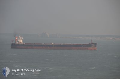
Bulk Carrier
Current Trip
| Time Travelled | 1 day |
|---|---|
| Remaining Time | 3 days |
| Distance Travelled | 357.55 nm |
| Remaining Distance | 887.38 nm |
| AVG Speed | 11.1 Knop |
| MAX Speed | 14.9 Knop |
| AVG Wind | 13.2 knots |
| MAX Wind | 19.9 knots |
| MIN Temp | 9.4°C / 48.92°F |
| MAX Temp | 19.6°C / 67.28°F |
| Djupgående | 7.8 m |
| Position mottagen | 1 m sen |
Current Position
| Longitud | 3.57161° |
|---|---|
| Latitude | 56.17952° |
| Status | Under way using engine |
| Fart | 11 Knop |
| Kurs | 4.6° |
| Område | North Sea |
| Station | T-AIS |
| Position mottagen | 1 m sen |
Info
Information
The current position of AM HAMBURG is in North Sea with coordinates 56.17952° / 3.57161° as reported on 2024-05-03 16:40 by AIS to our vessel tracker app. The vessel's current speed is 11 Knop and is heading at the port of NARVIK. The estimated time of arrival as calculated by MyShipTracking vessel tracking app is 2024-05-07 02:23 LT
The vessel AM HAMBURG (IMO: 9624093, MMSI: 538004948) is a Bulk Carrier that was built in 2013 ( 11 År gammal ). It's sailing under the flag of [MH] Marshall Is.
In this page you can find informations about the vessels current position, last detected port calls, and current voyage information. If the vessels is not in coverage by AIS you will find the latest position.
The current position of AM HAMBURG is detected by our AIS receivers and we are not responsible for the reliability of the data. The last position was recorded while the vessel was in Coverage by the Ais receivers of our vessel tracking app.
The current draught of AM HAMBURG as reported by AIS is 7.8 meters
Weather
| Temperature | 9.4°C / 48.92°F |
|---|---|
| Wind Speed | 20 knots |
| Direction | 79° E |
| Pressure | 1007.9 hPa |
| Humidity | 91.6 % |
| Cloud Coverage | 56 % |
Featured Company
Last Port Calls
| Port | Arrival | Departure | Time In Port |
|---|---|---|---|
| 2024-05-01 05:44 | 2024-05-02 09:36 | 1 d | |
| 2024-04-25 11:11 | 2024-04-28 12:01 | 3 d | |
| 2024-04-02 16:47 | 2024-04-07 21:56 | 5 d | |
| 2024-03-03 18:01 | 2024-03-09 06:44 | 5 d |
Most Visited Ports (Last year)
| Port | Arrivals | |
|---|---|---|
| 5 | ||
| 4 | ||
| 3 | ||
| 2 | ||
| 2 | ||
| 1 |
Last Trips
| Origin | Departure | Destination | Arrival | Distance | |
|---|---|---|---|---|---|
| 2024-04-28 14:01 | 2024-05-01 07:44 | 305.96 nm | |||
| 2024-04-07 17:56 | 2024-04-25 13:11 | 3848.84 nm | |||
| 2024-03-09 07:44 | 2024-04-02 12:47 | 4090.66 nm | |||
| 2024-02-11 01:14 | 2024-03-03 19:01 | 3548.55 nm |
Events
| Tid | Event | Detaljer | Position / Dest | Information |
|---|---|---|---|---|
| 2024-05-03 14:47 | Byter havsområde | Danish part of the North Sea German part of the North Sea |
55.86214 / 3.71098
North Sea
NARVIK
|
Fart: 11.3 kn Kurs: 321.4° |
| 2024-05-03 13:02 | Status ändrad | Under way using engine Default |
55.61018 / 4.07339
NARVIK
|
Fart: 11.2 kn Kurs: 321° |
| 2024-05-03 12:50 | Status ändrad | Default Under way using engine |
55.57985 / 4.11658
NARVIK
|
Fart: 11.1 kn Kurs: 319.8° |
| 2024-05-03 11:19 | Byter havsområde | German part of the North Sea Dutch part of the North Sea |
55.33398 / 4.34761
North Sea
NARVIK
|
Fart: 11.5 kn Kurs: 349.7° |
| 2024-05-03 11:19 | Status ändrad | Under way using engine Default |
55.33398 / 4.34761
NARVIK
|
Fart: 11 kn Kurs: 349° |
| 2024-05-03 11:10 | I täckningsområde |
55.33398 / 4.34761
North Sea
NARVIK
|
Fart: 11.5 kn Kurs: 349.7° |
|
| 2024-05-02 17:01 | Status ändrad | Default Under way using engine |
52.20167 / 3.32333
NARVIK
|
Fart: 10.5 kn Kurs: 327.1° |
| 2024-05-02 16:52 | UTANFÖR täckningsområde |
52.18166 / 3.34544
North Sea
NARVIK
|
Fart: 10.5 kn Kurs: 327.1° |
|
| 2024-05-02 16:52 | Status ändrad | Under way using engine Default |
52.18121 / 3.34591
NARVIK
|
Fart: 10.5 kn Kurs: 327° |
| 2024-05-02 16:42 | Status ändrad | Default Under way using engine |
52.15722 / 3.37123
NARVIK
|
Fart: 10.4 kn Kurs: 326.2° |