
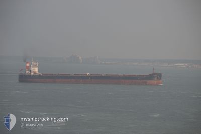
AM HAMBURG
Bulk Carrier
Current Trip
GHENT
| Time Travelled | 13 h, 36 mins |
|---|---|
| Remaining Time | --- |
| Distance Travelled | 7.84 nm |
| Remaining Distance | --- |
| AVG Speed | 4.7 Knots |
| MAX Speed | 5.2 Knots |
| AVG Wind | 10.3 knots |
| MAX Wind | 12 knots |
| MIN Temp | 17.6°C / 63.68°F |
| MAX Temp | 18.4°C / 65.12°F |
| Dybgang | 12.5 m |
| Position Modtaget | Nu |
Current Position
| Longitude | 3.79830° |
|---|---|
| Latitude | 51.17243° |
| Status | Moored |
| Fart | |
| Kurs | 202° |
| Område | North Sea |
| Station | T-AIS |
| Position Modtaget | Nu |
Info
Information
The current position of AM HAMBURG is in North Sea with coordinates 51.17243° / 3.79830° as reported on 2024-05-18 00:12 by AIS to our vessel tracker app. The vessel's current speed is 0 Knots
The vessel AM HAMBURG (IMO: 9624093, MMSI: 538004948) is a Bulk Carrier that was built in 2013 ( 11 år gamle ). It's sailing under the flag of [MH] Marshall Is.
In this page you can find informations about the vessels current position, last detected port calls, and current voyage information. If the vessels is not in coverage by AIS you will find the latest position.
The current position of AM HAMBURG is detected by our AIS receivers and we are not responsible for the reliability of the data. The last position was recorded while the vessel was in Coverage by the Ais receivers of our vessel tracking app.
The current draught of AM HAMBURG as reported by AIS is 12.5 meters
Weather
| Temperature | 13°C / 55.4°F |
|---|---|
| Wind Speed | 7 knots |
| Direction | 298° WNW |
| Pressure | 1010.2 hPa |
| Humidity | 94.9 % |
| Cloud Coverage | 100 % |
Featured Company
Last Port Calls
| Port | Arrival | Departure | Time In Port |
|---|---|---|---|
| 2024-05-17 10:17 | 2024-05-17 10:37 | 20 m | |
| 2024-05-07 03:59 | 2024-05-08 10:52 | 1 d | |
| 2024-05-01 05:44 | 2024-05-02 09:36 | 1 d | |
| 2024-04-25 11:11 | 2024-04-28 12:01 | 3 d | |
| 2024-04-02 16:47 | 2024-04-07 21:56 | 5 d | |
| 2024-03-03 18:01 | 2024-03-09 06:44 | 5 d |
Most Visited Ports (Last year)
| Port | Arrivals | |
|---|---|---|
| 6 | ||
| 4 | ||
| 3 | ||
| 3 | ||
| 2 | ||
| 1 |
Last Trips
| Origin | Departure | Destination | Arrival | Distance | |
|---|---|---|---|---|---|
| 2024-05-08 12:52 | 2024-05-17 12:17 | 1274.64 nm | |||
| 2024-05-02 11:36 | 2024-05-07 05:59 | 1239.82 nm | |||
| 2024-04-28 14:01 | 2024-05-01 07:44 | 305.96 nm | |||
| 2024-04-07 17:56 | 2024-04-25 13:11 | 3848.84 nm | |||
| 2024-03-09 07:44 | 2024-04-02 12:47 | 4090.66 nm | |||
| 2024-02-11 01:14 | 2024-03-03 19:01 | 3548.55 nm |
Events
| Tid | Hændelsen | Detaljer | Position / Dest | Info |
|---|---|---|---|---|
| 2024-05-17 12:42 | Status er ændret | Moored Under way using engine |
51.17248 / 3.79842
GHENT
|
Fart: Kurs: 203° |
| 2024-05-17 12:23 | STOP Sejllads | 1.61 nm, South of ZELZATE |
51.17245 / 3.79800
GHENT
|
Fart: 0.3 kn Kurs: 203° |
| 2024-05-17 10:37 | Afsejlet fra sidste havn |
|
51.29598 / 3.83495
GHENT
|
Fart: 4.6 kn Kurs: 168° |
| 2024-05-17 10:17 | Skibe i havn |
|
51.32167 / 3.82295
[NL] TERNEUZEN
|
Fart: 4.8 kn Kurs: 153° |
| 2024-05-17 10:14 | START Sejllads | 0.37 nm, North West of TERNEUZEN |
51.32496 / 3.81994
GHENT
|
Fart: 3.2 kn Kurs: 151° |
| 2024-05-17 09:32 | STOP Sejllads | 0.64 nm, North West of TERNEUZEN |
51.32899 / 3.81672
GHENT
|
Fart: 0.3 kn Kurs: 154° |
| 2024-05-17 08:08 | START Sejllads | 0.54 nm, South of ZEELAND REFINERY |
51.40414 / 3.73299
GHENT
|
Fart: 3.7 kn Kurs: 320° |
| 2024-05-17 07:58 | Status er ændret | Under way using engine At anchor |
51.40209 / 3.73901
GHENT
|
Fart: 0.3 kn Kurs: 284° |
| 2024-05-17 06:42 | Dybgangen er ændret | 12.5 15.1 |
51.40093 / 3.73861
GHENT
|
Fart: 0.1 kn Kurs: 315° |
| 2024-05-17 06:42 | ETA er ændret | 2024/05/17 10:00 2024/05/16 10:00 |
51.40093 / 3.73861
GHENT
|
Fart: 0.1 kn Kurs: 315° |