

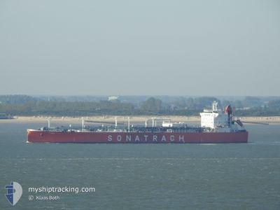
ALRAR
Lpg Tanker

Current Trip
| Time Travelled | 3 days |
|---|---|
| Remaining Time | 1 day |
| Distance Travelled | 993.40 nm |
| Remaining Distance | 682.64 nm |
| AVG Speed | 13.8 Knop |
| MAX Speed | 13.8 Knop |
| AVG Wind | 20.5 knots |
| MAX Wind | 26 knots |
| MIN Temp | 14.4°C / 57.92°F |
| MAX Temp | 16°C / 60.8°F |
| Djupgående | 11.3 m |
| Position mottagen | 23 h, 9 m sen |
Current Position
| Longitud | --- |
|---|---|
| Latitude | --- |
| Status | Under way using engine |
| Fart | 13 Knop |
| Kurs | 101.5° |
| Område | Mediterranean Sea - Eastern Basin |
| Station | T-AIS |
| Position mottagen | 23 h, 9 m sen |
Information
The current position of ALRAR is in Mediterranean Sea - Eastern Basin with coordinates 36.31179° / 14.61419° as reported on 2025-03-28 02:29 by AIS to our vessel tracker app. The vessel's current speed is 13 Knop and is heading at the port of ALIAGA. The estimated time of arrival as calculated by MyShipTracking vessel tracking app is 2025-03-30 05:59 LT
The vessel ALRAR (IMO: 9284013, MMSI: 636012377) is a Lpg Tanker that was built in 2004 ( 21 År gammal ). It's sailing under the flag of [LR] Liberia.
In this page you can find informations about the vessels current position, last detected port calls, and current voyage information. If the vessels is not in coverage by AIS you will find the latest position.
The current position of ALRAR is detected by our AIS receivers and we are not responsible for the reliability of the data. The last position was recorded while the vessel was in Coverage by the Ais receivers of our vessel tracking app.
The current draught of ALRAR as reported by AIS is 11.3 meters
Weather
| Temperature | 15.4°C / 59.72°F |
|---|---|
| Wind Speed | 24 knots |
| Direction | 259° W |
| Pressure | 1006.5 hPa |
| Humidity | 76.9 % |
| Cloud Coverage | 1 % |


Featured Company
Last Port Calls
| Port | Arrival | Departure | Time In Port |
|---|---|---|---|
| 2025-03-23 14:23 | 2025-03-25 17:39 | 2 d | |
| 2025-03-08 08:11 | 2025-03-10 07:04 | 1 d | |
| 2025-03-05 10:29 | 2025-03-06 14:10 | 1 d | |
| 2025-02-01 05:21 | 2025-02-04 23:38 | 3 d | |
| 2025-01-17 05:39 | 2025-01-18 07:49 | 1 d | |
| 2025-01-08 17:49 | 2025-01-10 15:02 | 1 d | |
| 2025-01-08 15:04 | 2025-01-08 15:59 | 55 m | |
| 2025-01-02 05:18 | 2025-01-03 13:04 | 1 d |
Last Trips
| Origin | Departure | Destination | Arrival | Distance | |
|---|---|---|---|---|---|
| 2025-03-10 08:04 | 2025-03-23 15:23 | 1380.01 nm | |||
| 2025-03-06 15:10 | 2025-03-08 09:11 | 549.08 nm | |||
| 2025-02-05 02:38 | 2025-03-05 11:29 | 2631.97 nm | |||
| 2025-01-18 10:49 | 2025-02-01 08:21 | 1217.60 nm | |||
| 2025-01-10 16:02 | 2025-01-17 08:39 | 1519.02 nm | |||
| 2025-01-08 16:59 | 2025-01-08 18:49 | 5.02 nm | |||
| 2025-01-03 16:04 | 2025-01-08 16:04 | 1523.17 nm | |||
| 2024-12-10 02:16 | 2025-01-02 08:18 | 2377.64 nm |
Events
| Tid | Event | Detaljer | Position / Dest | Information |
|---|---|---|---|---|
| 2025-03-28 02:33 | Status ändrad | Default Under way using engine |
36.30826 / 14.63583
DZ AZW>TR ALI
|
Fart: 13 kn Kurs: 101.5° |
| 2025-03-28 02:29 | UTANFÖR täckningsområde |
36.31179 / 14.61419
Mediterranean Sea - Eastern Basin
DZ AZW>TR ALI
|
Fart: 13 kn Kurs: 101.5° |
|
| 2025-03-28 01:02 | Djupgående ändrat | 11.3 7.8 |
36.38088 / 14.23034
DZ AZW>TR ALI
|
Fart: 13.2 kn Kurs: 109.3° |
| 2025-03-28 01:02 | Destination ändrad | DZ AZW>TR ALI FR LAV>DZ AZW |
36.38088 / 14.23034
DZ AZW>TR ALI
|
Fart: 13.2 kn Kurs: 109.3° |
| 2025-03-28 01:02 | ETA ändrat | 2025/03/30 16:00 2025/03/12 00:00 |
36.38088 / 14.23034
DZ AZW>TR ALI
|
Fart: 13.2 kn Kurs: 109.3° |
| 2025-03-28 00:25 | Byter havsområde | Maltese part of the Mediterranean Sea - Eastern Basin Algerian part of the Mediterranean Sea - Western Basin |
36.42713 / 14.07295
Mediterranean Sea - Eastern Basin
|
Fart: 13.3 kn Kurs: 110.9° |
| 2025-03-28 00:25 | Status ändrad | Under way using engine Default |
36.42713 / 14.07295
FR LAV>DZ AZW
|
Fart: 13.3 kn Kurs: 104° |
| 2025-03-28 00:25 | I täckningsområde |
36.42713 / 14.07295
Mediterranean Sea - Eastern Basin
|
Fart: 13.3 kn Kurs: 110.9° |
|
| 2025-03-25 17:39 | AVGÅTT HAMN |
|
35.86109 / -.20652
FR LAV>DZ AZW
|
Fart: 4.4 kn Kurs: 32° |
| 2025-03-23 14:23 | ANLÄNDER HAMN |
|
35.82250 / -.23077
[DZ] ARZEW
|
Fart: 4.1 kn Kurs: 214° |