
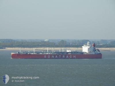
ALRAR
Lpg Tanker
Current Trip
| Trip Time | 11 days |
|---|---|
| Trip Distance | 2592.17 nm |
| AVG Speed | 12.2 Noeuds |
| MAX Speed | 15.3 Noeuds |
| Tirant d eau | 8.3 m |
| AVG Wind | 11.9 knots |
| MAX Wind | 23.8 knots |
| MIN Temp | 6.8°C / 44.24°F |
| MAX Temp | 20.5°C / 68.9°F |
| Position reçue | 8 h, 25 m depuis |
Current Position
| Longitude | --- |
|---|---|
| Latitude | --- |
| Etat | Under way using engine |
| Vitesse | |
| Parcours | 269° |
| Zone | Aegean Sea |
| Station | T-AIS |
| Position reçue | 8 h, 25 m depuis |
Info
Information
The current position of ALRAR is in Aegean Sea with coordinates 38.76922° / 26.93242° as reported on 2025-12-09 06:34 by AIS to our vessel tracker app. The vessel's current speed is 0 Noeuds and is currently inside the port of NEMRUT.
The vessel ALRAR (IMO: 9284013, MMSI: 636012377) is a Lpg Tanker that was built in 2004 ( 21 Age ). It's sailing under the flag of [LR] Liberia.
In this page you can find informations about the vessels current position, last detected port calls, and current voyage information. If the vessels is not in coverage by AIS you will find the latest position.
The current position of ALRAR is detected by our AIS receivers and we are not responsible for the reliability of the data. The last position was recorded while the vessel was in Coverage by the Ais receivers of our vessel tracking app.
The current draught of ALRAR as reported by AIS is 8.3 meters
Weather
| Temperature | 9.8°C / 49.64°F |
|---|---|
| Wind Speed | 14 knots |
| Direction | 24° NNE |
| Pressure | 1020.4 hPa |
| Humidity | 62.8 % |
| Cloud Coverage | 2 % |
Featured Company
Last Port Calls
| Port | Arrival | Departure | Time In Port |
|---|---|---|---|
| 2025-12-09 09:09 | |||
| 2025-11-25 18:25 | 2025-11-27 16:01 | 1 d | |
| 2025-11-10 08:58 | 2025-11-15 23:28 | 5 d | |
| 2025-11-01 15:40 | 2025-11-03 20:22 | 2 d | |
| 2025-10-23 07:00 | 2025-10-25 17:02 | 2 d | |
| 2025-10-15 13:43 | 2025-10-18 04:32 | 2 d | |
| 2025-10-03 19:53 | 2025-10-05 16:21 | 1 d |
Last Trips
| Origin | Departure | Destination | Arrival | Distance | |
|---|---|---|---|---|---|
| 2025-11-27 16:01 | 2025-12-09 09:09 | 2592.17 nm | |||
| 2025-11-15 23:28 | 2025-11-25 18:25 | 1950.52 nm | |||
| 2025-11-03 20:22 | 2025-11-10 08:58 | 1672.54 nm | |||
| 2025-10-25 17:02 | 2025-11-01 15:40 | 1936.31 nm | |||
| 2025-10-18 04:32 | 2025-10-23 07:00 | 929.92 nm | |||
| 2025-10-05 16:21 | 2025-10-15 13:43 | 1675.65 nm | |||
| 2025-09-23 15:37 | 2025-10-03 19:53 | 1834.30 nm |
Events
| Heure | Evenement | Détails | Position/ Destination | Info |
|---|---|---|---|---|
| 2025-12-09 06:40 | Etat Changé | Default Under way using engine |
38.76923 / 26.93241
[TR] NEMRUT
|
Vitesse: Parcours: 269° |
| 2025-12-09 06:34 | Etat Changé | Under way using engine Default |
38.76922 / 26.93242
[TR] NEMRUT
|
Vitesse: 1.2 kn Parcours: 261° |
| 2025-12-09 06:34 | Arret |
38.76922 / 26.93242
[TR] NEMRUT
|
Vitesse: Parcours: 269° |
|
| 2025-12-09 06:34 | Dans la zone couverte |
38.76922 / 26.93242
Aegean Sea
[TR] NEMRUT
|
Vitesse: Parcours: 176.3° |
|
| 2025-12-09 06:34 | Hors de la zone couverte |
38.76922 / 26.93242
Aegean Sea
[TR] NEMRUT
|
Vitesse: Parcours: 176.3° |
|
| 2025-12-09 06:09 | Port d'arrivée |
|
38.77584 / 26.91817
[TR] NEMRUT
|
Vitesse: 7.7 kn Parcours: 107° |
| 2025-12-09 04:40 | Etat Changé | Default Under way using engine |
38.80138 / 26.75773
TR DYL>TR ALI
|
Vitesse: 9.4 kn Parcours: 83.3° |
| 2025-12-09 04:32 | Hors de la zone couverte |
38.79976 / 26.73195
Aegean Sea
TR DYL>TR ALI
|
Vitesse: 9.4 kn Parcours: 83.3° |
|
| 2025-12-09 04:21 | Etat Changé | Under way using engine Default |
38.79642 / 26.69406
TR DYL>TR ALI
|
Vitesse: 9.6 kn Parcours: 82° |
| 2025-12-09 04:21 | Dans la zone couverte |
38.79642 / 26.69406
Aegean Sea
TR DYL>TR ALI
|
Vitesse: 9.5 kn Parcours: 82.7° |