
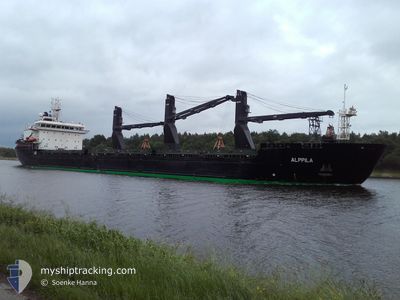
ALPPILA
Bulk Carrier
Current Trip
| Time Travelled | 2 days |
|---|---|
| Remaining Time | 2 days |
| Distance Travelled | 743.69 nm |
| Remaining Distance | 700.49 nm |
| AVG Speed | 10.4 Knop |
| MAX Speed | 13.3 Knop |
| AVG Wind | 13.4 knots |
| MAX Wind | 20 knots |
| MIN Temp | 14.7°C / 58.46°F |
| MAX Temp | 18.9°C / 66.02°F |
| Djupgående | 6.2 m |
| Position mottagen | Nu |
Current Position
| Longitud | 15.21188° |
|---|---|
| Latitude | 55.57523° |
| Status | Under way using engine |
| Fart | 11.3 Knop |
| Kurs | 60.7° |
| Område | Kattegat |
| Station | T-AIS |
| Position mottagen | Nu |
Info
Information
The current position of ALPPILA is in Kattegat with coordinates 55.57523° / 15.21188° as reported on 2024-07-27 03:55 by AIS to our vessel tracker app. The vessel's current speed is 11.3 Knop and is heading at the port of LULEA. The estimated time of arrival as calculated by MyShipTracking vessel tracking app is 2024-07-29 19:00 LT
The vessel ALPPILA (IMO: 9381706, MMSI: 230613000) is a Bulk Carrier that was built in 2011 ( 13 År gammal ). It's sailing under the flag of [FI] Finland.
In this page you can find informations about the vessels current position, last detected port calls, and current voyage information. If the vessels is not in coverage by AIS you will find the latest position.
The current position of ALPPILA is detected by our AIS receivers and we are not responsible for the reliability of the data. The last position was recorded while the vessel was in Coverage by the Ais receivers of our vessel tracking app.
The current draught of ALPPILA as reported by AIS is 6.2 meters
Weather
| Temperature | 18.6°C / 65.48°F |
|---|---|
| Wind Speed | 14 knots |
| Direction | 218° SW |
| Pressure | 1010.5 hPa |
| Humidity | 90.7 % |
| Cloud Coverage | 100 % |
Featured Company
Last Port Calls
| Port | Arrival | Departure | Time In Port |
|---|---|---|---|
| 2024-07-21 06:03 | 2024-07-24 07:44 | 3 d | |
| 2024-07-18 03:33 | 2024-07-20 08:49 | 2 d | |
| 2024-07-08 07:25 | 2024-07-09 19:42 | 1 d | |
| 2024-06-29 09:37 | 2024-07-02 18:31 | 3 d | |
| 2024-06-27 18:26 | 2024-06-29 00:25 | 1 d | |
| 2024-06-25 20:57 | 2024-06-26 13:29 | 16 h | |
| 2024-06-22 19:21 | 2024-06-23 23:21 | 1 d | |
| 2024-06-21 15:57 | 2024-06-22 10:53 | 18 h | |
| 2024-06-17 22:53 | 2024-06-20 09:28 | 2 d | |
| 2024-06-15 15:05 | 2024-06-17 14:05 | 1 d |
Last Trips
| Origin | Departure | Destination | Arrival | Distance | |
|---|---|---|---|---|---|
| 2024-07-20 08:49 | 2024-07-21 06:03 | 215.50 nm | |||
| 2024-07-09 19:42 | 2024-07-18 03:33 | 398.34 nm | |||
| 2024-07-02 18:31 | 2024-07-08 07:25 | 1293.10 nm | |||
| 2024-06-29 00:25 | 2024-06-29 09:37 | 79.95 nm | |||
| 2024-06-26 13:29 | 2024-06-27 18:26 | 17.33 nm | |||
| 2024-06-23 23:21 | 2024-06-25 20:57 | 84.59 nm | |||
| 2024-06-22 10:53 | 2024-06-22 19:21 | 79.59 nm | |||
| 2024-06-20 09:28 | 2024-06-21 15:57 | 81.21 nm | |||
| 2024-06-17 14:05 | 2024-06-17 22:53 | 79.59 nm | |||
| 2024-06-13 22:09 | 2024-06-15 15:05 | 16.16 nm |
Events
| Tid | Event | Detaljer | Position / Dest | Information |
|---|---|---|---|---|
| 2024-07-27 00:31 | Byter havsområde | Danish part of the Kattegat Swedish part of the Baltic Sea |
55.19622 / 14.30851
Kattegat
GB HUL>SE LLA
|
Fart: 11.4 kn Kurs: 84° |
| 2024-07-26 19:26 | Byter havsområde | Swedish part of the Baltic Sea Danish part of the Baltic Sea |
55.29387 / 12.65536
Baltic Sea
GB HUL>SE LLA
|
Fart: 10.5 kn Kurs: 110.4° |
| 2024-07-26 19:14 | Byter havsområde | Danish part of the Baltic Sea Danish part of the Kattegat |
55.32030 / 12.62866
Baltic Sea
GB HUL>SE LLA
|
Fart: 9.9 kn Kurs: 191.9° |
| 2024-07-26 19:05 | Upptäckt i hav | Danish part of the Kattegat |
55.34472 / 12.63777
Kattegat
GB HUL>SE LLA
|
Fart: 9.9 kn Kurs: 192.3° |
| 2024-07-26 18:20 | Byter havsområde | Swedish part of the Kattegat Danish part of the Kattegat |
55.46737 / 12.68359
Kattegat
GB HUL>SE LLA
|
Fart: 10.1 kn Kurs: 190.8° |
| 2024-07-26 15:53 | Byter havsområde | Danish part of the Kattegat Swedish part of the Kattegat |
55.80706 / 12.72541
Kattegat
GB HUL>SE LLA
|
Fart: 7.7 kn Kurs: 196.7° |
| 2024-07-26 14:26 | Byter havsområde | Swedish part of the Kattegat Danish part of the Kattegat |
56.01780 / 12.66058
Kattegat
GB HUL>SE LLA
|
Fart: 9 kn Kurs: 163.1° |
| 2024-07-26 12:44 | Upptäckt i hav | Danish part of the Kattegat |
56.19819 / 12.38669
Kattegat
GB HUL>SE LLA
|
Fart: 9.4 kn Kurs: 165.6° |
| 2024-07-26 12:03 | Djupgående ändrat | 6.2 6.1 |
56.30262 / 12.33892
GB HUL>SE LLA
|
Fart: 9.6 kn Kurs: 165.4° |
| 2024-07-26 03:22 | Upptäckt i hav | Swedish part of the Kattegat |
57.51940 / 11.33406
Kattegat
GB HUL>SE LLA
|
Fart: 9.3 kn Kurs: 136.4° |